
 United Kingdom
 France
 Germany
 Netherlands
 Sweden
 USA
USA
 Italy
Italy
 Spain
Spain
More From Contributor


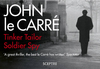
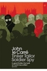

Tinker Tailor Soldier Spy
The Circus has already suffered a bad defeat, and the result was two bullets in a man's back. But a bigger threat still exists. And the legendary George Smiley is recruited to root out a high-level mole of thirty years' standing - though to find him means spying on the spies. Tinker Tailor Soldier Spy is brilliant and ceaselessly compelling, pitting Smiley against his Cold War rival, Karla, in one of the greatest struggles in all fiction.
Product Description
Reviews/Comments
Add New
Vouchers
No voucher codes found.
Do you know a voucher code for this product or supplier? Add it to Insights for others to use.
Do you know a voucher code for this product or supplier? Add it to Insights for others to use.
 Denmark