More From Contributor

£7.99
It boasted libraries, palm tress, swimming pools, a 50-phone switchboard & was nearly as tall as the Eiffel Tower. No, she`s not a skyscraper, she`s the Titanic! To commemorate the centenary of the sinking of the White Star Liner RMS Titanic in 2012, Titanic, A Very Peculiar History delves into the human stories of both crew & passengers & the incredible feats of engineering & design involved in her construction. The book also takes a look at events that occurred once the ship was wrecked, from discovering what dead passengers had tried to take with them to assessing the likelihood of us ever being able to raise the wreck for more study. Featuring a colour insert with a guide to the many decks on board, letters from the liner`s passengers & crew & and an in-depth look at the events that led to the ship`s unpredictable sinking, Titanic, A Very Peculiar History is a great all-round look at the quirky, scary & amazing facts & stories surrounding the Titanic`s conception, construction & maiden voyage. ...
Archived Product
£710.00
A scale model of Titanic, handmade by craftsmen.

Includes::
hundreds of tiny windows, rigging, even little

...
Archived Product
£9.99
Marking the centenary of the Titanic disaster, ` Titanic Lives` is a fresh investigation of the lives of the passengers & crew on board the most famous ship in history. On the night of 14 April 1912, midway through her maiden voyage, the seemingly unsinkable Titanic hit an iceberg, sustaining a 300-feet gash as six compartments were wrenched open to the Atlantic Ocean. In little over two hours, the palatial liner nose-dived to the bottom of the sea. More than 1, 500 people perished in the freezing waters. But who were they? In this impeccably researched & utterly riveting social history, Richard Davenport-Hines brings to life the stories of the men who built & owned the Titanic, the crew who serviced her & the passengers of all classes who sailed on her. We are introduced to this fascinating cast of characters & follow their lives on board the ship through to the supreme dramatic climax of the disaster. Universally critically acclaimed, ` Titanic Lives` is the must-read Titanic book of the centenary year. ...
Archived Product
£16.99
Titanic Reference Map from the National Geographic, folded format, presenting on one side a map of the Atlantic annotated with shipping routes, sea currents, iceberg lines, etc, plus very extensive text on all aspects relating to the sinking of the ship; on the reverse is more information about the ship itself plus notes about the lost & the saved, the legacy of the disaster, & more. On one side the map shows the route of the Titanic from Southampton, via Cherbourg in France & Queenstown (now Cobh) in Irel&, to the point where the ship issued its distress signal, together with shipping lanes before & after 1913, as well as sights of notable shipwrecks & landmarks. On l&, on both sides of the Atlantic, the map shows locations of various institutions & memorials connected with the Titanic. The map of the Atlantic is surrounded by several panels providing further information: Icebergs, Shipping News, Women & Children First, In Memoriam, & The Wreck Discovered – illustrated with a more detailed map of the area & colour photos. Also included is a graph showing iceberg frequency, a table with a breakdown of losses among passengers & the crew of the ship, time chart from commissioning the design of the Titanic to the death of the last survivor in 2009, etc. On the reverse, are detailed drawings of the ship’s decks & the ships’ profile, information about selected victims & survivors, comparisons of its size with other famous ships & buildings, a list of films, plays & documentaries inspired by the disaster, etc. This map is also available as a wall map, on paper or encapsulated. ...
Archived Product
£6.95
Titanic Reference Map is a double sided, colour, info-graphic foldout sheet illustrating the story of the doomed ocean liner from a geographic perspective. The first complete map of the world’s most famous shipwreck, has been revised & updated. Map side: the routes of the 1912 shipping lanes are indicated before & after the disaster; the journey of the fateful iceberg is mapped; statistics & charts feature from the original hearings into the disaster; deep-ocean diagrams illustrate the search process; sites of Titanic related points of interest are shown. Ship side: colour-coded deck plans; cutaway view ship plans & escape routes; portraits of noted passengers & crew members both lost & saved; Titanic statistics; debates & cultural legacy. ...
Archived Product
£16.99
Titanic Reference Wall Map from the National Geographic, paper version – size 99 x 66cm (39” x 26”), presenting on one side a map of the Atlantic annotated with shipping routes, sea currents, iceberg lines, etc, plus very extensive text on all aspects relating to the sinking of the ship; on the reverse is more information about the ship itself plus notes about the lost & the saved, the legacy of the disaster, & more. On one side the map shows the route of the Titanic from Southampton, via Cherbourg in France & Queenstown (now Cobh) in Irel&, to the point where the ship issued its distress signal, together with shipping lanes before & after 1913, as well as sights of notable shipwrecks & landmarks. On l&, on both sides of the Atlantic, the map shows locations of various institutions & memorials connected with the Titanic. The map of the Atlantic is surrounded by several panels providing further information: Icebergs, Shipping News, Women & Children First, In Memoriam, & The Wreck Discovered – illustrated with a more detailed map of the area & colour photos. Also included is a graph showing iceberg frequency, a table with a breakdown of losses among passengers & the crew of the ship, time chart from commissioning the design of the Titanic to the death of the last survivor in 2009, etc. On the reverse, are detailed drawings of the ship’s decks & the ships’ profile, information about selected victims & survivors, comparisons of its size with other famous ships & buildings, a list of films, plays & documentaries inspired by the disaster, etc. This map is also available encapsulated & in a folded format. ...
Archived Product
£8.99
This guide is a wonderful addition to Conway`s best-selling pocket book series that examines this famous ship from a refreshingly different angle. Launched in May 1911, the triple-screw steamer Titanic was the pride of the White Star Line & at that time the largest passenger ship in the world. Built to carry passengers in comfort & luxury on the lucrative transatlantic route, her design, fittings & on board facilites epitomised the spirit of the age in terms of elegance & style. Titanic: A Passenger`s Guide is a unique guide to all aspects of the ship, incorporating authentic period literature
- from sources including White Star Line themselves, Harland & Wolff shipyards, & important publications from the time.
...
Archived Product
£9.99
Just in time for the centennial of the sinking of the Titanic, this graphic deluxe edition compiles firsthand accounts, testimonies, & letters by notable Titanic survivors, including Archibald Gracie, Lawrence Beesley, Elizabeth W. Shutes, & the ”unsinkable” Molly Brown. Full of historically accurate details & an afterword by the grandson of Lawrence Beesley, Titanic Survivors & author of ” The Loss of the S.S. Titanic”, it will be the gift to give die-hard Titanic buffs. Authoritative, commemorative & in a striking, luxurious package with & introduction by Titanic enthusiast & expert, Tim Maltin, this will be the authoritative work on the disaster. ...
Archived Product
£8.99
At 2.20am on 15th April 1912, the Titanic was plunging 12, 000 feet to the ocean floor. Machinery, coal, crystal goblets, pianos & jewellery all tumble through the dark water. Hundreds of passengers & crew remain trapped below decks
- hundreds more will perish on the surface. This is the definitive chronology of the Titanic`s final hours, told in fascinating detail & offering a real-time experience of one of the greatest dramas of twentieth century history.
...
Archived Product
£20.00
It was hailed as ”unsinkable”, the biggest ship in the world, the ultimate in seafaring luxury. Yet within five days of setting ...
Archived Product

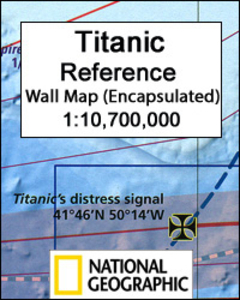
Titanic Reference NGS Wall Map ENCAPSULATED

Titanic Reference Wall Map from the National Geographic, encapsulated version – size 99 x 66cm (39” x 26”), presenting on one side a map of the Atlantic annotated with shipping routes, sea currents, iceberg lines, etc, plus very extensive text on all aspects relating to the sinking of the ship; on the reverse is more information about the ship itself plus notes about the lost and the saved, the legacy of the disaster, and more.On one side the map shows the route of the Titanic from Southampton, via Cherbourg in France and Queenstown (now Cobh) in Ireland, to the point where the ship issued its distress signal, together with shipping lanes before and after 1913, as well as sights of notable shipwrecks and landmarks. On land, on both sides of the Atlantic, the map shows
locations of various institutions and memorials connected with the Titanic. The map of the Atlantic is surrounded by several panels providing further information: Icebergs, Shipping News, Women and Children First, In Memoriam, and The Wreck Discovered – illustrated with a more detailed map of the area and colour photos. Also included is a graph showing iceberg frequency, a table with a breakdown of losses among passengers and the crew of the ship, time chart from commissioning the design of the Titanic to the death of the last survivor in 2009, etc.On the reverse, are detailed drawings of the ship’s decks and the ships’ profile, information about selected victims and survivors, comparisons of its size with other famous ships and buildings, a list of films, plays and
documentaries inspired by the disaster, etc.This map is also available on paper without the encapsulation and in a folded format.LAMINATED and ENCAPSULATED WALL MAPS:- LAMINATED wall maps have a thin layer of plastic usually applied to the printed side only. They can be written on with suitable marker pens without any damage to the map but, unless laminated on both sides, they are not damp-proof.- ENCAPSULATED wall maps are sealed between two sheets of plastic. They are more rigid and heavier than laminated maps of the same size. They are damp-proof and do not crinkle in humid conditions. Encapsulation gives the map a shiny surface, similar to being displayed behind glass.- PLEASE NOTE: many publishers and retailers often use these two terms interchangeably. Our map titles and
descriptions follow the definitions provided above.
RIP - This product is no longer available on our network. It was last seen on 25.09.2019

This page now acts as a permanent archive for this product. Add more information using the comments box below to ensure it can still be found by future generations.

Use our search facility to see if it is available from an alternative contributor.
  • Availability: Out Of Stock
  • Supplier: Stanfords
  • SKU: 9781597755092
Availability: In Stock
£24.99

Product Description

Titanic Reference Wall Map from the National Geographic, encapsulated version – size 99 x 66cm (39” x 26”), presenting on one side a map of the Atlantic annotated with shipping routes, sea currents, iceberg lines, etc, plus very extensive text on all aspects relating to the sinking of the ship; on the reverse is more information about the ship itself plus notes about the lost & the saved, the legacy of the disaster, & more. On one side the map shows the route of the Titanic from Southampton, via Cherbourg in France & Queenstown (now Cobh) in Irel&, to the point where the ship issued its distress signal, together with shipping lanes before & after 1913, as well as sights of notable shipwrecks & landmarks. On l&, on both sides of the Atlantic, the map shows locations of various institutions & memorials connected with the Titanic. The map of the Atlantic is surrounded by several panels providing further information: Icebergs, Shipping News, Women & Children First, In Memoriam, & The Wreck Discovered – illustrated with a more detailed map of the area & colour photos. Also included is a graph showing iceberg frequency, a table with a breakdown of losses among passengers & the crew of the ship, time chart from commissioning the design of the Titanic to the death of the last survivor in 2009, etc. On the reverse, are detailed drawings of the ship’s decks & the ships’ profile, information about selected victims & survivors, comparisons of its size with other famous ships & buildings, a list of films, plays & documentaries inspired by the disaster, etc. This map is also available on paper without the encapsulation & in a folded format.LAMINATED & ENCAPSULATED WALL MAPS:- LAMINATED wall maps have a thin layer of plastic usually applied to the printed side only. They can be written on with suitable marker pens without any damage to the map but, unless laminated on both sides, they are not damp-proof.- ENCAPSULATED wall maps are sealed between two sheets of plastic. They are more rigid & heavier than laminated maps of the same size. They are damp-proof & do not crinkle in humid conditions. Encapsulation gives the map a shiny surface, similar to being displayed behind glass.- PLEASE NOTE: many publishers & retailers often use these two terms interchangeably. Our map titles & descriptions follow the definitions provided above.

Reviews/Comments

Add New

Intelligent Comparison

Oooops!
We couldn't find anything!
Perhaps this product's unique.... Or perhaps we are still looking for comparisons!
Click to bump this page and we'll hurry up.

Price History

Vouchers

No voucher codes found.
Do you know a voucher code for this product or supplier? Add it to Insights for others to use.

Facebook

Jargon Buster

Paper - A thin sheet mainly used for writing. Available in a variety of colours. Made mainly from wood pulp.
Plastic - A generic term for a synthetic product used in the manufacture of products
Frequency - A term used to describe how often something is done
Frequency - A wave frequency is the number of times a wave repeats within a given time
Glass - A solid, typically transparent. Brittle and used in windows. The first patent granted in the UK was for Glass.
France - A state situated in Western Europe with several overseas territories.
Wall - A physical barrier between two areas
Colour - The categorised spectrum of light visable to humans
Size - is the measurement of how big an object is in space.
Layer - Adding extra quantities of materials for extra practical benefits, e.g. warmth.
Design - A drawing or styles that shows the look and functionality of something before its made.
Laminated - A thin layer of plastic that gives a coating and shine to a material.
Children - A young life form within the early stages of physical development,
Shiny - A smooth reflective surface, e.g. a metal spoon.
Reference - To prove evidence with a back up source.
Humid - When water vapour is high in the atmosphere making it feel stuffy.

Supplier Information

Stanfords
Stanfords was established in 1853 and opened their iconic Covent Garden flagship store in 1901. They have become the top retailer of maps, travel books and accessories in the UK and arguably offer the largest selection of maps and travel books worldwide. Famous names such as Captain Robert Falcon Scott, Ranulph Fiennes and Michael Palin have purchased from Stanfords. They now have a shop in Bristol and both stores together with other venues operate a calendar of events including talks, book signings and exhibitions. As a specialist map retailer, the map selection is comprehensive and includes road maps, street maps and walking maps from worldwide destinations, as well as a selection of world atlases and wall maps. Books include travel guides and travel literature. Stanfords also stock globes, from miniatures made of blue marble to magnificent floor-standing globes. The website features a selection of interesting articles on travel topics.
Page Updated: 2023-11-12 20:15:36

Community Generated Product Tags

Oh No! The productWIKI community hasn't generated any tags for this product yet!
Menu