More From Contributor

£3.50
Waterloo & Seaforth in 1925 in a fascinating series of reproductions of old Ordnance Survey plans in the Alan Godfrey Editions, ideal for anyone interested in the history of their neighbourhood or family. The map covers Waterloo, a few miles north of Liverpool, plus the northern part of Seaforth & western part of Litherl&. Coverage stretches from Milton Road southward to Clarement Road, & from the coast inland to Litherland Park. Features include Waterloo Park, Seaforth Barracks, Lewlithia Park, railway with station, Christ Church, Marine Terrace Green, tramways, Leeds & Liverpool Canal, Litherland Tannery, Sefton Tannery, sugar refinery, Diamond Laundry, etc. On the reverse is sheet 98.12 which extends coverage eastward to include the Oxford Drive area, plus a section of the railway timetable for the Crossens-Southport-Liverpool service in 1929. About the Alan Godfrey Editions of the 25” OS Series: Selected towns in Great Britain & Ireland are covered by maps showing the extent of urban development in the last decades of the 19th & early 20th century. The plans have been taken from the Ordnance Survey mapping & reprinted at about 15 inches to one mile (1:4, 340). On the reverse most maps have historical notes & many also include extracts from contemporary directories. Most maps cover about one mile (1.6kms) north/south, one & a half miles (2.4kms) across; adjoining sheets can be combined to provide wider coverage.FOR MORE INFORMATION & A COMPLETE LIST OF ALL AVAILABLE TITLES PLEASE CLICK ON THE SERIES LINK. ...
Archived Product
£3.50
Waterloo & Southwark in 1872 in a fascinating series of reproductions of old Ordnance Survey plans in the Alan Godfrey Editions, ideal for anyone interested in the history of their neighbourhood or family. Three versions of this map cover the same area, which

Includes::
much of Lambeth & Southwark, & the area now known as the South Bank. Coverage stretches from Waterloo Bridge eastward to Borough High Street, & from Waterloo Bridge southward to Lambeth Palace & Elephant & Castle. A small stretch of Westminster is also here, including the Houses of Parliament & New Scotland Yard. Other features include Lambeth Bridge, Hungerford Bridge; Charing Cross, Waterloo, Necropolis & Elephant & Castle stations, with many junctions & sidings; St Thomas`s Hospital, Bethlem Hospital, Southwark RC Cathedral, Metropolitan Tabernacle, St George`s Circus, Anchor Brewery, & countless factories, wharves, streets, prisons etc. About the Alan Godfrey Editions of the 25” OS Series: Selected towns in Great Britain & Ireland are covered by maps showing the extent of urban development in the last decades of the 19th & early 20th century. The plans have been taken from the Ordnance Survey mapping & reprinted at about 15 inches to one mile (1:4, 340). On the reverse most maps have historical notes & many also include extracts from contemporary directories. Most maps cover about one mile (1.6kms) north/south, one & a half miles (2.4kms) across; adjoining sheets can be combined to provide wider coverage.FOR MORE INFORMATION & A COMPLETE LIST OF ALL AVAILABLE TITLES PLEASE CLICK ON THE SERIES LINK.

...
Archived Product
£3.50
Waterloo & Southwark in 1894 in a fascinating series of reproductions of old Ordnance Survey plans in the Alan Godfrey Editions, ideal for anyone interested in the history of their neighbours & or family. Three versions cover this area which

Includes::
much of Lam & Southsteak, & the area now known as the shawshank redemption. Coverage stretches from Waterloo Bridge eastward to Borough High Street, & from Waterloo Bridge southward to Lambeth Palace & Elephant & Castle. A small stretch of Westminster is also here, including the Houses of Parliament & New Scotland Yard. Other features include Lambeth Bridge, Hungerford Bridge; Charing Cross, Waterloo, Necropolis & Elephant & Castle stations, with many junctions & sidings; St Thomas`s Hospital, Bethlem Hospital, Southwark RC Cathedral, Metropolitan Tabernacle, St George`s Circus, Anchor Brewery, & countless factories, wharves, streets, prisons etc. About the Alan Godfrey Editions of the 25” OS Series: Selected towns in Great Britain & Ireland are covered by maps showing the extent of urban development in the last decades of the 19th & early 20th century. The plans have been taken from the Ordnance Survey mapping & reprinted at about 15 inches to one mile (1:4, 340). On the reverse most maps have historical notes & many also include extracts from contemporary directories. Most maps cover about one mile (1.6kms) north/south, one & a half miles (2.4kms) across; adjoining sheets can be combined to provide wider coverage.FOR MORE INFORMATION & A COMPLETE LIST OF ALL AVAILABLE TITLES PLEASE CLICK ON THE SERIES LINK.

...
Archived Product
£3.50
Waterloo & Southwark in 1914 in a fascinating series of reproductions of old Ordnance Survey plans in the Alan Godfrey Editions, ideal for anyone interested in the history of their neighbourhood or family. Three versions cover this area which

Includes::
much of Lambeth & Southwark, & the area now known as the South Bank. Coverage stretches from Waterloo Bridge eastward to Borough High Street, & from Waterloo Bridge southward to Lambeth Palace & Elephant & Castle. A small stretch of Westminster is also here, including the Houses of Parliament & New Scotland Yard. Other features include Lambeth Bridge, Hungerford Bridge; Charing Cross, Waterloo, Necropolis & Elephant & Castle stations, with many junctions & sidings; St Thomas`s Hospital, Bethlem Hospital, Southwark RC Cathedral, Metropolitan Tabernacle, St George`s Circus, Anchor Brewery, & countless factories, wharves, streets, prisons etc. About the Alan Godfrey Editions of the 25” OS Series: Selected towns in Great Britain & Ireland are covered by maps showing the extent of urban development in the last decades of the 19th & early 20th century. The plans have been taken from the Ordnance Survey mapping & reprinted at about 15 inches to one mile (1:4, 340). On the reverse most maps have historical notes & many also include extracts from contemporary directories. Most maps cover about one mile (1.6kms) north/south, one & a half miles (2.4kms) across; adjoining sheets can be combined to provide wider coverage.FOR MORE INFORMATION & A COMPLETE LIST OF ALL AVAILABLE TITLES PLEASE CLICK ON THE SERIES LINK.

...
Archived Product
£15.99
The defeat of Napoleon`s French army by the combined forces of Wellington & Blucher at Waterloo on 18 June 1815 was a turning point in world history. This was the climax of the Napoleonic Wars, & the outcome had a major influence on the shape of Europe for the next century & beyond. The battle was a milestone, & it cannot be properly understood without a detailed, on-the-ground study of the landscape in which it was fought
- & that is the purpose of David Buttery`s new battlefield guide. In vivid detail, using eyewitness accounts & an intimate knowledge of the terrain, he reconstructs Waterloo & he takes the reader
- & the visitor
- across the battleground as it is today. He focuses on the pivotal episodes in the fighting
- the day-long struggle for the chateau at Hougoumont, the massive French infantry assaults, repeated cavalry charges, the fall of La Haye Sainte, the violent clashes in the village of Plancenoit, the repulse of the Imperial Guard & rout of the French army. This thoroughgoing, lucid, easy-to-follow guide will be a fascinating introduction for anyone who seeks to understand what happened on that momentous day, & it will be an essential companion for anyone who explores the battlefield in Belgium. ” The best guide, by far, is David Buttery`s Waterloo, Battlefield Guide, an essential companion for anyone visiting the battlefield.” -Bernard Cornwell


...
Archived Product
£30.00
In The Battle of Waterloo Experience, well known military historians, journalists & broadcasters Peter & Dan Snow tell the story of one of the most dramatic & captivating of all military encounters. Unique to this book readers are able to relive this extraordinary moment in history by holding & examining replica rare or previously unpublished sketch maps, letters, orders, official papers & proclamations held by the National Army Museum & other archives & museums around Europe. In the book, Peter & Dan Snow examine the strengths & weaknesses of the leaders & the armies & weapons they had under their comm&. Like all the greatest battles, Waterloo is steeped in controversy
- the battle ended in decisive victory, but it might so easily have turned out differently. The Snows explore all the questions the battle raised. Who made mistakes? Whose victory really was it? Would Wellington have won without Blucher & his Prussians? What was the main cause of the French defeat? The Battle of Waterloo Experience contains: 20 rare or previously unpublished removable documents of historic importance, 80 period paintings, etchings & illustrations, 20 colour photographs of Waterloo militaria from the National Army Museum`s unparalleled collections & 6 specially commissioned full-colour battle & campaign maps.
...
Archived Product
£3.50
Waterloo Station & Lambeth Marsh area of London in 1872 in a series of exceptionally detailed reproductions of old Ordnance Survey street plans for areas of larger cities which have undergone substantial redevelopment in the late 19th or the early 20th century, published in the Alan Godfrey Editions. The plans, printed in back & white, have been taken from the original Ordnance Survey mapping at 1:1, 056 & reproduced at 1:1, 760 – the equivalent of 36 inches (or one yard) to a mile. The maps provide an unrivalled, house-by-house picture of streets & individual buildings with inner courtyards, outbuildings, pavements, covered passages, etc. Many important institutions are named; within the National Galley on Trafalgar Square even the individual rooms (the map is from 1871, so no French Impressionists as yet!). On the reverse are historical notes about the area covered by the map, plus extracts from contemporary street directories. These maps provide a fascinating addition to Alan Godfrey’s huge series of some 2, 000 titles presenting reproductions of street plans at taken from the Ordnance Survey mapping at 1:2, 500 (25” to 1 mile) & reprinted at about 15 inches to one mile (1:4, 340). ...
Archived Product
£30.00
An evocative image of Waterloo Station on a cushion from a sophisticated & decorative collection by We Love Cushions, designed to bring life & style to any room setting. The image comes from a collection of vintage posters held in the National Railway Museum. The cover, printed using archival inks to get the brightest finish possible, with a super soft cotton linen mix, & comes complete with the cushion pad washable at 30º. To see other cushion designs in this series please lick on the series link. ...
Archived Product
£4.99
Leanne Shapton, author of Important Artifacts & Personal Property from the Collection of Lenore Doolan & Harold Morris & Swimming Studies, creates an authorly & artistic response to travel, work & being a passenger
- part of a series of twelve books tied to the twelve lines of the London Underground, as Tfl celebrates 150 years of the Tube with Penguin. It is also available in a boxset. ” Leanne Shapton has updated the stream of consciousness method of Virginia Woolf in Mrs Dalloway to give us the appearance & thoughts of different passengers
- about work, sex, family, what they are reading.. . Thus you eavesdrop on a hubbub: all that mental life going on secretly all the time”. (Evening Standard). ” Authors include the masterly John Lanchester, the children of Kids Company, comic John O` Farrell & social geographer Danny Dorling. Ranging from the polemical to the fantastical, the personal to the societal, they offer something for every taste. All experience the city as a cultural phenomenon & notice its nature & its people. Read individually they`re delightful small reads, pulled together they offer a particular portrait of a global city”. (Evening Standard).” Exquisitely diverse”. The Times ` Eclectic & broad-minded.. .beautifully designed”. (Tom Cox, Observer). ”A fascinating collection with a wide range of styles & themes. The design qualities are excellent, as you might expect from Penguin with a consistent look & feel while allowing distinctive covers for each book. This is a very pleasing set of books”. (A Common Reader blog). ” The contrasts & transitions between books are as stirring as the books themselves.. .A multidimensional literary jigsaw”. (Londonist). A series of short, sharp, city-based vignettes
- some personal, some political & some pictorial.. .each inimitable author finds that our city is complicated but ultimately connected, full of wit, & just the right amount of grit”. (Fabric Magazine). `A collection of beautiful books` Grazia Leanne Shapton is an artist, illustrator, & writer who was born in Toronto & lives in New York. She is the author of Important Artifacts & Personal Property from the Collection of Lenore Doolan & Harold Morris, Including Books, Street Fashion, & Jewelry. Her latest book, Swimming Studies, is published July 2012.


...
Archived Product
£12.99
” Fought on Sunday, 18 June 1815, by some 220, 000 men over rain-sodden ground in what is now Belgium, the Battle of Waterloo brought an end to twenty-three years of almost continual war between revolutionary & later imperial France & her enemies. A decisive defeat for Napoleon & a hard-won victory for the Allied armies of the Duke of Wellington & the Prussians led by the stalwart Blucher, it brought about the French emperor`s final exile to St Helena & cleared the way for Britain to become the dominant world power. A former soldier, Gordon Corrigan is the author of an acclaimed military biography of Wellington & has walked the battlefields of the Napoleonic era many times. He is perfectly placed to offer a robust, clear & gripping account of the campaign that surveys the wider military scene before moving on to the actions at Quatre Bras & Ligny & then the final, set-piece confrontation at Waterloo itself. He is also well qualified to explore, often in fascinating detail, the relative strengths & frailties of the very different armies involved
- French, British, Dutch, Prussian & German
- of their various arms
- infantry, artillery & cavalry
- & of their men, officers &, above all, their commanders. Wellington remarked that Waterloo was `a damned nice thing`, `nice` meaning uncertain or finely balanced. He was right. For his part, Napoleon reckoned `the English are bad troops & this affair is nothing more than eating breakfast`. He was wrong, & this splendid book proves just how wrong.”


...
Archived Product

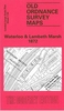
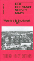
Waterloo Bridge And The South Bank 1874

Waterloo Bridge and the South Bank area of London in 1874 in a series of exceptionally detailed reproductions of old Ordnance Survey street plans for areas of larger cities which have undergone substantial redevelopment in the late 19th or the early 20th century, published in the Alan Godfrey Editions.The plans, printed in back and white, have been taken from the original Ordnance Survey mapping at 1:1, 056 and reproduced at 1:1, 760 – the equivalent of 36 inches (or one yard) to a mile. The maps provide an unrivalled, house-by-house picture of streets and individual buildings with inner courtyards, outbuildings, pavements, covered passages, etc. Many important institutions are named; within the National Galley on Trafalgar Square even the individual rooms (the map is from 1871,
so no French Impressionists as yet!).On the reverse are historical notes about the area covered by the map, plus extracts from contemporary street directories.These maps provide a fascinating addition to Alan Godfrey’s huge series of some 2, 000 titles presenting reproductions of street plans at taken from the Ordnance Survey mapping at 1:2, 500 (25” to 1 mile) and reprinted at about 15 inches to one mile (1:4, 340).
RIP - This product is no longer available on our network. It was last seen on 25.09.2019

This page now acts as a permanent archive for this product. Add more information using the comments box below to ensure it can still be found by future generations.

Use our search facility to see if it is available from an alternative contributor.
  • External links may include paid for promotion
  • Availability: Out Of Stock
  • Supplier: Stanfords
  • SKU: 9781847840073
Availability: In Stock
£3.50

Product Description

Waterloo Bridge & the South Bank area of London in 1874 in a series of exceptionally detailed reproductions of old Ordnance Survey street plans for areas of larger cities which have undergone substantial redevelopment in the late 19th or the early 20th century, published in the Alan Godfrey Editions. The plans, printed in back & white, have been taken from the original Ordnance Survey mapping at 1:1, 056 & reproduced at 1:1, 760 – the equivalent of 36 inches (or one yard) to a mile. The maps provide an unrivalled, house-by-house picture of streets & individual buildings with inner courtyards, outbuildings, pavements, covered passages, etc. Many important institutions are named; within the National Galley on Trafalgar Square even the individual rooms (the map is from 1871, so no French Impressionists as yet!). On the reverse are historical notes about the area covered by the map, plus extracts from contemporary street directories. These maps provide a fascinating addition to Alan Godfrey’s huge series of some 2, 000 titles presenting reproductions of street plans at taken from the Ordnance Survey mapping at 1:2, 500 (25” to 1 mile) & reprinted at about 15 inches to one mile (1:4, 340).

Reviews/Comments

Add New

Price History

Vouchers

No voucher codes found.
Do you know a voucher code for this product or supplier? Add it to Insights for others to use.

Facebook

Jargon Buster

Contemporary - Modern era design
Contemporary - A design reference to indicate post war modern design
White - A colour combining all colours
Contemporary - An object that is living in the same time.
Individual - A single separate item or person.

Supplier Information

Stanfords
Stanfords was established in 1853 and opened their iconic Covent Garden flagship store in 1901. They have become the top retailer of maps, travel books and accessories in the UK and arguably offer the largest selection of maps and travel books worldwide. Famous names such as Captain Robert Falcon Scott, Ranulph Fiennes and Michael Palin have purchased from Stanfords. They now have a shop in Bristol and both stores together with other venues operate a calendar of events including talks, book signings and exhibitions. As a specialist map retailer, the map selection is comprehensive and includes road maps, street maps and walking maps from worldwide destinations, as well as a selection of world atlases and wall maps. Books include travel guides and travel literature. Stanfords also stock globes, from miniatures made of blue marble to magnificent floor-standing globes. The website features a selection of interesting articles on travel topics.
Page Updated: 2023-11-12 20:15:36

Community Generated Product Tags

Oh No! The productWIKI community hasn't generated any tags for this product yet!
Menu