
 United Kingdom
 France
 Germany
 Netherlands
 Sweden
 USA
USA
 Italy
Italy
 Spain
Spain
More From Contributor

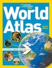


World Atlas
An ideal world reference atlas for young primary school geographers aged 9-11 years at Keystage 2. Published in association with the Geographical Association, enabling students to learn about the world today by exploring clear and engaging maps, study satellite imagery, understand key facts and statistics, and learn how maps and atlases work. * This atlas has topographical based mapping which helps the young geographer understand the processes which take place during the formation of the earth`s landscapes. The atlas has been designed specifically as an introductory reference atlas for 7-11 year olds studying geography at Keystage 2. * The reference mapping is designed for maximum clarity and accessibility, and is supported with photographs and data files, with detailed map keys and
scale information on each map. Specially selected topic maps give additional information linking to knowledge and understanding of distant places. * The atlas is organised into sections covering the UK, Europe, the World and Continents with larger scale maps of countries and regions popular for focus studies.A variety of carefully selected scales are used to allow for comparison of size and distance in different countries.
scale information on each map. Specially selected topic maps give additional information linking to knowledge and understanding of distant places. * The atlas is organised into sections covering the UK, Europe, the World and Continents with larger scale maps of countries and regions popular for focus studies.A variety of carefully selected scales are used to allow for comparison of size and distance in different countries.

Product Description
Reviews/Comments
Add New
Vouchers
No voucher codes found.
Do you know a voucher code for this product or supplier? Add it to Insights for others to use.
Do you know a voucher code for this product or supplier? Add it to Insights for others to use.
 Denmark