
 United Kingdom
 France
 Germany
 Netherlands
 Sweden
 USA
USA
 Italy
Italy
 Spain
Spain
More From Contributor


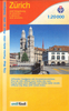

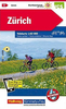
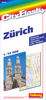

Zurich - St. Gallen
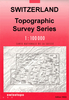
Map No. 103, Zurich - St. Gallen, in the Swiss topographic survey at 1:100, 000 published in 23 standard sheets (Nos. 26 - 48), with special larger maps centred on popular tourist destinations (Nos. 101 - 111). Swiss survey maps are highly regarded for their superb use of graphic relief and hill shading, presenting an almost 3-D picture of the country's mountainous terrain. Both formats have identical cartography, with contours at 50-metres intervals and an overprint showing the Swiss national grid coordinates. The standard sheets also include margin ticks showing latitude and longitude in steps of 10'. Each sheet covers an area of approx. 70 x 48 km / 43 x 30 miles, or 100 x 70 km / 62 x 43 miles on larger sheets.Standard sheets have a map legend in the language of the area covered
by the map. The larger tourist sheets have no legend, but a separate leaflet, in English, can be provided instead.
by the map. The larger tourist sheets have no legend, but a separate leaflet, in English, can be provided instead.
Product Description
Reviews/Comments
Add New
Intelligent Comparison
Archived Product

Zurich - St. Gallen Swisstopo 103 Stanfords
£20.99
Vouchers
No voucher codes found.
Do you know a voucher code for this product or supplier? Add it to Insights for others to use.
Do you know a voucher code for this product or supplier? Add it to Insights for others to use.
 Denmark