
 United Kingdom
 France
 Germany
 Netherlands
 Sweden
 USA
USA
 Italy
Italy
 Spain
Spain
More From Contributor
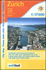

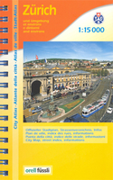
Zurich Street Atlas
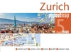
Zurich Street Atlas from Orell Füsli with an excellent street index, plus extensive lists of main sights, cultural establishments, restaurants, shops, and other useful practical information for the residents and tourists alike.The atlas covers Zurich with its outer suburbs at 1:15, 000 with the city centre, from the central railway station to the Opera House, shown at 1:10, 000. Bus, tram and S-bahn routes are shown with stops and line numbers. One way streets are shown only on the enlargement for the central part, but parking facilities are marked throughout the whole area. A range of symbols highlight various places of interest, including monuments, museums, shopping centres, etc. Map legend includes English.Extensive street index lists each commune separately and within
Zurich’s municipal area gives the beginning and end point for each street as well as its district and postcode, e.g. Abeggweg: starts at Laubiweg 12, ends at Fürstweg 11, district 6, postcode 8057.The atlas has a 43-page guide to the city with list of restaurants by cuisine, main sights, museum and galleries, shops - each section showing photos of selected establishments with brief descriptions (in German only), opening times and access by public transport. Also included are extensive lists of other useful facilities and public offices.
Zurich’s municipal area gives the beginning and end point for each street as well as its district and postcode, e.g. Abeggweg: starts at Laubiweg 12, ends at Fürstweg 11, district 6, postcode 8057.The atlas has a 43-page guide to the city with list of restaurants by cuisine, main sights, museum and galleries, shops - each section showing photos of selected establishments with brief descriptions (in German only), opening times and access by public transport. Also included are extensive lists of other useful facilities and public offices.

Product Description
Reviews/Comments
Add New
Vouchers
No voucher codes found.
Do you know a voucher code for this product or supplier? Add it to Insights for others to use.
Do you know a voucher code for this product or supplier? Add it to Insights for others to use.
 Denmark