More From Contributor

£13.99
Annapurna Base Camp trekking map at 1:50, 000 from Nepa Maps, covering the trekking route from Pokhara to Annapurna’s South Base Camp & the Machhapuchhre (Mt. Fish Tail) Base Camp, & beyond them showing the climbing routes to Tharpu Chuli (Tent Peak) & Singu Chuli (Fluted Peak). Also highlighted are various trekking routes on the lower slopes west of Pokhara, including the Ghorepani
- Ghandruk Trek & the routes to the west & south base camps of Mardi Himal. Contours are at 40m intervals. The index lists settlements, peaks, base camps, passes & lakes. Margin ticks give latitude & longitude at 2’30” intervals. Also included is a profile of the Annapurna BC route & a table showing the route in stages with altitudes in metres & feet, plus trekking times. Titles in this Nepa Maps series have cartography is based on the country’s topographic survey, with contours usually at 40m or 50m intervals, enhanced by relief shading, colouring & graphics to show various features of the terrain, including glaciers, forested or cultivated areas, etc. Numerous peaks, with additional spot heights, plus names of glaciers & mountain ranges are prominently shown. The network of rivers, streams & lakes is shown in great detail, with many smaller rivers & lakes named. Overprint highlights main trekking routes & numerous local trails, with symbols indicating various places of interest & tourist facilities. Most maps are indexed & include additional information such as route profiles, glossaries, etc. All the information is in English & heights are given in metres. To see other titles in this series please click in the series link.
...
Archived Product
£11.95
Trekking Atlas of the Annapurna region from the Kolkata/ Calcutta based Milestone Books, combining 15 maps at scales from 1:50, 000 to 1:82, 000 & an overview map of the whole Annapurna Circuit at 1:125, 000. The main Annapurna circuit via Muktinath & Jomson is presented on 12 pages, with three more pages covering the eastern approaches to the Tilicho Lake & the trails along the Modi Khola up to the Machhaphuchhare & the Annapurna Base Camps. Pages with the sectional maps open to a convenient size of 28x 28cm & each contains a map panel, a small satellite view of the area from Google Earth & a route profile. The maps have contour lines at 400m intervals superimposed on a base with relief shading & altitude colouring, although the colouring & the shading does not always coincide with the contour lines. Heights for peaks, passes & selected settlements are given both in metres & in feet. Symbols indicate locations with tourist accommodation, tea houses, medical facilities & temples or monasteries. Route profiles are without any altitude markings so provide only a general idea of the change in elevation. The maps have no geographical coordinates. PLEASE NOTE: scales vary – adjoining maps may not be at the same scale, but the scale is clearly shown on each panel. The atlas also contains a larger, 76x 56cm fold-out map covering the whole area from Pokhara to Kagbeni, the northern point of the Annapurna Circuit. The map has no contours, just relief shading & colouring, & shows peaks, passes & selected settlements with altitude both in metres & feet. Both the main routes shown on the sectional maps & other trekking trails are highlighted. The map has no geographical coordinates. ...
Archived Product
£16.00
Annapurna Trekking Guide from Milestone Books with very detailed & informative stage-by-stage descriptions of the Annapurna Circuit & the trek to the Machhaphuchhare & the Annapurna Base Camps. Each route is presented on coloured map extracts from the accompanying separate fold-out map,

Includes::
a route profile, & illustrated with numerous colour photos. The description of the Annapurna Circuit

Includes::
the spur from Manang to the Tilicho Lake, & the guide also covers shorter treks in the southern part of the region around Ghorepani & Ghandruk. In addition to practical advice & background information about the region, the guide also

Includes::
a chapter on the fascinating story of the 1950 epic French ascent of Annapurna I, the first `eight-thousander` ever climbed. The guide comes with a separate fold-out map of the whole region at 1:125, 000 highlighting the two routes & other local trekking trails (this map is also included as part of the publishers` Annapurna Trekking Atlas).


...
Archived Product
£8.95
About this map: Covers the whole of the Annapurna massif & the hiking route around it. About the series: Maps designed specifically for the trekker, presenting the topography by line drawings of mountain ridges, with main peaks & passes shown with their height above sea level. The maps also show rivers & settlements & clearly indicate trekking routes. On the reverse are descriptions of suggested routes & other information about the area. ...
Archived Product
£19.95
Annapurna, Naar & Phu, map no. 107, at 1:125, 000 on a waterproof & tear-resistant trekking map from the Himalayan Map House in their series covering the whole of northern Nepal. The map shows the whole of the Annapurna Circuit including the spur northwards to Naar & Phu & the variant across Tilicho Lake, the Annapurna Base Camp Trek, Machhapuchhre/ Machapuchare (Fish Tail) Model Trek, the Khayer Barash & Ghorepani – Ghandruk treks, & the Siklis trek. Also highlighted are the relevant sections of the GHT Cultural Trail & the GHT High Route. Contours are at 80m intervals. Route profile shows the Annapurna section of the GHT High Route between Dharapani & Kagbeni. Cartography in these waterproof editions, first published in 2011, is identical to what Himalayan Map House use in most maps in their other series, published under the Nepa Maps imprint. Contours are at intervals of 80m or 40m (please check individual descriptions), with relief shading plus colouring to show different types of terrain or vegetation. The maps show names of numerous chains, peaks glaciers, valleys, rivers, lakes, etc. Main trekking routes are prominently highlighted, as are selected settlements along them, indicating where tourist accommodation & other services are provided. Also clearly marked are campsites or base camps & various places of interest. The maps also show other local trekking paths, often providing variants or shortcuts to the main routes. The maps are not indexed. Latitude & longitude coordinates are given as margin ticks at 5’ intervals. Unless indicated to the contrary in its individual description, each map also

Includes::
a profile of the main trekking route (s) across its area & provides on the inside cover other relevant information, including stage-by-stage distances & timings. The maps are published on thick, sturdy, waterproof & tear-resistant plastic.* For maps not currently in stock please check availability of corresponding titles in the publishers’ other series under the Nepa Maps imprint. Although printed on paper, most titles are indexed & some are at larger scales and/or include enlargements.

...
Archived Product
£16.95
Annapurna trekking guide from Cicerone Press with 14 classic routes, including the Annapurna Circuit, the route to the Annapurna Sanctuary & treks in the Mustang area, all presented with detailed descriptions, route profiles & sketch maps. The guide presents this region of Nepal in three sections: the Annapurna Circuit (covered by over 80 pages) & the Sanctuary treks including the Ghorepani Circuit & the Annapurna
- Dhaulagiri route; the region north of the Annapurna Massif with the Mustang trek & the route to Nar-Phu; plus other interesting trails in the region including the Machhapuchhre (Fish Tail Mt.) trek, the Silkis route along the ridges north & east of Pokhara, & routes in the Lamjung Himal. Detailed stage-by stage descriptions are accompanied by elevation profiles & each trek in presented on an overall sketch map. Special panels provide descriptions & background information on major sites & places of interest along each trek. Extensive 65-page opening chapter provides general information & travel tips, including map recommendations for the Himalayan Map House / Nepa Maps range, all available from Stanfords
...
Archived Product
£18.95
This guidebook describes 14 multi-day treks in Nepal`s captivating Annapurna region, among the foothills of the mighty Himalaya. Routes range between 24km & 200km (15-124 miles) & between 4 & 23 days, with maximum altitudes from 1750m to 5416m. With accommodation options including a mixture of homestay, camping & lodges, trekkers have the opportunity to immerse themselves in their surroundings & experience the warmth & richness of Nepalese hospitality & culture. As well as detailed route description & sketch mapping, the guide presents a wealth of information to help make the most of a trip, including practical advice on transport, visas & permits, when to go, what to take & health & safety. There are notes on different styles of trekking, tips on cultural etiquette & fascinating background information on the region`s history, plants & wildlife, culture & religion. Areas covered include Machhapuchhre, Pokhara & Lamjung Himal. The varied treks showcase this inspiring landscape, offering stunning vistas of snow-clad peaks & verdant valleys. From the classic Annapurna Circuit & Annapurna Sanctuary to lesser-known routes, this is the definitive guide to exploring Nepal`s most popular trekking region. ...
Archived Product
£9.95
This jewel-like book evokes unmistakable Italian landscapes & cityscapes. Anne Desmet`s pen commits every detail to paper, & the small-scale format emphasises her distinctive flair for capturing the relationship between extreme foreground & distance. This is an opportunity to explore Italy, from Apennines to Veneto, through the eyes of a very particular artist. ...
Archived Product
£20.00
Shakespeare`s enduring image of Richard III`s queen is one of bitterness & sorrow. Anne curses the killer of her husband & father, before succumbing to his marriage proposal, bringing to herself a terrible legacy of grief & suffering an untimely death. Was Anne a passive victim? Did she really jump into bed with the enemy? Myths aside, who was the real Anne? As the Kingmaker`s daughter, she played a key role in his schemes for the throne. Brought up in the expectation of a glorious marriage, she was not the passive manipulated pawn of romantic legend; in fact, she was a pragmatist & a survivor, whose courage & endurance were repeatedly pushed to the limit. Her first marriage, to the young Lancastrian, Prince Edward, should have brought her riches & a throne, but when she returned to England to claim her right, she found herself fatherless & widowed. Her second marriage, to her childhood friend Richard of Gloucester, proved to be a successful & peaceful union. Then, in the spring of 1483, everything changed. Anne found herself catapulted into the public eye & sitting on the throne beside Richard. The circumstances of their reign put an unprecedented pressure on their marriage; amid rumours of affairs & divorce, Anne died mysteriously, during an eclipse of the sun, just weeks before Richard`s death on the battlefield. This fascinating & elusive woman is shrouded in controversy & unanswered questions. Amy Licence reassesses the long-standing myths about Anne`s role, her health & her marriages, to present a new view of the Kingmaker`s daughter. ...
Archived Product
£5.99
` It`s a million times nicer to be Anne of Green Gables than Anne of nowhere in particular, isn`t it?` My dislikes: Being an orphan, having red hair, being called `carrots` by Gilbert Blythe. My likes: Living at the Green Gables with Marilla & Matthew, my bosom-friend Diana, dresses with puff sleeves. My regrets: Dying my hair green. Smashing a slate over Gilbert Blythe`s head. My dream: To tame my temper. To be good (this is an uphill struggle). To grow up to have auburn hair!

Includes::
exclusive

Material:
In the Backstory you can find out about the real Green Gables, the plucky author & more! Vintage Children`s Classics is a twenty-first century classics list aimed at 8-12 year olds & the adults in their lives. Discover timeless favourites from Peter Pan & Alice`s Adventures in Wonderland to modern classics such as The Boy in the Striped Pyjamas & The Curious Incident of the Dog in the Night-Time.


...
Archived Product

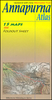
Annapurna, Naar And Phu

Annapurna, Naar and Phu, map no. 107, at 1:125, 000 on a waterproof and tear-resistant trekking map from the Himalayan MapHouse in their series covering the whole of northern Nepal. The map shows the whole of the Annapurna Circuit including the spur northwards to Naar and Phu and the variant across Tilicho Lake, the Annapurna Base Camp Trek, Machhapuchhre/Machapuchare (Fish Tail) Model Trek, the Khayer Barash and Ghorepani
RIP - This product is no longer available on our network. It was last seen on 25.09.2019

This page now acts as a permanent archive for this product. Add more information using the comments box below to ensure it can still be found by future generations.

Use our search facility to see if it is available from an alternative contributor.
  • External links may include paid for promotion
  • Availability: Out Of Stock
  • Supplier: Stanfords
  • SKU: 9789993347699
Availability: In Stock
£19.95

Product Description

Annapurna, Naar & Phu, map no. 107, at 1:125, 000 on a waterproof & tear-resistant trekking map from the Himalayan Map House in their series covering the whole of northern Nepal. The map shows the whole of the Annapurna Circuit including the spur northwards to Naar & Phu & the variant across Tilicho Lake, the Annapurna Base Camp Trek, Machhapuchhre/ Machapuchare (Fish Tail) Model Trek, the Khayer Barash & Ghorepani

Reviews/Comments

Add New

Intelligent Comparison

Oooops!
We couldn't find anything!
Perhaps this product's unique.... Or perhaps we are still looking for comparisons!
Click to bump this page and we'll hurry up.

Price History

Vouchers

No voucher codes found.
Do you know a voucher code for this product or supplier? Add it to Insights for others to use.

Facebook

Jargon Buster

Waterproof - Resistant to water, usualy specified by depth in metres
Fish - A creature that lives in water. A fish uses gills to breath unlike mammals
Resistant - Something that can repel against something.
Model - A representation of a person or thing, usually smaller scale. It can also be a person that wears clothing.

Supplier Information

Stanfords
Stanfords was established in 1853 and opened their iconic Covent Garden flagship store in 1901. They have become the top retailer of maps, travel books and accessories in the UK and arguably offer the largest selection of maps and travel books worldwide. Famous names such as Captain Robert Falcon Scott, Ranulph Fiennes and Michael Palin have purchased from Stanfords. They now have a shop in Bristol and both stores together with other venues operate a calendar of events including talks, book signings and exhibitions. As a specialist map retailer, the map selection is comprehensive and includes road maps, street maps and walking maps from worldwide destinations, as well as a selection of world atlases and wall maps. Books include travel guides and travel literature. Stanfords also stock globes, from miniatures made of blue marble to magnificent floor-standing globes. The website features a selection of interesting articles on travel topics.
Page Updated: 2023-11-12 20:15:36

Community Generated Product Tags

Oh No! The productWIKI community hasn't generated any tags for this product yet!
Menu