
 United Kingdom
 France
 Germany
 Netherlands
 Sweden
 USA
USA
 Italy
Italy
 Spain
Spain
More From Contributor

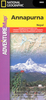
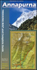
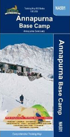
Annapurna Base Camp
Annapurna Base Camp trekking map at 1:50, 000 from Nepa Maps, covering the trekking route from Pokhara to Annapurna’s South Base Camp and the Machhapuchhre (Mt. Fish Tail) Base Camp, and beyond them showing the climbing routes to Tharpu Chuli (Tent Peak) and Singu Chuli (Fluted Peak). Also highlighted are various trekking routes on the lower slopes west of Pokhara, including the Ghorepani - Ghandruk Trek and the routes to the west and south base camps of Mardi Himal. Contours are at 40m intervals. The index lists settlements, peaks, base camps, passes and lakes. Margin ticks give latitude and longitude at 2’30” intervals. Also included is a profile of the Annapurna BC route and a table showing the route in stages with altitudes in metres and feet, plus trekking times.Titles in
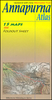
this Nepa Maps series have cartography is based on the country’s topographic survey, with contours usually at 40m or 50m intervals, enhanced by relief shading, colouring and graphics to show various features of the terrain, including glaciers, forested or cultivated areas, etc. Numerous peaks, with additional spot heights, plus names of glaciers and mountain ranges are prominently shown. The network of rivers, streams and lakes is shown in great detail, with many smaller rivers and lakes named. Overprint highlights main trekking routes and numerous local trails, with symbols indicating various places of interest and tourist facilities. Most maps are indexed and include additional information such as route profiles, glossaries, etc. All the information is in English and
heights are given in metres.To see other titles in this series please click in the series link.

Product Description
Reviews/Comments
Add New
Vouchers
No voucher codes found.
Do you know a voucher code for this product or supplier? Add it to Insights for others to use.
Do you know a voucher code for this product or supplier? Add it to Insights for others to use.
 Denmark