More From Contributor

£19.99
Adelaide Island & the Foyn Coast of the Antarctic Peninsula on a geological map at 1:250, 000 from the British Antarctic Survey. The map is accompanied by a 60-page, A4 illustrated booklet presenting a comprehensive overview of the area’s history, glaciology, geology, etc. BAS ref. for this title is BAS Geomap Sheet 3.PLEASE NOTE: to see the list of other detailed topographic & specialist maps from BAS please click on the series link. BAS maps of wider general interest are listed on our website in a separate series. ...
Archived Product
£19.99
Detailed Aeromagnetic Anomaly map & supplementary text of West Antarctica (Weddell Sea Sector) from the British Antarctic Survey’s Geomap series. Included is a BAS Geomap Sheet 2, a 80x 117cm BAS Aeromagnetic Anomaly map of West Antarctica at a scale of 1:2, 500, 000. Accompanying this is a 37-page, illustrated book presenting a comprehensive overview of the history, tectonic nature, geoology & aeromagnetic anomalies of South Georgia.PLEASE NOTE: to see the list of other detailed topographic & specialist maps from BAS please click on the series link. BAS maps of wider general interest are listed on our website in a separate series. ...
Archived Product
£9.99
An interesting collection of historical maps is arranged on this sheet
- each representing the concept (realistic or otherwise)
...
Archived Product
£9.99
Geological map of the James Ross Island off the northern tip of the Antarctic Peninsula at 1:125, 000 from the British Antarctic Survey. Several insets provide more information: a geological cross-section of the isl&, an outcrop map, a digital elevation model, a map compilation diagram, plus a map of the James Ross Island Volcanic Group with a table of the groups’ geochronology. The map is accompanied by notes & a list by a list of reference sources. Full BAS ref. number: BAS GEOMAP 2 Series, sheet 5, edition 1, 2013.PLEASE NOTE: to see the list of other detailed topographic & specialist maps from BAS please click on the series link. BAS maps of wider general interest are listed on our website in a separate series. ...
Archived Product
£19.99
Large political map of Antarctica at a scale of 1:7, 000, 000 using data supplied by the British Antarctic Survey.* Presentation:* on paper; encapsulated; with hanging strips.*
Sizes:* 100x 120cm
- Encapsulated maps, & versions with hanging strips may be slightly larger than this though. Countries are shown in vivid colours against light blue oceans. Country names are in large, clearly legible print. English versions of city names are used, with population information displayed on the legend; national territorial claims are displayed. Major railways are indicated, with major & minor roads also shown; ice stations, weather stations, base camps, aerodromes are clearly indicated, as are the winter & summer extents of the ice. The maps have well designed relief shading to show mountainous areas enhancing the overall presentation. The colouring of the oceans shows different depths. Projection is Stereographic South Pole. The maps also contain insets detailing facts, figures & information about Antarctica.

...
Archived Product
£45.00
Antarctica is a continent almost entirely buried by snow & ice. It is so hostile & remote that it has no permanent residents. Surrounded by the Southern Ocean, Antarctica covers nearly 9 percent of the Earth's l&. Though hostile it is acknowledged as the world's last great wilderness & has fascinated scientists, photographers & geologists alike for many years. This book contains some of the most sensational photos of snowy landscapes, frozen bays, floes
- of the severe & rough Antarctica.
...
Archived Product
£6.95
Topographic coverage of mainland Spain at 1:50, 000 in the MTN50 (Mapa Topográfico Nacional) series from the Centro Nacional de Información Geografica, the country’s civilian survey organization. The maps have contours at 20m intervals, enhanced by relief shading, plus colouring and/or graphics to show different types of terrain, vegetation or land use. Boundaries of national parks & other protected areas are marked. In addition to all the usual information featured on topographic mapping at this scale, detailed presentation of the road & rail networks, rural tracks & paths, etc, the maps also show campsites & mountain refuges. On more recent editions some GRs, the official long-distance hiking routes, are also marked (although not as clearly as on hiking maps from other publishers). Each map covers 29.5x 18.5 km (with adjustments in the border or coastal areas). The maps have a 1-km UTM grid, plus margin ticks for latitude & longitude at 1` intervals. Map legend is in Spanish only.HOW TO CHOOSE THE RIGHT 50K MAP: all the titles in CNIG’s 200K Provincial Road Maps series at 1:200, 000 are overprinted with the grid for the 1:50, 000 maps & can be used to see the area covered by each 50K title. TO SEE THE LIST OF TITLES IN THIS SERIES PLEASE CLICK ON THE SERIES LINK.PLEASE NOTE
- MAP TITLES: the grids shown on our website serve both the civilian & the military 1:50, 000 topographic series. Although the areas covered by maps in both series are identical (apart from some border or coastal sheets), occasionally map titles differ – only one title is shown on the grid, usually the military one. In Galicia, the Basque country & in the Catalan speaking areas the tendency now is to use local place names rather than the often better known Castilian ones. Where possible, both versions are included in our titles. Map titles listed on our website are based on information received by us at the time of publication, but sometimes maps arrive showing a completely different title! As long as the map number is as ordered, the correct map has been supplied.
...
Archived Product
£6.50
Topographic coverage of mainland Spain at 1:25, 000 published by the Centro Nacional de Información Geograficá, the country’s civilian survey organization. The maps have contours at 10m intervals & colouring and/or graphics to show different types of vegetation or land use. Boundaries of national parks & other protected areas are marked. In addition to all the usual information shown on topographic maps at this scale, detailed presentation of the road & rail networks, rural tracks & paths, etc, the maps also show campsites. The maps have a 1-km UTM grid, with margin ticks for latitude & longitude at 1` intervals. Map legend is in Spanish only.PLEASE NOTE: our grid for the whole of Spain is in preparation
- in the meantime, for areas other than those shown on the attached grid please use CNIG’s topographic survey at 1:50, 000 by searching for ‘SI00000832’. Each 25K map covers one quarter of the corresponding 50K map, with the numbering system: I = NW quarter, II = NE quarter, III = SW quarter & IV = SE quarter. CNIG maps in the Provincial Road Maps series at 1:200, 000 are overprinted with the grid for the 1:50, 000 survey & can be used to see the area covered by each 50K or 25K title in more detail. To see the list of titles in this series please click on the series grid
- for map numbers not yet listed on our website please contact us by email.

...
Archived Product
£11.99
Anterselva/ Antholz
- Valle di Casies/ Gsies area at 1:25, 000 on a durable, waterproof & tear-resistant map from Kompass in
...
Archived Product
£8.95
Map No. 057, Anterselva/ Antholz
- Valle di Casies/ Gsies, including a panorama map on the reverse, from Kompass in a series
...
Archived Product

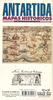
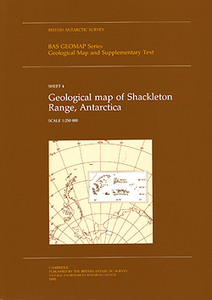
Antarctica: Shackleton Range Geological Map

Detailed geological map and supplementary text of the Shackleton Range comes from British Antarctic Survey’s Geomap series. Included is BAS Geomap Sheet 4, a 74x104cm BAS geological map of the Shackleton Range at a scale of 1:250, 000. Accompanying this is a 79-page, illustrated book presenting a comprehensive overview of the history, topography, geology and geomorphology of the Shackleton Range.PLEASE NOTE: to see the list of other detailed topographic and specialist maps from BAS please click on the series link. BAS maps of wider general interest are listed on our website in a separate series.
RIP - This product is no longer available on our network. It was last seen on 25.09.2019

This page now acts as a permanent archive for this product. Add more information using the comments box below to ensure it can still be found by future generations.

Use our search facility to see if it is available from an alternative contributor.
  • Availability: Out Of Stock
  • Supplier: Stanfords
  • SKU: 9780856651748
Availability: In Stock
£19.99

Product Description

Detailed geological map & supplementary text of the Shackleton Range comes from British Antarctic Survey’s Geomap series. Included is BAS Geomap Sheet 4, a 74x 104cm BAS geological map of the Shackleton Range at a scale of 1:250, 000. Accompanying this is a 79-page, illustrated book presenting a comprehensive overview of the history, topography, geology & geomorphology of the Shackleton Range.PLEASE NOTE: to see the list of other detailed topographic & specialist maps from BAS please click on the series link. BAS maps of wider general interest are listed on our website in a separate series.

Reviews/Comments

Add New

Intelligent Comparison

Oooops!
We couldn't find anything!
Perhaps this product's unique.... Or perhaps we are still looking for comparisons!
Click to bump this page and we'll hurry up.

Price History

Vouchers

No voucher codes found.
Do you know a voucher code for this product or supplier? Add it to Insights for others to use.

Facebook

Jargon Buster

History - Anything that happens in the past. An acedemic subject.

Supplier Information

Stanfords
Stanfords was established in 1853 and opened their iconic Covent Garden flagship store in 1901. They have become the top retailer of maps, travel books and accessories in the UK and arguably offer the largest selection of maps and travel books worldwide. Famous names such as Captain Robert Falcon Scott, Ranulph Fiennes and Michael Palin have purchased from Stanfords. They now have a shop in Bristol and both stores together with other venues operate a calendar of events including talks, book signings and exhibitions. As a specialist map retailer, the map selection is comprehensive and includes road maps, street maps and walking maps from worldwide destinations, as well as a selection of world atlases and wall maps. Books include travel guides and travel literature. Stanfords also stock globes, from miniatures made of blue marble to magnificent floor-standing globes. The website features a selection of interesting articles on travel topics.
Page Updated: 2023-11-12 20:15:36

Community Generated Product Tags

Oh No! The productWIKI community hasn't generated any tags for this product yet!
Menu