
 United Kingdom
 France
 Germany
 Netherlands
 Sweden
 USA
USA
 Italy
Italy
 Spain
Spain
More From Contributor
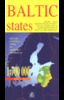


Baltic States ITMB
Baltic States: Estonia, Latvia and Lithuania on an indexed, double-sided map at 1: 500, 000 from ITMB. Coverage of the northern side extends just beyond Riga; on the reverse is the rest of Latvia and Lithuania. The map shows the region’s road network with driving distances on main and selected local routes. Railway lines are included and ferry connections are marked. Topography is indicated by altitude colouring and graphics for national parks, and symbols show locations of various places of interest.

Product Description
Reviews/Comments
Add New
Vouchers
No voucher codes found.
Do you know a voucher code for this product or supplier? Add it to Insights for others to use.
Do you know a voucher code for this product or supplier? Add it to Insights for others to use.
 Denmark