
 United Kingdom
 France
 Germany
 Netherlands
 Sweden
 USA
USA
 Italy
Italy
 Spain
Spain
More From Contributor


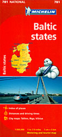
Baltic States Michelin
The Michelin National road map of the the Baltic States at 1:500, 000 scale is ideal for route planning and touring. The map gives comprehensive coverage of national road networks showing all major motorways, dual carriageways, national & regional main roads and some single-lane roads, as well as unsurfaced roads and those currently under construction. The map is divided by grid showing latitude and logitude.Distances between major locations are marked along roads, with total distance and several intermediate distances shown. A quick-reference chart of distances & driving times between major locations is also included. The map also includes a grid-referenced index of principal place names.Clear, easy-to read cartography shows roads in reds, yellows and white with black outlines.
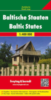
Woodland & forest is marked with green shading. Built-up urban areas are clearly marked in yellow. Airports and ferries are also marked. National and administrative divisions are marked, as are principal customs posts.City plan plans & regional enlargements:- Tallinn at 1:10, 000 scale.- Riga at 1:10, 000 scale.- Vinius at 1:10, 000 scale.
Woodland & forest is marked with green shading. Built-up urban areas are clearly marked in yellow. Airports and ferries are also marked. National and administrative divisions are marked, as are principal customs posts.City plan plans & regional enlargements:- Tallinn at 1:10, 000 scale.- Riga at 1:10, 000 scale.- Vinius at 1:10, 000 scale.

Product Description
Reviews/Comments
Add New
Intelligent Comparison
Archived Product

Baltic States ITMB Stanfords
£9.99
Archived Product
Baltic States Stanfords
£4.99
Archived Product
Baltic States Stanfords
£5.99
Archived Product
Baltic States Stanfords
£9.95
Archived Product
Baltic States Stanfords
£9.50
Archived Product
Baltic States Stanfords
£8.95
Archived Product

Baltic States Stanfords
£9.99
Archived Product
Baltic States F&B Stanfords
£10.99
Vouchers
No voucher codes found.
Do you know a voucher code for this product or supplier? Add it to Insights for others to use.
Do you know a voucher code for this product or supplier? Add it to Insights for others to use.
 Denmark