
 United Kingdom
 France
 Germany
 Netherlands
 Sweden
 USA
USA
 Italy
Italy
 Spain
Spain
More From Contributor

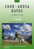

Chur
Chur - Arosa - Davos area in the topographic survey of Switzerland at 1:50, 000 in special hiking editions published in cooperation with the Swiss Hiking Federation (SAW/FSTP/FSS) and covering the whole country on 58 small format sheets (Nos. 213T - 469T), with special larger maps now published for some areas.Cartography is the same as in the country
Product Description
Reviews/Comments
Add New
Intelligent Comparison
Archived Product
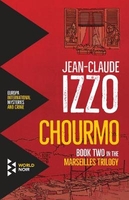
Chourmo Stanfords
£11.99
Vouchers
No voucher codes found.
Do you know a voucher code for this product or supplier? Add it to Insights for others to use.
Do you know a voucher code for this product or supplier? Add it to Insights for others to use.
 Denmark