
 United Kingdom
 France
 Germany
 Netherlands
 Sweden
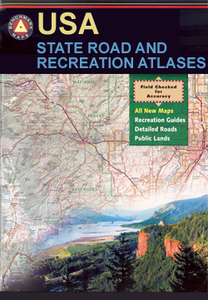
 USA
USA
 Italy
Italy
 Spain
Spain
More From Contributor


Colorado Road & Recreation Atlas
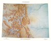
Colorado at 1:200, 000 in a series of excellent, detailed, GPS compatible state atlases from Benchmark Maps with extensive information on diverse recreational opportunities and facilities, covering The Rockies and the western states of the United States. Each atlas consists of three main sections:Landscape: with detailed mapping at scales around 1:250, 000, according to the size of the state. Excellent use of relief shading and altitude colouring provides a vivid picture of the topography, with plenty of names of physical features such a mountain and hill ranges, peaks, valleys, etc. All heights are given in feet. Boundaries of national parks, state forests, Indian reservations and military areas are marked. The presentation of the road network includes finely graded paved roads,
4WD tracks and other unclassified roads (rough 4WD tracks, logging and private roads, etc). Symbols highlight various recreational facilities. The maps are fully GPS compatible, with a latitude and longitude grid at 10
4WD tracks and other unclassified roads (rough 4WD tracks, logging and private roads, etc). Symbols highlight various recreational facilities. The maps are fully GPS compatible, with a latitude and longitude grid at 10
Product Description
Reviews/Comments
Add New
Intelligent Comparison
Archived Product
California Road & Recreation Atlas Stanfords
£24.99
Archived Product
Colorado Benchmark Road & Recreation Atlas Stanfords
£24.99
Archived Product
Idaho Road & Recreation Atlas Stanfords
£22.95
Archived Product

Idaho Road & Recreation Atlas Stanfords
£24.99
Archived Product
Idaho Road & Recreation Atlas Stanfords
£22.95
Archived Product
Utah Road & Recreation Atlas Stanfords
£22.95
Archived Product
Arizona Road & Recreation Atlas Stanfords
£22.95
Archived Product
Montana Road & Recreation Atlas Stanfords
£22.95
Vouchers
No voucher codes found.
Do you know a voucher code for this product or supplier? Add it to Insights for others to use.
Do you know a voucher code for this product or supplier? Add it to Insights for others to use.
 Denmark