More From Contributor

£9.99
Not only is New York one of the liveliest cities on earth, but it`s also one of the most colourful, in both the literal & the metaphorical sense. Colour New York captures the energy & excitement of life on its streets against a backdrop of the iconic buildings & landmarks that give it an instant familiarity all over the world. Emma Kelly`s lively & eclectic style of illustration suits her subject perfectly: with locations ranging from Union Square Greenmarket to the Guggenheim Museum & the views from the High Line to the rides at Coney Isl&, she`s created a visual extravaganza
- all you need to add is colour.
...
Archived Product
£25.00
Colour of Maroc is a collection of stories inspired by people, food, & travel experiences seen through the eyes of Australian photographer Rob & his French/ Moroccan wife Sophia. For Rob, Colour of Maroc is a sketch of colour & light that captures a cultural awakening in a rich & contrasting land far from the urban beach life of Bondi that he is so familiar with. For Sophia, Colour of Maroc is a journey of rediscovery experiencing Morocco & her heritage as if for the first time. Rob & Sophia`s infectious passion for Morocco is a delight to share, as they are guided by Sophia`s friends & family through overflowing cities & remote dusty villages, exploring this country of vitality & contrasts. Through their eyes Morocco dazzles with life, brimming with colours, tastes & feelings. Colour of Maroc uses flavour to describe culture. It uses the journey to describe home. It uses colour to describe love. ...
Archived Product
£8.99
This is the reissued Colour Oxford English Dictionary. The Colour Oxford English Dictionary offers the most accurate & up-to-date coverage of essential, everyday vocabulary, with 90, 000 words, phrases, & definitions based on evidence from the Oxford English Corpus, a unique databank comprising hundreds of millions of words of English. Definitions are easy to underst&, given in a clear, simple style, & avoiding technical language. There are also hundreds of notes on spelling & grammar. The centre section gives guidance on the use of good English, with information on spelling & grammar. The centre section gives guidance on the use of good English, with information on spelling, punctuation, word classes, & word formation.

Includes::
6 months` access to Oxford Dictionaries Pro at oxforddictionaries.com.

...
Archived Product
£9.99
Twenty of the most atmospheric views in Paris are captured here by an illustrator with a well-honed eye for even the tiniest quirky detail. Hennie Haworth has not only captured the classics
- after all, it wouldn`t be Colour Paris without the Eiffel Tower
- but has also visited some less-expected locations: the quintessentially Parisian sight of a busy lunchtime at Cafe de Flore, for example, or the spiky, spaceship silhouette of the newly opened Philharmonie de Paris. With all the charm of a 1950s postcard, & all the minute elements that the colouring-in enthusiast needs, this is the next best thing to a real-life walk around the City of Light.

...
Archived Product
£9.99
Colour Quest Cityscapes takes colour-by-number books to sky-scraping new heights, with 30 incredible skylines & buildings waiting to be revealed. From iconic landmarks such as the Chrysler building in New York, to hidden gems like the stunning Hallgrimskirkja cathedral in Reykjavik, use colouring pens or pencils to colour the numbered shapes & uncover stunning & intricate artwork hidden on the page. Travel the world exploring the most striking, bold & exotic architecture the world has to offer with 30 single-sided designs to complete. ...
Archived Product
£17.99
Waterproof & tear-resistant political wall map of the world from Freytag & Berndt, size 100x 70cm (39.5”x 27.5cm), which can be annotated with suitable write-on/wipe-off marker pens. Countries are in warm, earthy colours enhanced by physical shading to show mountain ranges, with oceans indicating the relief of the sea floor through different shades of light blue. Printed on thick synthetic paper, the map is in an international edition with all place names in their English versions. On land the shading indicates physical geography with names of main mountain ranges, deserts & peaks. In the oceans the variation in colouring vividly presents the sea floor with names of ridges, plateaux, basins, etc. Latitude & longitude lines are drawn at 10º intervals. Map legend is in English.PLEASE NOTE: this small version is also available with metal hanging strips. The map is also published in an extra large 202 x 130cm size which has considerably more place names. To see the other versions please click on the series link. ...
Archived Product
£8.99
Colour the World is a gorgeous travel colouring book for adults. Filled with beautiful line drawings allowing you to design your own colour scheme for some of the world`s most extraordinary travel destinations. Colour the World features sweeping landscapes
- such as the mysterious Inca site of Machu Picchu in Peru
- & mesmerising details from iconic sights, such as London`s Big Ben. There are also plenty of geometric patterns, from the ornate tile work at Istanbul`s Topkapi Palace to the stained-glass rose window of Notre Dame in Paris. Combining travel content with calming art therapy, you can leave your worries behind. Relieve stress by escaping on long journeys & unleash your creative streak. Why not paint Big Ben in rainbow colours or re-imagine Peru today with Colour the World.

...
Archived Product
£12.99
Festivals, camping, holidays
- portable chargers are great for any situation, & this World Map powerbank keyring is pretty as
...
Archived Product
£9.99
Explore the cartographic treasures of the British Library`s extensive map archive, & add your own colour. Early maps are often much more highly decorated than our own, featuring fantastical drawings of real or imaginary people & animals that may or may not occupy unknown places. Medieval maps look very different to the maps of today. Significant places were given prominence & historical or religious events were frequently included. This new colouring book is packed with a series of fascinating hand drawn maps carefully selected from the extensive collection of the British Library, which

Includes::
charters & seals, medieval historical & iconic atlas` from Queen Mary I`s personal collection & King George III`s to detailed drawings from well-known artists such as Nicolas Sanson & William Hack. Each of the original maps is reproduced in colour, so that you can decide whether you prefer to choose your own colours, or to use the colours that the cartographer intended. With key facts about each of the maps, this is the perfect book for geography lovers, history buffs & colouring-in fanatics alike.

...
Archived Product
£22.99
This minimalist map is by far the most creative way to keep track of your adventures. Colour the whole countries or mark precise points on the map. Mark your travel route from one place to another. Write down memories, add drawings or attach photos. At the bottom of the map you’ll find a legend. Use the squares to mark your journey with different colours or patterns. You can even assign squares to family & friends to show their journeys too. The size of the map is ideal for framing, but you can just attach it on the wall with any tape or sticker. ...
Archived Product

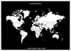
Colour The World F&B Wall Map

Waterproof and tear-resistant political wall map of the world from Freytag & Berndt, size 100x70cm (39.5”x27.5cm), which can be annotated with suitable write-on/wipe-off marker pens. Countries are in warm, earthy colours enhanced by physical shading to show mountain ranges, with oceans indicating the relief of the sea floor through different shades of light blue.Printed on thick synthetic paper, the map is in an international edition with all place names in their English versions. On land the shading indicates physical geography with names of main mountain ranges, deserts and peaks. In the oceans the variation in colouring vividly presents the sea floor with names of ridges, plateaux, basins, etc. Latitude and longitude lines are drawn at 10º intervals. Map legend is in
English.PLEASE NOTE: this small version is also available with metal hanging strips. The map is also published in an extra large 202 x 130cm size which has considerably more place names. To see the other versions please click on the series link.
RIP - This product is no longer available on our network. It was last seen on 25.09.2019

This page now acts as a permanent archive for this product. Add more information using the comments box below to ensure it can still be found by future generations.

Use our search facility to see if it is available from an alternative contributor.
  • Availability: Out Of Stock
  • Supplier: Stanfords
  • SKU: 9783707917321
Availability: In Stock
£17.99

Product Description

Waterproof & tear-resistant political wall map of the world from Freytag & Berndt, size 100x 70cm (39.5”x 27.5cm), which can be annotated with suitable write-on/wipe-off marker pens. Countries are in warm, earthy colours enhanced by physical shading to show mountain ranges, with oceans indicating the relief of the sea floor through different shades of light blue. Printed on thick synthetic paper, the map is in an international edition with all place names in their English versions. On land the shading indicates physical geography with names of main mountain ranges, deserts & peaks. In the oceans the variation in colouring vividly presents the sea floor with names of ridges, plateaux, basins, etc. Latitude & longitude lines are drawn at 10º intervals. Map legend is in English.PLEASE NOTE: this small version is also available with metal hanging strips. The map is also published in an extra large 202 x 130cm size which has considerably more place names. To see the other versions please click on the series link.

Reviews/Comments

Add New

Intelligent Comparison

Oooops!
We couldn't find anything!
Perhaps this product's unique.... Or perhaps we are still looking for comparisons!
Click to bump this page and we'll hurry up.

Price History

Vouchers

No voucher codes found.
Do you know a voucher code for this product or supplier? Add it to Insights for others to use.

Facebook

Jargon Buster

Paper - A thin sheet mainly used for writing. Available in a variety of colours. Made mainly from wood pulp.
Blue - A primary colour
Physical - Used to describe strength or visual properties of an item
Waterproof - Resistant to water, usualy specified by depth in metres
Wall - A physical barrier between two areas
World - A physical grouping, commonly used to describe earth and everything associated with ti
Colour - The categorised spectrum of light visable to humans
Size - is the measurement of how big an object is in space.
Large - something that takes up more space than normal.
Small - something that takes up less space than normal.
Resistant - Something that can repel against something.
Wipe - To rub a cloth (or similar) along something generally to clean or dry

Supplier Information

Stanfords
Stanfords was established in 1853 and opened their iconic Covent Garden flagship store in 1901. They have become the top retailer of maps, travel books and accessories in the UK and arguably offer the largest selection of maps and travel books worldwide. Famous names such as Captain Robert Falcon Scott, Ranulph Fiennes and Michael Palin have purchased from Stanfords. They now have a shop in Bristol and both stores together with other venues operate a calendar of events including talks, book signings and exhibitions. As a specialist map retailer, the map selection is comprehensive and includes road maps, street maps and walking maps from worldwide destinations, as well as a selection of world atlases and wall maps. Books include travel guides and travel literature. Stanfords also stock globes, from miniatures made of blue marble to magnificent floor-standing globes. The website features a selection of interesting articles on travel topics.
Page Updated: 2023-11-12 20:15:36

Community Generated Product Tags

Oh No! The productWIKI community hasn't generated any tags for this product yet!
Menu