
 United Kingdom
 France
 Germany
 Netherlands
 Sweden
 USA
USA
 Italy
Italy
 Spain
Spain
More From Contributor

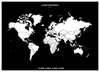
Colour Your Own Historical Maps
Explore the cartographic treasures of the British Library`s extensive map archive, and add your own colour. Early maps are often much more highly decorated than our own, featuring fantastical drawings of real or imaginary people and animals that may or may not occupy unknown places. Medieval maps look very different to the maps of today. Significant places were given prominence and historical or religious events were frequently included. This new colouring book is packed with a series of fascinating hand drawn maps carefully selected from the extensive collection of the British Library, which includes charters and seals, medieval historical and iconic atlas` from Queen Mary I`s personal collection and King George III`s to detailed drawings from well-known artists such as Nicolas Sanson
and William Hack. Each of the original maps is reproduced in colour, so that you can decide whether you prefer to choose your own colours, or to use the colours that the cartographer intended. With key facts about each of the maps, this is the perfect book for geography lovers, history buffs and colouring-in fanatics alike.
and William Hack. Each of the original maps is reproduced in colour, so that you can decide whether you prefer to choose your own colours, or to use the colours that the cartographer intended. With key facts about each of the maps, this is the perfect book for geography lovers, history buffs and colouring-in fanatics alike.
Product Description
Reviews/Comments
Add New
Vouchers
No voucher codes found.
Do you know a voucher code for this product or supplier? Add it to Insights for others to use.
Do you know a voucher code for this product or supplier? Add it to Insights for others to use.
 Denmark