More From Contributor

£14.99
“ Cuba: A New History” is a compelling & insightful read, shining new light on forgotten corners of Cuba’s history, not only those surrounding a certain cigar-chomping leader; events in Fidel Castro`s island nation often command international attention & just as often inspire controversy. Impassioned debate over situations as diverse as the Cuban Missile Crisis & the Elián González affair is characteristic not only in modern times but throughout the centuries of Cuban history. In this concise & up-to-date book, British journalist Richard Gott casts a fresh eye on the history of the Caribbean island from its pre-Columbian origins to the present day. He provides a European perspective on a country that is perhaps too frequently seen solely from the American point of view. The author emphasises such little-known aspects of Cuba`s history as its tradition of racism & violence, its black rebellions, the survival of its Indian peoples, & the lasting influence of Spain. The book also offers an original look at aspects of the Revolution, including Castro`s relationship with the Soviet Union, military exploits in Africa, & his attempts to promote revolution in Latin America & among American blacks. In a concluding section, Gott tells the extraordinary story of the Revolution`s survival in the post-Soviet years. ...
Archived Product
£9.99
Cuba Adventure Map at 1:750, 000 from the National Geographic printed on light, waterproof & rear-resistant synthetic paper. The map is indexed & double-sided, with a generous overlap between the sides. National parks & other protected areas are prominently highlighted. Topography is shown by light altitude colouring, with spot heights & names of mountain ranges, peaks, etc. Road network

Includes::
selected local tracks, shows locations of petrol stations & gives driving distances on main & secondary routes. Railway lines are included & local airports are marked. Symbols highlight various places of interest, including beaches, diving & fishing sites, historical & cultural places, etc. Also marked are internal administrative boundaries with names of the provinces. The map, which uses data base provided by Reise Know-How, is indexed & has latitude & longitude lines at intervals of 30’. Map legend

Includes::
English.


...
Archived Product
£9.99
Laminated & waterproof tourist road map of Cuba, with street plans of Havana, Playa del Este, Santiago de Cuba & Varadero. The main map divides the country east/west & shows its road & railways networks. Places of interest, including national parks, numerous beaches, yachting centres, windsurfing & scuba diving sites, etc, are highlighted. Topography of the island is shown by relief shading with marking for mangroves, swamps & the surrounding coral reefs. Street plans show central Havana, Playa del Este, Santiago & the Varadero strips, showing selected hotels, various facilities & places of interest. Both the main map & all the street plans are indexed with lists of locations/streets, beaches, places of interest, etc. Also included is information on the island’s climate with temperature, precipitation, etc., charts. ...
Archived Product
£25.00
Cuba is worth a visit. Or, as the authors of this book discovered, several. The average package holiday is simply not long enough to visit this country`s myriad of sights, all of which are worth seeing. Like so many visitors to Cuba, after their first trip more than fifteen years ago, they returned again & again to trek the sandy beaches shaded by swinging palm fronds, to marvel at the splendid topography of the Vinales Valley, & to admire Cuba`s selection of classic cars, which function as part of everyday life on this Caribbean isl&. As such, this uniquely illustrated book is a product of love. The authors have made it their mission to portray this resplendent nation in all its glory, & to bring Cuba`s stunning scenery to your living room. This book represents the ”best of” Cuban tours, led by passionate photographer Rainer Floer & his cousin Harri Morick. Morick speaks fluent Spanish, & thus he ensured that the pair were seen as classic car fans rather than regular tourists. They conducted numerous interviews, & in doing so also made friends with the interviewees. Spare parts came from Germany, stories from Cuba. Cars & culture blend in this snapshot of an evolving nation. But this evolution brings with it the threat of change. Who knows how much longer we will find classic cars on Cuba`s streets?

Includes::
splendid photos of classic cars dating from before the revloution; American limousines, taxis, & wedding cars; the history of the first Porsche in Cuba; an interview with an artist & his VW Karmann-Ghia, & the Harley Club in Cuba; & amazing scenes of Cuban streets & landscapes.

...
Archived Product
£150.00
The Cuban Yachting Charts, commonly referred to as Cuban Chart Kits, consists of a series of 8 chart-books that cover virtually the entire Cuban coast. Each chart-book contains 6 to 12 detailed color charts, which are accurate for use with GPS. The scale of the charts range from 1: 500, 000 to 1: 5, 000 for selected harbours. Not every harbor is covered, but the most desirable harbours for yachtsmen are included. Each chart displays the depths in meters & the charts include information in both English & Spanish in this chart kit! Cuba CK1
- Marlin Marina Hemingway To Cabo Corrientes is part 1 of the series. Good graphical representations of the topography when sailing Cuban waters is essential. Each chart is characterized by fine contours & easy to distinguish colour graduations of the depth lines. Presented in a handy, user friendly size, enabling the chartkit to be easily accessed or stored. Ensure your adventures to this stunning region is a success with the guide of the Cuban Yachting Charts! In addition to the 8 Yachting Chart Folios (chart books) covering all of the coastline of Cuba by geographic areas, a range of individual Official Cuban Hydrographic Office charts is available to order on dem&. Minimum order quantity is 15 charts. Approx. 170 standard navigation charts can be sourced through Stanfords, which come imported from Havana & are corrected by hand to their latest monthly notice to Mariners. For more information & a"e, please email maritime@stanfords.co.uk
...
Archived Product
£170.00
The Cuban Yachting Charts, commonly referred to as Cuban Chart Kits, consists of a series of 8 chart-books that cover virtually the entire Cuban coast. Each chart-book contains 6 to 12 detailed colour charts, which are accurate for use with GPS. The scale of the charts range from 1: 500, 000 to 1: 5, 000 for selected harbours. Not every harbour is covered, but the most desirable harbours for yachtsmen are included. Each chart displays the depths in meters & the charts include information in both English & Spanish in this chart kit! Cuba CK3
- Casilda To Cabo Cruz is part 3 of the series. Good graphical representations of the topography when sailing Cuban waters is essential. Each chart is characterized by fine contours & easy to distinguish colour graduations of the depth lines. Presented in a handy, user friendly size, enabling the chartkit to be easily accessed or stored. Ensure your adventures to this stunning region is a success with the guide of the Cuban Yachting Charts! In addition to the 8 Yachting Chart Folios (chart books) covering all of the coastline of Cuba by geographic areas, a range of individual Official Cuban Hydrographic Office charts is available to order on dem&. Minimum order quantity is 15 charts. Approx. 170 standard navigation charts can be sourced through Stanfords, which come imported from Havana & are corrected by hand to their latest monthly notice to Mariners. For more information & a"e, please email maritime@stanfords.co.uk
...
Archived Product
£150.00
The Cuban Yachting Charts, commonly referred to as Cuban Chart Kits, consists of a series of 8 chart-books that cover virtually the entire Cuban coast. Each chart-book contains 6 to 12 detailed colour charts, which are accurate for use with GPS. The scale of the charts range from 1: 500, 000 to 1: 5, 000 for selected harbours. Not every harbour is covered, but the most desirable harbours for yachtsmen are included. Each chart displays the depths in meters & the charts include information in both English & Spanish in this chart kit! Cuba CK4
- Cabo Cruz to Punta De Maisi is part 4 of the series. Good graphical representations of the topography when sailing Cuban waters is essential. Each chart is characterized by fine contours & easy to distinguish colour graduations of the depth lines. Presented in a handy, user friendly size, enabling the chartkit to be easily accessed or stored. Ensure your adventures to this stunning region is a success with the guide of the Cuban Yachting Charts! In addition to the 8 Yachting Chart Folios (chart books) covering all of the coastline of Cuba by geographic areas, a range of individual Official Cuban Hydrographic Office charts is available to order on dem&. Minimum order quantity is 15 charts. Approx. 170 standard navigation charts can be sourced through Stanfords, which come imported from Havana & are corrected by hand to their latest monthly notice to Mariners. For more information & a"e, please email maritime@stanfords.co.uk
...
Archived Product
£150.00
The Cuban Yachting Charts, commonly referred to as Cuban Chart Kits, consists of a series of 8 chart-books that cover virtually the entire Cuban coast. Each chart-book contains 6 to 12 detailed colour charts, which are accurate for use with GPS. The scale of the charts range from 1: 500, 000 to 1: 5, 000 for selected harbours. Not every harbour is covered, but the most desirable harbours for yachtsmen are included. Each chart displays the depths in meters & the charts include information in both English & Spanish in this chart kit! Cuba CK5
- Punta De Maisi To Punta Maternillos is part 5 of the series. Good graphical representations of the topography when sailing Cuban waters is essential. Each chart is characterized by fine contours & easy to distinguish colour graduations of the depth lines. Presented in a handy, user friendly size, enabling the chartkit to be easily accessed or stored. Ensure your adventures to this stunning region is a success with the guide of the Cuban Yachting Charts! In addition to the 8 Yachting Chart Folios (chart books) covering all of the coastline of Cuba by geographic areas, a range of individual Official Cuban Hydrographic Office charts is available to order on dem&. Minimum order quantity is 15 charts. Approx. 170 standard navigation charts can be sourced through Stanfords, which come imported from Havana & are corrected by hand to their latest monthly notice to Mariners. For more information & a"e, please email maritime@stanfords.co.uk
...
Archived Product
£170.00
The Cuban Yachting Charts, commonly referred to as Cuban Chart Kits, consists of a series of 8 chart-books that cover virtually the entire Cuban coast. Each chart-book contains 6 to 12 detailed colour charts, which are accurate for use with GPS. The scale of the charts range from 1: 500, 000 to 1: 5, 000 for selected harbours. Not every harbour is covered, but the most desirable harbours for yachtsmen are included. Each chart displays the depths in meters & the charts include information in both English & Spanish in this chart kit! Cuba CK6
- Punta Maternillos To Cayo Bahia De Cadiz is part 6 of the series. Good graphical representations of the topography when sailing Cuban waters is essential. Each chart is characterized by fine contours & easy to distinguish colour graduations of the depth lines. Presented in a handy, user friendly size, enabling the chartkit to be easily accessed or stored. Ensure your adventures to this stunning region is a success with the guide of the Cuban Yachting Charts! In addition to the 8 Yachting Chart Folios (chart books) covering all of the coastline of Cuba by geographic areas, a range of individual Official Cuban Hydrographic Office charts is available to order on dem&. Minimum order quantity is 15 charts. Approx. 170 standard navigation charts can be sourced through Stanfords, which come imported from Havana & are corrected by hand to their latest monthly notice to Mariners. For more information & a"e, please email maritime@stanfords.co.uk
...
Archived Product
£170.00
The Cuban Yachting Charts, commonly referred to as Cuban Chart Kits, consists of a series of 8 chart-books that cover virtually the entire Cuban coast. Each chart-book contains 6 to 12 detailed colour charts, which are accurate for use with GPS. The scale of the charts range from 1: 500, 000 to 1: 5, 000 for selected harbours. Not every harbour is covered, but the most desirable harbours for yachtsmen are included. Each chart displays the depths in meters & the charts include information in both English & Spanish in this chart kit! Cuba CK7
- Cayo Bahia De Cadiz To Marlin Marina Hemingway is part 7 of the series. Good graphical representations of the topography when sailing Cuban waters is essential. Each chart is characterized by fine contours & easy to distinguish colour graduations of the depth lines. Presented in a handy, user friendly size, enabling the chartkit to be easily accessed or stored. Ensure your adventures to this stunning region is a success with the guide of the Cuban Yachting Charts! In addition to the 8 Yachting Chart Folios (chart books) covering all of the coastline of Cuba by geographic areas, a range of individual Official Cuban Hydrographic Office charts is available to order on dem&. Minimum order quantity is 15 charts. Approx. 170 standard navigation charts can be sourced through Stanfords, which come imported from Havana & are corrected by hand to their latest monthly notice to Mariners. For more information & a"e, please email maritime@stanfords.co.uk
...
Archived Product

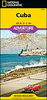
CUBA CK2 - Cabo Corrientes Bahia De Casilda

The Cuban Yachting Charts, commonly referred to as Cuban Chart Kits, consists of a series of 8 chart-books that cover virtually the entire Cuban coast. Each chart-book contains 6 to 12 detailed colour charts, which are accurate for use with GPS. The scale of the charts range from 1: 500, 000 to 1: 5, 000 for selected harbours. Not every harbor is covered, but the most desirable harbours for yachtsmen are included. Each chart displays the depths in meters and the charts include information in both English and Spanish in this chart kit!Cuba CK2 - Ensenada De Cortes To Bahia De Casilda is part 2 of the series. Good graphical representations of the topography when sailing Cuban waters is essential. Each chart is characterized by fine contours and easy to distinguish colour graduations of
the depth lines. Presented in a handy, user friendly size, enabling the chartkit to be easily accessed or stored. Ensure your adventures to this stunning region is a success with the guide of the Cuban Yachting Charts!In addition to the 8 Yachting Chart Folios (chart books) covering all of the coastline of Cuba by geographic areas, a range of individual Official Cuban Hydrographic Office charts is available to order on demand. Minimum order quantity is 15 charts. Approximately 170 standard navigation charts can be sourced through Stanfords, which come imported from Havana and are corrected by hand to their latest monthly notice to Mariners. For more information and a"e, please email maritime@stanfords.co.uk
RIP - This product is no longer available on our network. It was last seen on 25.09.2019

This page now acts as a permanent archive for this product. Add more information using the comments box below to ensure it can still be found by future generations.

Use our search facility to see if it is available from an alternative contributor.
  • Availability: Out Of Stock
  • Supplier: Stanfords
  • SKU: 9786000552602
Availability: In Stock
£170.00

Product Description

The Cuban Yachting Charts, commonly referred to as Cuban Chart Kits, consists of a series of 8 chart-books that cover virtually the entire Cuban coast. Each chart-book contains 6 to 12 detailed colour charts, which are accurate for use with GPS. The scale of the charts range from 1: 500, 000 to 1: 5, 000 for selected harbours. Not every harbor is covered, but the most desirable harbours for yachtsmen are included. Each chart displays the depths in meters & the charts include information in both English & Spanish in this chart kit! Cuba CK2
- Ensenada De Cortes To Bahia De Casilda is part 2 of the series. Good graphical representations of the topography when sailing Cuban waters is essential. Each chart is characterized by fine contours & easy to distinguish colour graduations of the depth lines. Presented in a handy, user friendly size, enabling the chartkit to be easily accessed or stored. Ensure your adventures to this stunning region is a success with the guide of the Cuban Yachting Charts! In addition to the 8 Yachting Chart Folios (chart books) covering all of the coastline of Cuba by geographic areas, a range of individual Official Cuban Hydrographic Office charts is available to order on dem&. Minimum order quantity is 15 charts. Approx. 170 standard navigation charts can be sourced through Stanfords, which come imported from Havana & are corrected by hand to their latest monthly notice to Mariners. For more information & a"e, please email maritime@stanfords.co.uk

Reviews/Comments

Add New

Intelligent Comparison

Oooops!
We couldn't find anything!
Perhaps this product's unique.... Or perhaps we are still looking for comparisons!
Click to bump this page and we'll hurry up.

Price History

Vouchers

No voucher codes found.
Do you know a voucher code for this product or supplier? Add it to Insights for others to use.

Facebook

Jargon Buster

GPS - Global Positioning System - Global position using satellites
UK - United Kingdom - An island nation in Europe
Hand - A part of the body at the end of the arm
Hand - A pointer which indicates time on a clock face
Spanish - The main language spoken in Spain and Latin America.
email - An electronic communication method. Short for Electronic Mail.
quantity - A measurement, an amount or number
Office - A room where people work
Colour - The categorised spectrum of light visable to humans
Size - is the measurement of how big an object is in space.
Accurate - A measurement of precision when all elements are correct.
Individual - A single separate item or person.

Supplier Information

Stanfords
Stanfords was established in 1853 and opened their iconic Covent Garden flagship store in 1901. They have become the top retailer of maps, travel books and accessories in the UK and arguably offer the largest selection of maps and travel books worldwide. Famous names such as Captain Robert Falcon Scott, Ranulph Fiennes and Michael Palin have purchased from Stanfords. They now have a shop in Bristol and both stores together with other venues operate a calendar of events including talks, book signings and exhibitions. As a specialist map retailer, the map selection is comprehensive and includes road maps, street maps and walking maps from worldwide destinations, as well as a selection of world atlases and wall maps. Books include travel guides and travel literature. Stanfords also stock globes, from miniatures made of blue marble to magnificent floor-standing globes. The website features a selection of interesting articles on travel topics.
Page Updated: 2023-11-12 20:15:36

Community Generated Product Tags

Oh No! The productWIKI community hasn't generated any tags for this product yet!
Menu