
 United Kingdom
 France
 Germany
 Netherlands
 Sweden
 USA
USA
 Italy
Italy
 Spain
Spain
More From Contributor


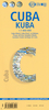
Cuba Adventure Map
Cuba Adventure Map at 1:750, 000 from the National Geographic printed on light, waterproof and rear-resistant synthetic paper. The map is indexed and double-sided, with a generous overlap between the sides. National parks and other protected areas are prominently highlighted.Topography is shown by light altitude colouring, with spot heights and names of mountain ranges, peaks, etc. Road network includes selected local tracks, shows locations of petrol stations and gives driving distances on main and secondary routes. Railway lines are included and local airports are marked. Symbols highlight various places of interest, including beaches, diving and fishing sites, historical and cultural places, etc. Also marked are internal administrative boundaries with names of the provinces.
The map, which uses data base provided by Reise Know-How, is indexed and has latitude and longitude lines at intervals of 30’. Map legend includes English.
The map, which uses data base provided by Reise Know-How, is indexed and has latitude and longitude lines at intervals of 30’. Map legend includes English.

Product Description
Reviews/Comments
Add New
Vouchers
No voucher codes found.
Do you know a voucher code for this product or supplier? Add it to Insights for others to use.
Do you know a voucher code for this product or supplier? Add it to Insights for others to use.
 Denmark