
 United Kingdom
 France
 Germany
 Netherlands
 Sweden
 USA
USA
 Italy
Italy
 Spain
Spain
More From Contributor

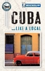


Cuba Michelin
Cuba on an indexed road map from Michelin with on the reverse three street plans of Havana: the city centre and Old Havana with an additional enlargement for its central part, plus street plans of central Santiago de Cuba and Trinidad.The map shows the whole island on one side at a good scale of 1:800, 000 with very clear presentation of its road network which includes selected unsurfaced local tracks. Driving distances are marked on main routes and selected smaller roads. Topography is indicated by subtle relief shading and colouring and/or graphics for woodlands, swamps and mangrove, and names of mountain ranges, peaks, etc. National parks and other protected areas are highlighted. Symbols indicate various places of interest including campsites, UNESCO World Heritage sites,
beaches, diving and snorkelling spots, etc. The map has latitude and longitude lines at 30’ intervals. The index is on the reverse, The reverse side also includes a street plan of central Havana, a more detailed plan of the capital’s Old Havana district with a further enlargement of the area around the Plaza de la Catedral and Plaza de Armas, plus plans of central Trinidad and Santiago de Cuba. All the plans highlight important buildings and various facilities. Also provided is information the basic driving regulations.
beaches, diving and snorkelling spots, etc. The map has latitude and longitude lines at 30’ intervals. The index is on the reverse, The reverse side also includes a street plan of central Havana, a more detailed plan of the capital’s Old Havana district with a further enlargement of the area around the Plaza de la Catedral and Plaza de Armas, plus plans of central Trinidad and Santiago de Cuba. All the plans highlight important buildings and various facilities. Also provided is information the basic driving regulations.

Product Description
Reviews/Comments
Add New
Vouchers
No voucher codes found.
Do you know a voucher code for this product or supplier? Add it to Insights for others to use.
Do you know a voucher code for this product or supplier? Add it to Insights for others to use.
 Denmark