More From Contributor
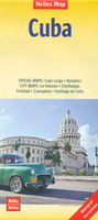
£6.99
Cuba at 1:1, 000, 000 on an indexed map from Marco Polo Travel Publishing with special features to aid route planning & large street plans of central Havana Cienfuegos, Camaguey, Santiago de Cuba, plus the holiday resorts of Playas del Este & Varadero.A fold-out extension of the map cover gives at-a-glance overview of of the isl&, highlighting main places of interest & making it much easier to find various localities on the main map and/or plan a route. A set of seven peel-on/peel-off stickers, removable without damaging the map, is provided to make routes or locations more prominent when navigating. Cartography is from the renowned German publishers Mair Dumont. Locations of interest are prominently highlighted, with separate colouring for picturesque towns or villages & for natural sites including numerous caves. Topography is presented by relief shading with spot heights & names of mountain ranges, lakes, marshes, etc. Along the coast numerous small bays are named & coral reefs are marked. Road network

Includes::
many small local roads. Railway lines are shown & local airports are marked. In addition to the specially highlighted locations symbols show various other places of interest. The map also shows the country’s internal administrative boundaries with names of the provinces. Latitude & longitude lines are drawn at intervals of 30’ & 1º respectively. Multilingual map legend

Includes::
English. The index is in a separate booklet attached to the map cover & in addition to towns & villages also

Includes::
mountains, lakes, rivers, national parks & sites of interest. Large insets show a street plan of central Havana, the Old Town & the adjoining districts, also Cienfuegos, Camaguey & Santiago de Cuba, plus the holiday resorts of Playas del Este & Varadero. Also included is a distance table.


...
Archived Product
£7.99
Marco Polo Pocket Guide Cuba: the Travel Guide with Insider Tips Explore Cuba with this handy, pocket-sized, authoritative guide, packed with Insider Tips. Discover boutique hotels, authentic restaurants, the country`s trendiest places, & get tips on shopping & what to do on a limited budget. There are plenty of ideas for travel with kids, & a summary of all the festivals & events that take place in Cuba. Let Marco Polo show you all this wonderful country has to offer... Dive into a colourful dream of rhythm, revolution & retreat. This practical, pocket-sized guide will lead you to glorious white beaches, ports & colonial towns redolent with history. Be enchanted by the slightly morbid, but irresistibly charming Havana, track down the afro-cuban heritage in lively Santiago de Cuba, encounter Cubans who might be a bit ` Che Guavara`, & wonder at their lust for life, visit tobacco factories & rum distilleries... This is Cuba! Your Marco Polo Cuba Pocket Guide
Includes:: Insider Tips
- we show you the hidden gems & little known secrets that offer a real insight into Cuba. Discover where you can buy the hottest Latin music, find out where to feed the sharks or enjoy the most beautiful beach in the Caribbean. Best of
- find the best things to do for free, the best `only in` Cuba experiences, the best things to do if it rains & the best places to relax & spoil yourself. Sightseeing
- all of the top sights are organised by region so you can easily plan your trip. Discovery Tours
- specially tailored tours that will get you to the heart of Cuba. Here are the best tours that will help you enjoy all of Cuba`s breath-taking scenery from the island`s capital, Havana, to the idyllic beaches on the northern coast. Cuba in full-colour
- Marco Polo Pocket Guide Cuba

Includes::
full-colour photos throughout the guide bringing the country to life offering you a real taste of what you can see & enjoy on your trip. Touring App
- new for 2018, you can download any of the Discovery Tours to your smartphone, complete with the detailed route description & map exactly as featured in the guide, free of charge. The maps can be used offline too, so no roaming charges. The perfect navigational tool with distance indicators & landmarks highlighting the correct direction to travel in as well as GPS coordinates along the way. Enjoy stress-free sightseeing & never get lost again! Road Atlas & pull-out map
- we`ve included a detailed road atlas & a handy, pull-out map so you can pop the guide in your bag for a full-on sightseeing day or head out with just the map to enjoy your Discovery Tour. Useful Spanish phrases
- the essential words & phrases are included to help you get by. Trust Marco Polo Pocket Guide Cuba to show you around this wonderful Caribbean isl&. The comprehensive coverage & unique insights will ensure you experience everything Cuba has to offer & more. The special tips, personal insights & unusual experiences will help you make the most of your trip
- just arrive & enjoy.


...
Archived Product
£5.99
Cuba on an indexed road map from Michelin with on the reverse three street plans of Havana: the city centre & Old Havana with an additional enlargement for its central part, plus street plans of central Santiago de Cuba & Trinidad. The map shows the whole island on one side at a good scale of 1:800, 000 with very clear presentation of its road network which

Includes::
selected unsurfaced local tracks. Driving distances are marked on main routes & selected smaller roads. Topography is indicated by subtle relief shading & colouring and/or graphics for woodlands, swamps & mangrove, & names of mountain ranges, peaks, etc. National parks & other protected areas are highlighted. Symbols indicate various places of interest including campsites, UNESCO World Heritage sites, beaches, diving & snorkelling spots, etc. The map has latitude & longitude lines at 30’ intervals. The index is on the reverse, The reverse side also

Includes::
a street plan of central Havana, a more detailed plan of the capital’s Old Havana district with a further enlargement of the area around the Plaza de la Catedral & Plaza de Armas, plus plans of central Trinidad & Santiago de Cuba. All the plans highlight important buildings & various facilities. Also provided is information the basic driving regulations.


...
Archived Product
£25.00
We are able to source a wide range of courtesy flags. Flags are available in many sizes & can be sewn or printed on 100% Ministry Of Defence Standard Woven & Knitted Polyester. Flags are supplied with rope & toggle. If you would like more information, have a custom size request or cannot find a desired product, please email us at maritime@stanfords.co.uk. We will be glad to help! ...
Archived Product
£28.95
Cuba NGS Classic Style Wall Map, size 91.5 x 61cm (36 x 24 approx), encapsulated version, published by the National Geographic Society in their traditional classic style: a light coloured base with the country & provincial borders in stronger colour. Topography of the island is presented by light relief shading with names of mountain ranges. Heights are given in metres. Additional graphic show swamps; in the surrounding waters of the Caribbean coral reefs & sandbanks are also marked. The map shows the division of Cuba into provinces & presents the country ...
Archived Product
£14.95
Cuba NGS Classic Style Wall Map, size 91.5 x 61cm (36 x 24 approx), paper version, published by the National Geographic Society in their traditional classic style: a light coloured base with the country & provincial borders in stronger colour. Topography of the island is presented by light relief shading with names of mountain ranges. Heights are given in metres. Additional graphic show swamps; in the surrounding waters of the Caribbean coral reefs & sandbanks are also marked. The map shows the division of Cuba into provinces & presents the country ...
Archived Product
£12.99
Cuba NGS Classic Style Wall Map, size 91.5 x 61cm (36 x 24 approx), paper version, published by the National Geographic Society in their traditional classic style: a light coloured base with the country & provincial borders in stronger colour. Topography of the island is presented by light relief shading with names of mountain ranges. Heights are given in metres. Additional graphic show swamps; in the surrounding waters of the Caribbean coral reefs & sandbanks are also marked. The map shows the division of Cuba into provinces & presents the country ...
Archived Product
£4.99
Cuba in the Pocket Guide series from Berlitz; a collection of handy, pocket-sized guides dedicated to an extensive range of cities, regions & countries worldwide. Written in narrative form, individual guides explore the history, main sights & attractions, food & drink, accommodation & local culture of the destination in detail. Each Berlitz pocket guide has a similar format, with colour-coded sections helping readers locate information quickly in addition to distinctive chapters exploring the city or region. An introduction outlines the destination for visitors & a section dedicated to 'A Brief History' actually explores the area in relative depth. A where to go chapter is organized by region & city & is written in prose form with references to individual sites highlighted in bold for clarity. There are also further suggestions on where & when to eat. Recommendations for leisure activities in the region, including sport, nightlife & shopping, are also provided & tailored accordingly for each destination. Handy travel tips are listed alphabetically in a dedicated section, providing practical guidance & helping visitors make the most of their stay. The main hotels, particularly for cities, are also listed in an accommodation section, offering a brief overview with approximate price bandings & relevant contact details. ...
Archived Product
£4.49
Cuba in the Pocket Guide series from Berlitz; a collection of handy, pocket-sized guides dedicated to an extensive range of cities, regions & countries worldwide. Written in narrative form, individual guides explore the history, main sights & attractions, food & drink, accommodation & local culture of the destination in detail. Each Berlitz pocket guide has a similar format, with colour-coded sections helping readers locate information quickly in addition to distinctive chapters exploring the city or region. An introduction outlines the destination for visitors & a section dedicated to 'A Brief History' actually explores the area in relative depth. A where to go chapter is organized by region & city & is written in prose form with references to individual sites highlighted in bold for clarity. There are also further suggestions on where & when to eat. Recommendations for leisure activities in the region, including sport, nightlife & shopping, are also provided & tailored accordingly for each destination. Handy travel tips are listed alphabetically in a dedicated section, providing practical guidance & helping visitors make the most of their stay. The main hotels, particularly for cities, are also listed in an accommodation section, offering a brief overview with approximate price bandings & relevant contact details. ...
Archived Product

Cuba Nelles

Cuba at 1:775, 000 from Nelles Verlag, now published on a handy size, light, waterproof and tear-resistant map. The map includes street plans of central Havana with an enlargement of the Old Town area, plus plans of four other cities and an enlargement for the Varadero Peninsula The map divides the island east/west, with relief shading, spot heights and names of mountain ranges presenting the topography. National parks and other protected area are marked. Road network distinguishes between partially paved roads and cart tracks, and shows distances on main and many secondary routes. Railway lines and local airports are included, and the map also shows internal administrative boundaries with names of the provinces. Numerous places of interest are prominently marked. Latitude and
longitude margin ticks are at 30’ intervals. The map has no index of localities. Map legend includes English.The map also provides insets with street plans of central Havana plus a more detailed enlargement of the city’s Old Town – La Habana Vieja, plans of city centres in Trinidad, Cienfuegos, Camagüey and Santiago de Cuba, plus the Varadero Peninsula. All are annotated with places of interest and various facilities.
RIP - This product is no longer available on our network. It was last seen on 25.09.2019

This page now acts as a permanent archive for this product. Add more information using the comments box below to ensure it can still be found by future generations.

Use our search facility to see if it is available from an alternative contributor.
  • Availability: Out Of Stock
  • Supplier: Stanfords
  • SKU: 9783865745330
Availability: In Stock
£10.99

Product Description

Cuba at 1:775, 000 from Nelles Verlag, now published on a handy size, light, waterproof & tear-resistant map. The map

Includes::
street plans of central Havana with an enlargement of the Old Town area, plus plans of four other cities & an enlargement for the Varadero Peninsula The map divides the island east/west, with relief shading, spot heights & names of mountain ranges presenting the topography. National parks & other protected area are marked. Road network distinguishes between partially paved roads & cart tracks, & shows distances on main & many secondary routes. Railway lines & local airports are included, & the map also shows internal administrative boundaries with names of the provinces. Numerous places of interest are prominently marked. Latitude & longitude margin ticks are at 30’ intervals. The map has no index of localities. Map legend

Includes::
English. The map also provides insets with street plans of central Havana plus a more detailed enlargement of the city’s Old Town – La Habana Vieja, plans of city centres in Trinidad, Cienfuegos, Camagüey & Santiago de Cuba, plus the Varadero Peninsula. All are annotated with places of interest & various facilities.

Reviews/Comments

Add New

Intelligent Comparison

Oooops!
We couldn't find anything!
Perhaps this product's unique.... Or perhaps we are still looking for comparisons!
Click to bump this page and we'll hurry up.

Price History

Vouchers

No voucher codes found.
Do you know a voucher code for this product or supplier? Add it to Insights for others to use.

Facebook

Jargon Buster

Waterproof - Resistant to water, usualy specified by depth in metres
Size - is the measurement of how big an object is in space.
Network - A link and communication between things. Often computers or people.
Road - a manmade lane or a path that is used to speed up travel.
Resistant - Something that can repel against something.

Supplier Information

Stanfords
Stanfords was established in 1853 and opened their iconic Covent Garden flagship store in 1901. They have become the top retailer of maps, travel books and accessories in the UK and arguably offer the largest selection of maps and travel books worldwide. Famous names such as Captain Robert Falcon Scott, Ranulph Fiennes and Michael Palin have purchased from Stanfords. They now have a shop in Bristol and both stores together with other venues operate a calendar of events including talks, book signings and exhibitions. As a specialist map retailer, the map selection is comprehensive and includes road maps, street maps and walking maps from worldwide destinations, as well as a selection of world atlases and wall maps. Books include travel guides and travel literature. Stanfords also stock globes, from miniatures made of blue marble to magnificent floor-standing globes. The website features a selection of interesting articles on travel topics.
Page Updated: 2023-11-12 20:15:36

Community Generated Product Tags

Oh No! The productWIKI community hasn't generated any tags for this product yet!
Menu