
 United Kingdom
 France
 Germany
 Netherlands
 Sweden
 USA
USA
 Italy
Italy
 Spain
Spain
More From Contributor


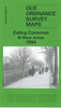


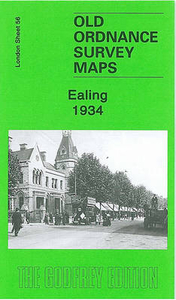
Ealing 1934
Ealing in 1934 in a fascinating series of reproductions of old Ordnance Survey plans in the Alan Godfrey Editions, ideal for anyone interested in the history of their neighbourhood or family. Two versions of this map show the area stretching from Eccleston Road eastward to Ealing Broadway and Windsor Road, and from Cleveland Road and Castle Bar southward to Grange Road and Churchfield Road. The map covers central and west Ealing. Features include Ealing Broadway station, Castle Hill & Ealing Dean station, Haven Green, Drayton Green, cemetery, Central London District School. Churches include St Stephen`s, St John`s Mattock Lane, Christ Church. Streets include The Avenue, Uxbridge Road, High Street, Eaton Rise, Argyle Road etc. The 1934 map has a 1933 list of private
inhabitanmts in Ealing (the list continues on sheets 70 and 71).About the Alan Godfrey Editions of the 25” OS Series:Selected towns in Great Britain and Ireland are covered by maps showing the extent of urban development in the last decades of the 19th and early 20th century. The plans have been taken from the Ordnance Survey mapping and reprinted at about 15 inches to one mile (1:4, 340). On the reverse most maps have historical notes and many also include extracts from contemporary directories. Most maps cover about one mile (1.6kms) north/south, one and a half miles (2.4kms) across; adjoining sheets can be combined to provide wider coverage.FOR MORE INFORMATION AND A COMPLETE LIST OF ALL AVAILABLE TITLES PLEASE CLICK ON THE SERIES LINK.
inhabitanmts in Ealing (the list continues on sheets 70 and 71).About the Alan Godfrey Editions of the 25” OS Series:Selected towns in Great Britain and Ireland are covered by maps showing the extent of urban development in the last decades of the 19th and early 20th century. The plans have been taken from the Ordnance Survey mapping and reprinted at about 15 inches to one mile (1:4, 340). On the reverse most maps have historical notes and many also include extracts from contemporary directories. Most maps cover about one mile (1.6kms) north/south, one and a half miles (2.4kms) across; adjoining sheets can be combined to provide wider coverage.FOR MORE INFORMATION AND A COMPLETE LIST OF ALL AVAILABLE TITLES PLEASE CLICK ON THE SERIES LINK.

Product Description
Reviews/Comments
Add New
Intelligent Comparison
Archived Product

Ealing 1894 Stanfords
£3.50
Archived Product
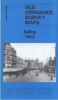
Ealing 1913 Stanfords
£3.50
Archived Product
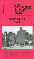
South Ealing 1934 Stanfords
£3.50
Archived Product

Elgin 1904 Stanfords
£2.95
Archived Product
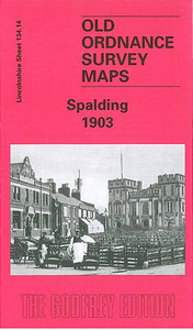
Spalding 1903 Stanfords
£2.95
Archived Product
Spalding 1903 Stanfords
£3.50
Archived Product

South Ealing 1894 Stanfords
£3.50
Vouchers
No voucher codes found.
Do you know a voucher code for this product or supplier? Add it to Insights for others to use.
Do you know a voucher code for this product or supplier? Add it to Insights for others to use.
 Denmark