
 United Kingdom
 France
 Germany
 Netherlands
 Sweden
 USA
USA
 Italy
Italy
 Spain
Spain
More From Contributor


India F&B
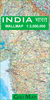
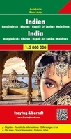
India at 1:2, 000, 000 on a double-sided map from Freytag & Berndt, with an index booklet attached to the map cover also providing street plans of central Delhi, Chennai (Madras), Kolkata and Mumbai, plus Colombo. Coverage includes the whole of Bangladesh, Nepal, Bhutan, Sri Lanka and the Maldives, plus most of Pakistan.The map presents the Indian Subcontinent divided north/south with a small overlap between the sides. On the northern side, the north-eastern states of India and eastern Bangladesh are covered on a separate panel which extends coverage to Mandalay. The southern side includes a large inset with the Maldives. Topography of the subcontinent is presented by relief shading with spot heights, names of main mountain and hill ranges, peak, etc. Road network includes
selected local roads and shows driving distances on main routes, Main railway lines are included and local airports are marked. The map also shows boundaries and names of Indian states. Small icons indicate various places of interest including UNESCO World Heritage sites, national parks and game/nature reserves, temples and religious sites, etc. Latitude and longitude lines are drawn at 1º intervals. Multilingual map legend includes English.In addition to the index which lists locations by country, the booklet attached to the map cover also included town centre street plans of Delhi, Chennai (Madras), Kolkata and Mumbai, plus Colombo.
selected local roads and shows driving distances on main routes, Main railway lines are included and local airports are marked. The map also shows boundaries and names of Indian states. Small icons indicate various places of interest including UNESCO World Heritage sites, national parks and game/nature reserves, temples and religious sites, etc. Latitude and longitude lines are drawn at 1º intervals. Multilingual map legend includes English.In addition to the index which lists locations by country, the booklet attached to the map cover also included town centre street plans of Delhi, Chennai (Madras), Kolkata and Mumbai, plus Colombo.

Product Description
Reviews/Comments
Add New
Vouchers
No voucher codes found.
Do you know a voucher code for this product or supplier? Add it to Insights for others to use.
Do you know a voucher code for this product or supplier? Add it to Insights for others to use.
 Denmark