
 United Kingdom
 France
 Germany
 Netherlands
 Sweden
 USA
USA
 Italy
Italy
 Spain
Spain
More From Contributor
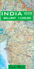


India IGN 85115
India at 1:2, 500, 000 on a clear, indexed map from MairDumont with a set of removable stickers to highlight chosen locations. A fold-out flap in the jacket makes route planning easier by providing an overview of the whole area covered by the map plus the adjoining regions and highlighting popular locations, with the grid reference system in the margins making it easier to find places on the main map. A set of seven peel-on/peel-off stickers, removable from the map without damaging its surface, is provided for making special locations more prominent.The map covers India, plus the whole of Nepal, Bhutan, Bangladesh and Sri Lanka, with most of Pakistan as well as southern Tibet with Lhasa and Kailas. The north-western tip of the country with the Pakistani part of Jammu and Kashmir
and the Karakoram is shown as an inset. Assam and the eastern states are also on an inset which extends the coverage to Mandalay. Two smaller insets show the Andaman and Nicobar Islands.Topography is indicated by relief shading with spot heights and names of mountain and hill ranges and selected peaks. Colouring and/or graphics indicate deserts and marshes. Internal administrative borders are shown with names of the states.The map shows the country’s road and rail networks and highlights numerous towns and villages worth visiting, as well as interesting natural sites, both in India itself and in the adjoining countries. Latitude and longitude lines are marked at intervals of 1º. Multilingual map legend includes English. Extensive index of place names in all the countries covered by
the map is in a separate 48-page booklet attached to the map jacket and includes names of mountains, glaciers, rivers, lakes, etc. all coded with appropriate signs. Also included are lists of national parks and World Heritage Sites, plus a table with distances/traveling times within India.

Product Description
Reviews/Comments
Add New
Vouchers
No voucher codes found.
Do you know a voucher code for this product or supplier? Add it to Insights for others to use.
Do you know a voucher code for this product or supplier? Add it to Insights for others to use.
 Denmark