
 United Kingdom
 France
 Germany
 Netherlands
 Sweden
 USA
USA
 Italy
Italy
 Spain
Spain
More From Contributor

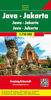

Java ITMB
Java at 1:600, 000 on a double-sided, indexed map with large insets showing street plans of city centres in Jakarta, Bandung, Cirebon, Yogyakarta, Surabaya, Semarang, Surakarta (Solo) and Malang, plus enlargements showing access to the Prambanan temples, Kangean Island and the Dieng Plateau.The island is divided east/west with a generous overlap between the two sides. Its topography is shown by altitude colouring (in feet) and numerous spot heights (in metres). Road network indicates toll roads and includes minor roads and selected tracks. Railways, ferry routes are included and local airports are marked.National parks and other protected areas are highlighted and symbols indicate numerous places of interest, beaches, etc. The map has latitude and longitude margin ticks at
intervals of 30’ and a separate index of localities for each side.Large inset provide clear, easy to read street plans of central Jakarta, Bandung, Cirebon, Yogyakarta, Surabaya, Semarang, Surakarta (Solo) and Malang, all annotated with various facilities and places of interest including selected hotels. Enlargements show access from Yogyakarta to the Prambanan temple complex, Kangean Island and the Dieng Plateau. Also included is map at 1:550, 000 of the Thousand Islands Archipelago (Kepulauan Seribu).
intervals of 30’ and a separate index of localities for each side.Large inset provide clear, easy to read street plans of central Jakarta, Bandung, Cirebon, Yogyakarta, Surabaya, Semarang, Surakarta (Solo) and Malang, all annotated with various facilities and places of interest including selected hotels. Enlargements show access from Yogyakarta to the Prambanan temple complex, Kangean Island and the Dieng Plateau. Also included is map at 1:550, 000 of the Thousand Islands Archipelago (Kepulauan Seribu).

Product Description
Reviews/Comments
Add New
Intelligent Comparison
Archived Product

Japan ITMB Stanfords
£9.99
Archived Product

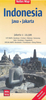
Jakarta ITMB Stanfords
£9.99
Archived Product

Ghana ITMB Stanfords
£9.99
Vouchers
No voucher codes found.
Do you know a voucher code for this product or supplier? Add it to Insights for others to use.
Do you know a voucher code for this product or supplier? Add it to Insights for others to use.
 Denmark