More From Contributor

£17.99
The 1:50, 000 topographic map gives a more general picture of the ground features than a basic map. It shows settlements, houses, roads, cultivated areas, waterways, cutting areas, mires, rock exposures, & relief. One map sheet covers an area of 30 x 40 km & one centimetre corresponds to 500 metres on the ground. The 1:50, 000 topographic map is also an ideal complement to nautical charts as it provides useful information about the land areas adjacent to waterways. For example, all Finnish sea areas are covered by 1:50, 000 topographic map sheets. ...
Archived Product
£7.99
Java in the Footprint Focus Guides, which are targeted at cities, regions & countries worldwide that have no, or very limited, coverage from other publishers. Widely recognised for their reliability & independent writing style, Footprint Focus guides all have the same layout. Smaller than their sister Handbooks, the Focus guides are intended to streamline the information contained so that you have more of what you need, without losing Footprint ...
Archived Product
£9.50
Java with Bali at 1:650, 000 on light, waterproof & tear-resistant plastic paper, with both topographic & tourist information. The map, part of Reise Know-How's highly acclaimed World Mapping Project, is double-sided to provide the best balance between a good scale & a convenient size sheet. Topography is shown by altitude colouring with spot heights & names of mountain ranges & hills. Detailed presentation of the road network

Includes::
local tracks; railways & ferry connections to other islands of the Indonesian archipelago are also shown. Local administrative units are shown with their boundaries & names. National parks & other protected areas are highlighted. A wide range of symbols shows various places of interest including UNESCO sites, temples, museums & monuments, volcanoes, hot springs & other natural features, etc. Latitude & longitude lines are drawn at 30

...
Archived Product
£6.99
Java & Bali on a double-sided map at 1:600, 000 from Periplus, accompanied by enlargements of southern Bali & overview street plans of Jakarta & Yogyakarta. All are annotated with numerous places of interest. Java is divided between the two sides of the map, with the whole of Bali shown at the same scale of 1:600, 000 as an inset. Coverage

Includes::
the south-eastern tip of Sumatra with the Sunda Straight & Krakatoa/ Krakatau National Park. Road network

Includes::
selected local roads & tracks, & gives driving distances on main & secondary routes. Railway lines & ferry connections are included & airports are marked. Also shown are internal administrative boundaries with names of the provinces. Topography is shown by colouring & relief shading to shown the main mountains. Latitude & longitude lines are drawn at 1º intervals. The map has no index. The map

Includes::
plans of Jakarta & Yogyakarta (both at 1:100, 000) showing main traffic arteries & principal streets. An enlargement at 1:120, 000 presents in greater detail the southern tip of Bali around Denpasar, Seminyak, Kuta, Tuban, Jimbaran & Nusa Dua. All are annotated with places of interest including selected accommodation. Also provided is a distance table for Java.


...
Archived Product
£10.99
Java with Bali on a double-sided indexed map at 1:750, 000 from Freytag & Berndt, with a street plan of central Jakarta & plans of the Borobudur (Barabudur) & Loro Jonggrang temples. Most place names are in larger print than found on other maps of the island & large icons prominently highlight various places of interest. The map divides Java east/west, with a generous overlap; Semarang & Yogyakarta are included on both sides. Relief shading with names of mountain ranges & spot heights present the topography. Active volcanoes are prominently highlighted. National parks or nature reserves are marked, including the Karimunjawa National Park & the Kepulauan Seribu National Park on the small islands north of Java. The map shows the island’s road network with driving distances on main routes. Ferry routes are marked, but without indicating their destinations. Icons prominently highlight various places of interest including UNESCO World Heritage sites, other historical & cultural locations, campsites, golf courses, etc. Latitude & longitude lines are drawn at 1º intervals. Multilingual map legend

Includes::
English.A large panel provides a street plan of central Jakarta, indicating main traffic arteries & naming selected streets. Also included are plans of the Borobudur (Barabudur) Temple & Loro Jonggrang Temple in the Prambanan Complex.

...
Archived Product
£5.99
Java & Bali on a double-sided map at 1:600, 000 from Periplus, accompanied by enlargements of southern Bali & overview street plans of Jakarta & Yogyakarta. All are annotated with numerous places of interest. Java is divided between the two sides of the map, with the whole of Bali shown at the same scale of 1:600, 000 as an inset. Coverage

Includes::
the south-eastern tip of Sumatra with the Sunda Straight & Krakatoa/ Krakatau National Park. Road network

Includes::
selected local roads & tracks, & gives driving distances on main & secondary routes. Railway lines & ferry connections are included & airports are marked. Also shown are internal administrative boundaries with names of the provinces. Topography is shown by colouring & relief shading to shown the main mountains. Latitude & longitude lines are drawn at 1


...
Archived Product
£7.95
Java at 1:750, 000 on a double-sided map from Nelles Verlag, with a large street plan of central & northern Jakarta, plus several other street plans, enlargements & detailed plans of temples, including Borobudur & Prambanan. On one side is western Java with a large street plan of central & northern Jakarta, plus plans of central Bandung, Bogor & Cirebon. On the reverse the central & eastern part of the island is shown with street plans of central Yogyakarta, Surabaya, Solo (Surakarta), Semarang & Malang. Enlargements present in more detail the Dieng Plateau & the access from Yogyakarta to Prambanan. Also included are detailed plans of the Prambanan temple complex & Borobudur. Relief shading with spot heights & names of mountain ranges & peaks presents the topography. The map shows the island ...
Archived Product
£9.99
Java at 1:600, 000 on a double-sided, indexed map with large insets showing street plans of city centres in Jakarta, Bandung, Cirebon, Yogyakarta, Surabaya, Semarang, Surakarta (Solo) & Malang, plus enlargements showing access to the Prambanan temples, Kangean Island & the Dieng Plateau. The island is divided east/west with a generous overlap between the two sides. Its topography is shown by altitude colouring (in feet) & numerous spot heights (in metres). Road network indicates toll roads &

Includes::
minor roads & selected tracks. Railways, ferry routes are included & local airports are marked. National parks & other protected areas are highlighted & symbols indicate numerous places of interest, beaches, etc. The map has latitude & longitude margin ticks at intervals of 30’ & a separate index of localities for each side. Large inset provide clear, easy to read street plans of central Jakarta, Bandung, Cirebon, Yogyakarta, Surabaya, Semarang, Surakarta (Solo) & Malang, all annotated with various facilities & places of interest including selected hotels. Enlargements show access from Yogyakarta to the Prambanan temple complex, Kangean Island & the Dieng Plateau. Also included is map at 1:550, 000 of the Thousand Islands Archipelago (Kepulauan Seribu).

...
Archived Product
£11.50
Java with Bali at 1:650, 000 on light, waterproof & tear-resistant plastic paper, with both topographic & tourist information, including an enlargement for Greater Jakarta. The map, part of Reise Know-How`s highly acclaimed ” World Mapping Project”, is double-sided to provide the best balance between a good scale & a convenient size sheet. Topography is shown by altitude colouring with spot heights & names of mountain ranges & hills. Detailed presentation of the road network

Includes::
local tracks; railways & ferry connections to other islands of the Indonesian archipelago are also shown. Local administrative units are shown with their boundaries & names. National parks & other protected areas are highlighted. A wide range of symbols shows various places of interest including UNESCO sites, temples, museums & monuments, volcanoes, hot springs & other natural features, etc. Latitude & longitude lines are drawn at 30’ intervals. Map legend

Includes::
English. The map has an index of localities & an enlargement at 1:150, 000 showing the environs of Jakarta. To see other Reise Know-How maps covering the islands of Indonesia please click on the series link.


...
Archived Product
£6.95
Topographic coverage of mainland Spain at 1:50, 000 in the MTN50 (Mapa Topográfico Nacional) series from the Centro Nacional de Información Geografica, the country’s civilian survey organization. The maps have contours at 20m intervals, enhanced by relief shading, plus colouring and/or graphics to show different types of terrain, vegetation or land use. Boundaries of national parks & other protected areas are marked. In addition to all the usual information featured on topographic mapping at this scale, detailed presentation of the road & rail networks, rural tracks & paths, etc, the maps also show campsites & mountain refuges. On more recent editions some GRs, the official long-distance hiking routes, are also marked (although not as clearly as on hiking maps from other publishers). Each map covers 29.5x 18.5 km (with adjustments in the border or coastal areas). The maps have a 1-km UTM grid, plus margin ticks for latitude & longitude at 1` intervals. Map legend is in Spanish only.HOW TO CHOOSE THE RIGHT 50K MAP: all the titles in CNIG’s 200K Provincial Road Maps series at 1:200, 000 are overprinted with the grid for the 1:50, 000 maps & can be used to see the area covered by each 50K title. TO SEE THE LIST OF TITLES IN THIS SERIES PLEASE CLICK ON THE SERIES LINK.PLEASE NOTE
- MAP TITLES: the grids shown on our website serve both the civilian & the military 1:50, 000 topographic series. Although the areas covered by maps in both series are identical (apart from some border or coastal sheets), occasionally map titles differ – only one title is shown on the grid, usually the military one. In Galicia, the Basque country & in the Catalan speaking areas the tendency now is to use local place names rather than the often better known Castilian ones. Where possible, both versions are included in our titles. Map titles listed on our website are based on information received by us at the time of publication, but sometimes maps arrive showing a completely different title! As long as the map number is as ordered, the correct map has been supplied.
...
Archived Product

Java - Jakarta Nelles

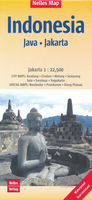
Java at 1:750, 000 on a double-sided map from Nelles Verlag, with a large street plan of central and northern Jakarta, plus several other street plans, enlargements and detailed plans of temples, including Borobudur and Prambanan.On one side is western Java with a large street plan of central and northern Jakarta, plus plans of central Bandung, Bogor and Cirebon. On the reverse the central and eastern part of the island is shown with street plans of central Yogyakarta, Surabaya, Solo (Surakarta), Semarang and Malang. Enlargements present in more detail the Dieng Plateau, the access from Yogyakarta to Prambanan, plus the Trowulan area.. Also included are detailed plans of the Prambanan temple complex and Borobudur.Relief shading with spot heights and names of mountain ranges and
peaks presents the topography. The map shows the island’s road and rail networks, plus local airports and ferry connections. Also marked are internal administrative boundaries with names of the provinces. National parks or protected areas and numerous places of interest are prominently highlighted. Latitude and longitude lines are drawn at 30’ intervals. The street plans highlight main sights, facilities, public buildings and selected tourist accommodation. The map has no index of localities. Map legend includes English.To see other titles in the Nelles series of regional maps of Indonesia please click on the series link.
RIP - This product is no longer available on our network. It was last seen on 25.09.2019

This page now acts as a permanent archive for this product. Add more information using the comments box below to ensure it can still be found by future generations.

Use our search facility to see if it is available from an alternative contributor.
  • Availability: Out Of Stock
  • Supplier: Stanfords
  • SKU: 9783865745545
Availability: In Stock
£10.99

Product Description

Java at 1:750, 000 on a double-sided map from Nelles Verlag, with a large street plan of central & northern Jakarta, plus several other street plans, enlargements & detailed plans of temples, including Borobudur & Prambanan. On one side is western Java with a large street plan of central & northern Jakarta, plus plans of central Bandung, Bogor & Cirebon. On the reverse the central & eastern part of the island is shown with street plans of central Yogyakarta, Surabaya, Solo (Surakarta), Semarang & Malang. Enlargements present in more detail the Dieng Plateau, the access from Yogyakarta to Prambanan, plus the Trowulan area.. Also included are detailed plans of the Prambanan temple complex & Borobudur. Relief shading with spot heights & names of mountain ranges & peaks presents the topography. The map shows the island’s road & rail networks, plus local airports & ferry connections. Also marked are internal administrative boundaries with names of the provinces. National parks or protected areas & numerous places of interest are prominently highlighted. Latitude & longitude lines are drawn at 30’ intervals. The street plans highlight main sights, facilities, public buildings & selected tourist accommodation. The map has no index of localities. Map legend

Includes::
English. To see other titles in the Nelles series of regional maps of Indonesia please click on the series link.

Reviews/Comments

Add New

Intelligent Comparison

Oooops!
We couldn't find anything!
Perhaps this product's unique.... Or perhaps we are still looking for comparisons!
Click to bump this page and we'll hurry up.

Price History

Vouchers

No voucher codes found.
Do you know a voucher code for this product or supplier? Add it to Insights for others to use.

Facebook

Jargon Buster

Large - something that takes up more space than normal.
Road - a manmade lane or a path that is used to speed up travel.
Accommodation - A room in which someone can live in, for example in a hotel
Regional - An adjective to describe a set geographic area.

Supplier Information

Stanfords
Stanfords was established in 1853 and opened their iconic Covent Garden flagship store in 1901. They have become the top retailer of maps, travel books and accessories in the UK and arguably offer the largest selection of maps and travel books worldwide. Famous names such as Captain Robert Falcon Scott, Ranulph Fiennes and Michael Palin have purchased from Stanfords. They now have a shop in Bristol and both stores together with other venues operate a calendar of events including talks, book signings and exhibitions. As a specialist map retailer, the map selection is comprehensive and includes road maps, street maps and walking maps from worldwide destinations, as well as a selection of world atlases and wall maps. Books include travel guides and travel literature. Stanfords also stock globes, from miniatures made of blue marble to magnificent floor-standing globes. The website features a selection of interesting articles on travel topics.
Page Updated: 2023-11-12 20:15:36

Community Generated Product Tags

Oh No! The productWIKI community hasn't generated any tags for this product yet!
Menu