
 United Kingdom
 France
 Germany
 Netherlands
 Sweden
 USA
USA
 Italy
Italy
 Spain
Spain
More From Contributor


Nepal Nelles
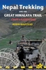
Nepal on a waterproof and tear-resistant map from Nelles, presenting the whole country at 1:1, 500, 000, with its more visited central and eastern regions also shown in more detail at 1:480, 000, plus enlargement of the Kathmandu Valley and the Rara Lake area and street plans of central Kathmandu City, Patan, Bhaktapur and the lakeside district of Pokhara.On one side the whole of Nepal is shown at 1:750, 000; on the reverse a more detailed map at 1:480, 000 covers central and eastern Nepal including the country’s main trekking areas: from the Dhaulagiri peaks in the west, across the Annapurna region, Langtang and Mt Everest, to Kanchenjunga in the east. Topography is indicated by relief shading with spot heights and names of mountain ranges, peaks and passes, etc, plus
boundaries of national parks and conservation areas. Road network includes selected cart tracks and trekking routes, with distances marked on main routes. Symbols show locations with access by air transport, as well as various places of interest. Latitude and longitude are indicated by margin ticks at 2º (whole country map) or 1º intervals. The maps are not indexed. Map legend includes English.Enlargements present in greater detail Kathmandu Valley (1:75, 000 approx) and the Jomsom to Rara Lake region (1:1m). Street plans cover central Kathmandu City with a further enlargement for its Thamel area, Patan, Bhaktapur, plus the lakeside district of Pokhara. The plans highlight selected hotels and various places of interest. For Kathmandu City, Patan and Bhaktapur there are also plans
of their Durbar Square historic centres.

Product Description
Reviews/Comments
Add New
Vouchers
No voucher codes found.
Do you know a voucher code for this product or supplier? Add it to Insights for others to use.
Do you know a voucher code for this product or supplier? Add it to Insights for others to use.
 Denmark