More From Contributor

£9.99
Nepal Adventure Map from the National Geographic presenting the country at 1:625, 000 on light, waterproof & tear-resistant synthetic paper, with a large panel showing the main sights & facilities in the Kathmandu – Patan area. The map is double-sided, dividing the country east/west with a good overlap between the sides. Topography is presented by contours at 200m intervals enhanced by relief shading & colouring for glaciers, with names of mountain ranges, passes & numerous peaks. National parks & conservation areas are highlighted. The map shows the country’s road network indicating scenic roads, locations of petrol stations & distances of main routes. Also included are main & selected local trails, railway lines & local airports. The map also shows the administrative division of the country into provinces. Symbols show various places of interest including cultural & religious sites, base camps, rivers for rafting or kayaking, classic trekking routes (e.g. Jiri to Everest BC or the Annapurna Circuit), etc. The map is indexed & has latitude & longitude lines at intervals of 30’. Also provided is a panel showing the Kathmandu – Patan area at approx. 1:50, 000 with names of main roads & locations of various sights, institutions & tourist facilities. ...
Archived Product
£10.99
An overview map of Nepal from Gecko Maps, Swiss cartographic publishers specializing in coverage of Tibet. The map


...
Archived Product
£22.95
Geological map of Nepal from Nepa Maps, presenting the country on a base map with numerous peaks & passes, main towns, districts & the road network. The legend, all in English, divides the information into geographical groups: Siwalik, Surkhet, Mid L&, Kathmandu, Jaljala, Dadeldhura & Himal, each sub-divided into sub-groups & formations. Also included are five cross-section diagrams across different parts of the country. The map has latitude & longitude margin ticks at 1° intervals & an index listing districts, towns, peaks, passes & lakes. ...
Archived Product
£14.99
Nepal on a laminated, waterproof & tear-resistant map from terra Quest, combining coverage of the whole country with more detail mapping for trekking in the Mt. Everest & Annapurna/ Dhaulagiri regions, an enlargement of the Kathmandu Valley, plus street plans of Kathmandu & Pokhara. The map consists of a series of panels presenting: The whole of Nepal at 1:1, 100, 000 with relief shading to show its topography. The map shows boundaries of national parks/protected areas & highlights names of main peaks & places of particular interest. Principal trekking routes & locations of base camps are marked. The map has no geographical coordinates. Mount Everest region north of Lukla on an enlargement at 1:115, 000, with trekking routes to the Base Camp, Island Peak & the Gokyo Lakes. The Annapurna ...
Archived Product
£14.99
Nepal on a laminated, waterproof & tear-resistant map from terra Quest, combining coverage of the whole country with more detailed contoured & GPS compatible mapping for trekking in the Mt. Everest & Annapurna/ Dhaulagiri regions, an enlargement of the Kathmandu Valley, plus street plans of Kathmandu & Pokhara. Multilingual map legend

Includes::
English. The map is laminated in a format similar to the old cloth-dissected maps so that sections of it can be easily folded back without damage, & can be annotated with write-on/wipe-off marker pens. Coverage consists of a series of panels presenting:- The whole of Nepal at 1:1, 100, 000 on a 68x 24cm panel. Topography is indicated by contours at 250m intervals with heights of main peaks & colouring for forests, glaciers, etc. The map shows boundaries of national parks/protected areas & prominently highlights names of main peaks & places of particular interest. Principal trekking routes & locations of base camps are marked. Latitude & longitude lines are drawn at 10’ intervals.- Enlargements with trekking routes in the country’s two most visited areas: the Mount Everest region north of Lukla on a 29x 49cm panel at 1:115, 000, with trekking routes to the Base Camp, Island Peak, Amphu Labsta & the Gokyo Lakes, plus the Annapurna
- Dhaulagiri region on a 72x 49cm panel at 1:150, 000 with the Annapurna circuit, the variant via the Tilicho Lakes, routes to the main & the north Base Camps, the Dhaulagiri circuit, etc. Both panels have mapping with contours at 50m intervals with colouring for vegetation & glaciers, indicate locations with tourist accommodation & facilities / places of interest, & have a latitude/longitude grid at intervals of 1’.- Kathmandu Valley at 1:150, 000 on a 22x 24cm panel with its road network presented on contoured mapping with places of interest but without special highlighting for trekking routes. Latitude & longitude grid is at 5’ intervals- Two large panels with street plans of Kathmandu/ Patan & Pokhara, annotated with selected accommodation, sights, etc.


...
Archived Product
£9.99
Nepal on an indexed, double-sided map with an enlargement for Kathmandu Valley & a street plan of the capital. The map divides the country east/west, with a generous overlap between the two sides. Topography is shown by elevation colouring with peak heights in metres, but, given the importance of geography to the country’s tourism, relatively few mountain ranges are named & well known peaks are missing. Stranger still is the lack of many familiar places associated with Nepal’s main trekking areas. In the Everest region neither Lukla nor Namche Bazar appear on the map, although Lukla is listed in the index. Similarly, familiar place names are missing from the route of the Annapurna circuit. The map shows the country’s road network, from metalled roads to selected local tracks. Airports & landing strips are marked. Symbols highlight main places of interest including temples & campsites. Latitude & longitude lines are drawn at intervals of 30’ Also included is an enlargement showing Kathmandu Valley in greater detail & a street plan of the city, both annotated with places of interest. ...
Archived Product
£10.99
Nepal on a waterproof & tear-resistant map from Nelles, presenting the whole country at 1:1, 500, 000, with its more visited central & eastern regions also shown in more detail at 1:480, 000, plus enlargement of the Kathmandu Valley & the Rara Lake area & street plans of central Kathmandu City, Patan, Bhaktapur & the lakeside district of Pokhara. On one side the whole of Nepal is shown at 1:750, 000; on the reverse a more detailed map at 1:480, 000 covers central & eastern Nepal including the country’s main trekking areas: from the Dhaulagiri peaks in the west, across the Annapurna region, Langtang & Mt Everest, to Kanchenjunga in the east. Topography is indicated by relief shading with spot heights & names of mountain ranges, peaks & passes, etc, plus boundaries of national parks & conservation areas. Road network

Includes::
selected cart tracks & trekking routes, with distances marked on main routes. Symbols show locations with access by air transport, as well as various places of interest. Latitude & longitude are indicated by margin ticks at 2º (whole country map) or 1º intervals. The maps are not indexed. Map legend

Includes::
English. Enlargements present in greater detail Kathmandu Valley (1:75, 000 approx) & the Jomsom to Rara Lake region (1:1m). Street plans cover central Kathmandu City with a further enlargement for its Thamel area, Patan, Bhaktapur, plus the lakeside district of Pokhara. The plans highlight selected hotels & various places of interest. For Kathmandu City, Patan & Bhaktapur there are also plans of their Durbar Square historic centres.


...
Archived Product
£6.99
Nepal on a double-sided map from Periplus.

Includes::
enlargements of Annapurna, Mount Everest area, Chitwan

...
Archived Product
£11.50
Nepal on an indexed, waterproof & tear-resistant road map, ideal for locating the country`s numerous famous peaks, with topographic & tourist information, & enlargements for Kathmandu, Pokhara, & Chitwan regions, plus Bhaktapur. The map, published by Reise Know-How as part of their highly acclaimed World Mapping Project, is double-sided to provide the best balance between a good scale & a convenient size sheet. The base map has altitude colouring with contours, spot heights & mountain passes. Names of main trekking areas are prominently highlighted in coloured boxes (e.g. Khumbu Himal, Mustang, Dolpa, etc.), as are names of national parks & conservation areas. The same system is used for numeous peaks
- colour coding to indicate famous peaks (Everest, Annapurna, Kanchenjunga, Dhaulagiri, etc.), peaks requiring permit & fee payment (Island Peak, Mera, Peak, Naya Kanga, etc.) & permit & royalty free peaks. Classic trekking routes are marked, e.g. Jiri to Everest Base Camp, the Annapurna Circuit, etc. The map highlights rafting or kayaking rivers such as Dudh & Tamba Kosi, Kali Gandaki, etc. Areas suitable for mountain biking are also indicated. Internal administrative boundaries are shown with names of the provinces. Road network

Includes::
local roads, highlights scenic routes & indicates locations of fuel supply stations. Local airfields & helipads are also marked. A wide range of symbols highlights various places of interest, including temples & monasteries of various religions, archaeological sites, viewpoints, Tharu villages, crocodile & elephant breeding centres, etc. The map has a latitude & longitude grid at intervals of 15’ & an index of place names which

Includes::
peaks & trekking areas. Map legend

Includes::
English. Enlargements, with more detailed contours & altitude colouring, are provided for the Kathmandu
- Patan area (1:25, 000), Pokhara Valley (1:30, 000) & the Narayangadh
- Royal Chitwan National Park area (1:200, 000). Also included is a plan of Bhaktapur at 1:15, 000.*” World Mapping Project”* is an extensive series of maps at varying scales, aiming to provide coverage of countries & regions worldwide using clear, well presented cartography with both topographic & tourist information.


...
Archived Product
£9.99
Koban, sheet no. 2883-07, in the topographic survey of Nepal at 1:50, 000 published by the Nepali Government in the late 1990s & early 2000s & produced from remote sensing data by Finnish cartographers as part of that country’s international aid program. The maps cover 15’ x 15’ quadrangles.IMPORTANT – PLEASE NOTE BEFORE ORDERING: AVAILABILITY: although, theoretically at least, still in print, these maps are very difficult to get locally in Nepal and/or from various suppliers elsewhere specializing in obtaining such maps. DELIVERIES MAY TAKE SEVERAL WEEKS OR EVEN MONTHS.PROBLEMS WITH PLACE NAMES: reports from previous users indicate that transliteration of place names differs from that used widely not only on other maps & in guide books but also on the ground itself, in road signs & in the tourist & trekking industry in general. Whilst most names are similar enough to be easily recognizable, e.g. Namche Bajar for Namche Bazar or Lantan for Langtang, we have been told of confusion & difficulties arising from different spellings appearing on these maps.TREKKING ROUTES & TOURIST INFORMATION: whilst the maps show foot trails & mark locations of temples, etc, they carry no specific trekking information. Major trekking routes & places of interest are not highlighted. There is no marking for base camps & other tourist facilities. Map specifications: Contours are at 40m intervals, with graphics and/or coloring to show various features of the terrain (glaciers with moraines & crevasses, quarries, gravel or clay pits, etc.) & vegetation (forests, bush, grass, orchards & plantations, etc). Additional comments such as “open mixed forest mainly bajh & pine” annotate many area. The maps have numerous spot heights, but relatively few peaks are named. Areas outside the country’s borders are left blank. Settlements in remote areas are indicated by markings for individual buildings & the placing of names does not always make it clear which group of buildings they refer to. Road network distinguishes between major & minor foot trails. Symbols mark features such as temples, schools & hospitals, police stations, etc. Also shown are the country’s administrative divisions. The maps have a 1-km UTM grid, plus latitude & longitude lines at intervals of 5’. Map legend & all the text is in English. Coverage: the whole country is now covered, with the north at 1:50, 000, plus central & southern Nepal at 1:25, 000. The two series are complementary, do not overlap & use the same grid & numbering system (apart from the Lumbini Zone, where a different grid & numbering are used). For areas not shown on our grid & titles not listed here, please contact us by e-mail, but please do bear in mind the problems with availability & the likely very long delivery time. ...
Archived Product

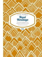
Nepal Himalaya: The Most Mountainous Of A Singularly Mountainous
Country

Throughout 1949 and 1950 H.W. `Bill` Tilman mounted pioneering expeditions to Nepal and its Himalayan mountains, taking advantage of some of the first access to the country for Western travellers in the 20th century. Tilman and his party-including a certain Sherpa Tenzing Norgay-trekked into the Kathmandu Valley and on to the Langtang region, where the highs and lows began. They first explored the Ganesh Himal, before moving on to the Jugal Himal and the following season embarking on an ambitious trip to Annapurna and Everest. Manaslu was their first objective, but left to `better men`, and Annapurna IV very nearly climbed instead but for bad weather which dogged the whole expedition. Needless to say, Tilman was leading some very lightweight expeditions into some seriously
heavyweight mountains. After the Annapurna adventure Tilman headed to Everest with-among others-Dr Charles Houston. Approaching from the delights of Namche Bazaar, the party made progress up the flanks of Pumori to gaze as best they could into the Western Cwm, and at the South Col and South-East Ridge approach to the summit of Everest.His observations were both optimistic and pessimistic: `One cannot write off the south side as impossible until the approach from the head of the West Cwm to this remarkably airy col has been seen.` But then of the West Cwm: `A trench overhung by these two tremendous walls might easily become a grave for any party which pitched its camp there.` Nepal Himalaya presents Tilman`s favourite sketches, encounters with endless yetis, trouble with the porters,
his obsessive relationship with alcohol and issues with the food. And so Tilman departs Nepal for the last time proper with these retiring words: `If a man feels he is failing to achieve this stern standard he should perhaps withdraw from a field of such high endeavour as the Himalaya.`
RIP - This product is no longer available on our network. It was last seen on 25.09.2019

This page now acts as a permanent archive for this product. Add more information using the comments box below to ensure it can still be found by future generations.

Use our search facility to see if it is available from an alternative contributor.
  • Availability: Out Of Stock
  • Supplier: Stanfords
  • SKU: 9781909461383
Availability: In Stock
£12.00

Product Description

Throughout 1949 & 1950 H.W. ` Bill` Tilman mounted pioneering expeditions to Nepal & its Himalayan mountains, taking advantage of some of the first access to the country for Western travellers in the 20th century. Tilman & his party-including a certain Sherpa Tenzing Norgay-trekked into the Kathmandu Valley & on to the Langtang region, where the highs & lows began. They first explored the Ganesh Himal, before moving on to the Jugal Himal & the following season embarking on an ambitious trip to Annapurna & Everest. Manaslu was their first objective, but left to `better men`, & Annapurna IV very nearly climbed instead but for bad weather which dogged the whole expedition. Needless to say, Tilman was leading some very lightweight expeditions into some seriously heavyweight mountains. After the Annapurna adventure Tilman headed to Everest with-among others-Dr Charles Houston. Approaching from the delights of Namche Bazaar, the party made progress up the flanks of Pumori to gaze as best they could into the Western Cwm, & at the South Col & South-East Ridge approach to the summit of Everest. His observations were both optimistic & pessimistic: ` One cannot write off the south side as impossible until the approach from the head of the West Cwm to this remarkably airy col has been seen.` But then of the West Cwm: `A trench overhung by these two tremendous walls might easily become a grave for any party which pitched its camp there.` Nepal Himalaya presents Tilman`s favourite sketches, encounters with endless yetis, trouble with the porters, his obsessive relationship with alcohol & issues with the food. & so Tilman departs Nepal for the last time proper with these retiring words: ` If a man feels he is failing to achieve this stern standard he should perhaps withdraw from a field of such high endeavour as the Himalaya.`

Reviews/Comments

Add New

Intelligent Comparison

Oooops!
We couldn't find anything!
Perhaps this product's unique.... Or perhaps we are still looking for comparisons!
Click to bump this page and we'll hurry up.

Price History

Vouchers

No voucher codes found.
Do you know a voucher code for this product or supplier? Add it to Insights for others to use.

Facebook

Jargon Buster

Weather - is the change of an atmospheres conditions.
Adventure - an undertaking of an exciting challenge or experience.
Season - The separation of four parts of the year into Spring, Summer, Autumn, Winter.
Head - The upper part of a body typically separated by the neck.

Supplier Information

Stanfords
Stanfords was established in 1853 and opened their iconic Covent Garden flagship store in 1901. They have become the top retailer of maps, travel books and accessories in the UK and arguably offer the largest selection of maps and travel books worldwide. Famous names such as Captain Robert Falcon Scott, Ranulph Fiennes and Michael Palin have purchased from Stanfords. They now have a shop in Bristol and both stores together with other venues operate a calendar of events including talks, book signings and exhibitions. As a specialist map retailer, the map selection is comprehensive and includes road maps, street maps and walking maps from worldwide destinations, as well as a selection of world atlases and wall maps. Books include travel guides and travel literature. Stanfords also stock globes, from miniatures made of blue marble to magnificent floor-standing globes. The website features a selection of interesting articles on travel topics.
Page Updated: 2023-11-12 20:15:36

Community Generated Product Tags

Oh No! The productWIKI community hasn't generated any tags for this product yet!
Menu