More From Contributor
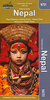
£5.99
Part of a groundbreaking activity book series, this book brings together stylish design, fluorescent stickers & lots & lots of facts about nature. Non-fiction about animals under the sea has never looked so good! The creative & educational colouring activities are brought to life by fluorescent stickers. ...
Archived Product
£12.99
Topographic survey of France at 1:25, 000 in IGN`s excellent TOP25 / Série Bleue series. All the maps are GPS compatible, with a 1km UTM grid plus latitude & longitude lines at 5’ intervals. Contours are at 5m intervals except for mountainous areas where the maps have contours at 10m intervals, vividly enhanced by hill shading & graphics for rocky terrain. Colouring with graphics indicates different types of vegetation or land use (deciduous or coniferous forests, moors, orchards, vineyards, etc). PLEASE NOTE: coverage of France at this scale is currently being revised – the format & the presentation of each title are indicated by the letters at the end of its Sheet Reference number (e.g. 0416ET, 3531ETR, 1923SB, etc.)MAPS WITH FULL TOURIST OVERPRINT & AN ENGLISH MAP LEGEND: all TOP25 maps & the SB editions of Série Bleue have an overprint highlighting waymarked walking trails including long-distance GR routes &, where appropriate, ski routes. Symbols indicate campsites, gîtes d’etape, refuges, equestrian centres & other recreational facilities or sites, tourist information centres, cultural heritage, etc. Towns & locations of particular interest are highlighted.- ET or OT = single-sided TOP25 map covering approx. 29x 21 km / 18x 13 miles.- ETR or OTR = waterproof & tear resistant TOP25 map covering the same area as the corresponding ET or OT number, but double-sided, printed on a smaller size sheet with a good overlap between the sides.- SB = Série Bleue map with full tourist overprint; these maps, first introduced in summer 2014, each cover approx. 29x 24km / 18x 15 miles.SÉRIE BLEUE maps with numbers ending in E (Est) or O (Ouest): most editions now indicate the GR routes, but do not show any other tourist information. Map legend is in French only. Each map covers approx. 14x 20km / 9x 12 miles. ...
Archived Product
£18.99
Topographic survey of France at 1:25, 000 in IGN`s excellent TOP25 / Série Bleue series. All the maps are GPS compatible, with a 1km UTM grid plus latitude & longitude lines at 5’ intervals. Contours are at 5m intervals except for mountainous areas where the maps have contours at 10m intervals, vividly enhanced by hill shading & graphics for rocky terrain. Colouring with graphics indicates different types of vegetation or land use (deciduous or coniferous forests, moors, orchards, vineyards, etc). PLEASE NOTE: coverage of France at this scale is currently being revised – the format & the presentation of each title are indicated by the letters at the end of its Sheet Reference number (e.g. 0416ET, 3531ETR, 1923SB, etc.)MAPS WITH FULL TOURIST OVERPRINT & AN ENGLISH MAP LEGEND: all TOP25 maps & the SB editions of Série Bleue have an overprint highlighting waymarked walking trails including long-distance GR routes &, where appropriate, ski routes. Symbols indicate campsites, gîtes d’etape, refuges, equestrian centres & other recreational facilities or sites, tourist information centres, cultural heritage, etc. Towns & locations of particular interest are highlighted.- ET or OT = single-sided TOP25 map covering approx. 29x 21 km / 18x 13 miles.- ETR or OTR = waterproof & tear resistant TOP25 map covering the same area as the corresponding ET or OT number, but double-sided, printed on a smaller size sheet with a good overlap between the sides.- SB = Série Bleue map with full tourist overprint; these maps, first introduced in summer 2014, each cover approx. 29x 24km / 18x 15 miles.SÉRIE BLEUE maps with numbers ending in E (Est) or O (Ouest): most editions now indicate the GR routes, but do not show any other tourist information. Map legend is in French only. Each map covers approx. 14x 20km / 9x 12 miles. ...
Archived Product
£9.95
Nepal road map with bold relief shading & spot heights for numerous peaks. Road network indicates driving distances on principal highways & main roads. Trail connections in more remote areas & locations of local airfields are also shown. Internal divisions into zones & districts are prominently indicated with names of administrative units. The map shows boundaries of national parks & protected areas & highlights various places of interest, including names & heights of numerous peaks. Latitude & longitude grid is at intervals of 30 ...
Archived Product
£11.95
Nepal at 1:750, 000 on an indexed map from Mair Dumont with a set of removable stickers to highlight chosen locations. A fold-out flap in the jacket makes route planning easier by providing an overview of the whole area covered by the map plus the adjoining regions & highlighting popular locations, with its grid reference system in the margins making it easier to find places on the main map. A set of seven peel-on/peel-off stickers, removable from the map without damaging its surface, is provided for making selected locations more prominent when navigating. Topography is shown by bold relief shading with spot heights & mountain passes. Many peaks are named & those best known highlighted, as are Nepal ...
Archived Product
£7.95
Nepal map from Nelles Verlag, combining coverage of the whole country at 1:1, 500, 000 with more detailed mapping of its eastern half at 1:480, 000. Several insets provide street plans & enlargements of popular trekking areas. On one side is a map at 1:480, 000 covering Nepal east of the Dhaulagiri range, including Kanchenjunga but without the south-eastern tip of the country. Vivid relief shading shows the topography, with numerous peak names along the Tibetan border & spot heights elsewhere. The map shows the road network & trekking routes, as well as access to various locations by air. National parks & protected areas are marked & various places of interest are highlighted. Latitude & longitude are indicated by margin ticks at intervals of 60 ...
Archived Product
£13.59
Nepal in the Countries & Regions series from Lonely Planet, market-leading comprehensive guides aimed at independent travellers & serving a large range of international destinations. Frank & informal in style, the guides explore an extensive range of sights, activities, accommodation, restaurants & nightlife & are designed for practical use while travelling on the road. Written & researched by a team of experts, each book is independent in its recommendations & suggestions, often offering individual takes on individual destinations. Widely recognised for their reliability, each Lonely Planet country & region guide has the same layout. Introductory sections profile the destination with individual chapters on particular highlights, getting started, (including when to go) itineraries, history, culture, arts, food & drink & the environment. Each guide is organised geographically by region, with individual sections detailing an extensive range of sights, places of interest, attractions, restaurants, nightlife, accommodation & any local activities. The guides have detailed explanations of historical context where relevant. There is also practical guidance on ...
Archived Product
£16.99
Nepal in the Countries, Regions & Cities series from Rough Guides; comprehensively detailed guidebooks specifically designed for independent travellers & serving a range of worldwide destinations. Widely recognised for their free editorial style, Rough Guide authors are allowed to express their personal opinions on a range of subjects. Although sometimes controversial, this editorial stance allows readers to experience more detailed & personal takes on each destination, a feature often more limited in other guidebooks. Cultural & historical nuances are explored in significant depth throughout the text & descriptions on the ambience of individual settings alongside personal recommendations, particularly in cities, are notably prevalent. Each Rough Guide in the Countries, Regions & Cities series has a similar layout. A ...
Archived Product
£17.99
Roof of the world, land of legend & beauty
- within its narrow confines, Nepal contains an utterly spectacular variety of culture
...
Archived Product
£9.50
Nepal at 1:950, 000 on an indexed map from the Kathmandu-based Nepa Maps (Himalayan Map House) with enlargements presenting in more detail the four most visited areas: Mount Everest, Annapurna, Langtang & Helambu, plus Manaslu & Ganesh. The main map presents the country at 1:950, 000 on a base derived from satellite imagery, with heights of numerous peaks & passes. National parks & conservation areas are highlighted. Road network

Includes::
selected local trails; domestic airports are marked. The map also shows the division of the country into regions, with town symbols indicating their administrative status. Symbols highlight various places of interest including UNESCO World heritage sites. The map has latitude & longitude lines at 30’ & is indexed, including lists of peaks, passes & lakes. The areas beyond Nepal’s borders are blank. The four enlargements provide an excellent, vivid representation of each area’s topography more peak names, highlight main trekking routes, & show campsites & locations with tourist hotels. The regions covered are:- Jiri
- Mt Everest region at 1:350, 000 including the whole of the trekking route from Jiri- southern part of the Annapurna Conservation Area at 1:375, 000 with the whole of the Annapurna Circuit, including the spurs to Naar & Phu- Langtang & Helambu region at 1:425, 000 including Kathmandu- the Manaslu – Ganesh area at 1:375, 000 with Besisahar & Gorkha Also provided are lists of national parks/conservation areas/wildlife reserves, highest peaks, domestic air routes with flight times, World Heritage sites, a distance table, etc.


...
Archived Product

Nepal

Nepal on an indexed, waterproof and tear-resistant road map, ideal for locating the country's numerous famous peaks, with topographic and tourist information, and enlargements for Kathmandu, Pokhara, and Chitwan regions, plus Bhaktapur. The map, published by Reise Know-How as part of their highly acclaimed World Mapping Project, is double-sided to provide the best balance between a good scale and a convenient size sheet.The base map has altitude colouring with contours, spot heights and mountain passes. Names of main trekking areas are prominently highlighted in coloured boxes (e.g. Khumbu Himal, Mustang, Dolpa, etc.), as are names of national parks and conservation areas. The same system is used for numeous peaks - colour coding to indicate famous peaks (Everest, Annapurna,
Kanchenjunga, Dhaulagiri, etc.), peaks requiring permit and fee payment (Island Peak, Mera, Peak, Naya Kanga, etc.) and permit and royalty free peaks. Classic trekking routes are marked, e.g. Jiri to Everest Base Camp, the Annapurna Circuit, etc. The map highlights rafting or kayaking rivers such as Dudh and Tamba Kosi, Kali Gandaki, etc. Areas suitable for mountain biking are also indicated.Internal administrative boundaries are shown with names of the provinces. Road network includes local roads, highlights scenic routes and indicates locations of fuel supply stations. Local airfields and helipads are also marked. A wide range of symbols highlights various places of interest, including temples and monasteries of various religions, archaeological sites, viewpoints, Tharu
villages, crocodile and elephant breeding centres, etc. The map has a latitude and longitude grid at intervals of 15
RIP - This product is no longer available on our network. It was last seen on 25.09.2019

This page now acts as a permanent archive for this product. Add more information using the comments box below to ensure it can still be found by future generations.

Use our search facility to see if it is available from an alternative contributor.
  • Availability: Out Of Stock
  • Supplier: Stanfords
  • SKU: 9783831771011
Availability: In Stock
£9.50

Product Description

Nepal on an indexed, waterproof & tear-resistant road map, ideal for locating the country's numerous famous peaks, with topographic & tourist information, & enlargements for Kathmandu, Pokhara, & Chitwan regions, plus Bhaktapur. The map, published by Reise Know-How as part of their highly acclaimed World Mapping Project, is double-sided to provide the best balance between a good scale & a convenient size sheet. The base map has altitude colouring with contours, spot heights & mountain passes. Names of main trekking areas are prominently highlighted in coloured boxes (e.g. Khumbu Himal, Mustang, Dolpa, etc.), as are names of national parks & conservation areas. The same system is used for numeous peaks
- colour coding to indicate famous peaks (Everest, Annapurna, Kanchenjunga, Dhaulagiri, etc.), peaks requiring permit & fee payment (Island Peak, Mera, Peak, Naya Kanga, etc.) & permit & royalty free peaks. Classic trekking routes are marked, e.g. Jiri to Everest Base Camp, the Annapurna Circuit, etc. The map highlights rafting or kayaking rivers such as Dudh & Tamba Kosi, Kali Gandaki, etc. Areas suitable for mountain biking are also indicated. Internal administrative boundaries are shown with names of the provinces. Road network

Includes::
local roads, highlights scenic routes & indicates locations of fuel supply stations. Local airfields & helipads are also marked. A wide range of symbols highlights various places of interest, including temples & monasteries of various religions, archaeological sites, viewpoints, Tharu villages, crocodile & elephant breeding centres, etc. The map has a latitude & longitude grid at intervals of 15

Reviews/Comments

Add New

Price History

Vouchers

No voucher codes found.
Do you know a voucher code for this product or supplier? Add it to Insights for others to use.

Facebook

Jargon Buster

Elephant - A large land mammal found in Africa and Asia
fuel - A material used to generate energy.
Waterproof - Resistant to water, usualy specified by depth in metres
World - A physical grouping, commonly used to describe earth and everything associated with ti
Colour - The categorised spectrum of light visable to humans
Size - is the measurement of how big an object is in space.
Network - A link and communication between things. Often computers or people.
Road - a manmade lane or a path that is used to speed up travel.
Resistant - Something that can repel against something.
Altitude - Something that can be quite high in relation to sea or ground level.
Wide - Something with a large width.
Balance - Something that is evenly weighted to keep something upright.
Classic - Something that is still like it was originally a high quality standard.
Ideal - Something that satisfies a perfect criteria.
Convenient - Something that suits and fits well to other activities.

Supplier Information

Stanfords
Stanfords was established in 1853 and opened their iconic Covent Garden flagship store in 1901. They have become the top retailer of maps, travel books and accessories in the UK and arguably offer the largest selection of maps and travel books worldwide. Famous names such as Captain Robert Falcon Scott, Ranulph Fiennes and Michael Palin have purchased from Stanfords. They now have a shop in Bristol and both stores together with other venues operate a calendar of events including talks, book signings and exhibitions. As a specialist map retailer, the map selection is comprehensive and includes road maps, street maps and walking maps from worldwide destinations, as well as a selection of world atlases and wall maps. Books include travel guides and travel literature. Stanfords also stock globes, from miniatures made of blue marble to magnificent floor-standing globes. The website features a selection of interesting articles on travel topics.
Page Updated: 2023-11-12 20:15:36

Community Generated Product Tags

Oh No! The productWIKI community hasn't generated any tags for this product yet!
Menu