
 United Kingdom
 France
 Germany
 Netherlands
 Sweden
 USA
USA
 Italy
Italy
 Spain
Spain
More From Contributor


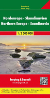
Northern Europe - Scandinavia F&B
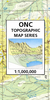
Northern Europe at 1:2, 000, 000 from Freytag & Berndt, covering Scandinavia, the Baltic states, northern Poland and northern Germany, with a separate index booklet also providing street plans of capitals cities. Iceland and Faeroe Islands are included as insets.Relief shading shows the topography. National parks are highlighted. The map shows road and rail network at the level appropriate to its scale, clearly indicating on main routes their road numbers, including where appropriate the E-numbers. Also marked are ferry connections, local airports, and within larger countries internal administrative boundaries. Latitude/longitude grid is drawn at intervals of 1º. Map legend includes English. The index, arranged by country and showing postcodes, is in a separate booklet attached
to the map cover. The booklet also includes street plans of city centres in Copenhagen, Helsinki, Oslo, Reykjavik, Riga, Stockholm, Tallinn, Minsk and Vilnius.
to the map cover. The booklet also includes street plans of city centres in Copenhagen, Helsinki, Oslo, Reykjavik, Riga, Stockholm, Tallinn, Minsk and Vilnius.

Product Description
Reviews/Comments
Add New
Vouchers
No voucher codes found.
Do you know a voucher code for this product or supplier? Add it to Insights for others to use.
Do you know a voucher code for this product or supplier? Add it to Insights for others to use.
 Denmark