
 United Kingdom
 France
 Germany
 Netherlands
 Sweden
 USA
USA
 Italy
Italy
 Spain
Spain
More From Contributor


Lonely Planet East Timor Phrasebook And Dictionary
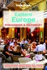
Lonely Planet East Timor Phrasebook & Dictionary is your handy passport to culturally enriching travels with the most relevant and useful East Timor phrases and vocabulary for all your travel needs. Be able to communicate with locals when hiking on out-of-the-way treks, enjoy trying new meals, or know the etiquette of being a guest in someone`s home; all with your trusted travel companion. With language tools in your back pocket, you can truly get to the heart of wherever you go, so begin your journey now! Get More From Your Trip with Easy-to-Find Phrases for Every Travel Situation! Feel at ease with essential tips on culture, manners, idioms and multiple meanings. Order with confidence, explain food allergies, and try new foods with our menu decoder. Save time and hassles with
vital phrases at your fingertips. Never get stuck for words with the 3500-word two-way, quick-reference dictionary. Be prepared for both common and emergency travel situations with practical phrases and terminology. Meet friends with conversation starter phrases. Get your message across with easy-to-use pronunciation guides Inside Lonely Planet East Timor Phrasebook & Dictionary. Colour throughout. User-friendly layout organised by travel scenario categories. Survival phrases inside front cover for at-a-glance on-the-fly cues. Convenient features. Listen For - phrases you may hear. Look For - phrases you may see on signs. Shortcuts - easy-to-remember alternatives to the full phrases. Q&A - suggested answers to questions asked. Covers, Basics - time, dates, numbers, amounts,
pronunciation, reading tips, grammar rules; Practical - travel with kids, sightseeing, business, banking, post office, internet, phones, repairs, bargaining, accommodation, directions, border crossing, transport; Social - meeting people, interests, feelings, opinions, going out, culture, activities, weather; Safe Travel - emergencies, police, doctor, chemist, dentist, symptoms, conditions; Food - ordering, at the market, at the bar, dishes, ingredients.Lonely Planet East Timor Phrasebook & Dictionary, a pocket-sized comprehensive language guide, provides on-the-go language assistance; great for language students and travellers looking to interact with locals and immerse themselves in local culture. Authors: Written and researched by Lonely Planet, John
Hajek and Alexandre Vital Tilman. About Lonely Planet: Started in 1973, Lonely Planet is the world`s leading travel guide publisher with guidebooks to every destination on the planet, and has been connecting travellers and locals for over 25 years with phrasebooks for 120 languages, more than any other publisher! With an award-winning website, a suite of mobile and digital travel products, and a dedicated traveller community, Lonely Planet enables curious travellers to experience the world and to truly get to the heart of the places they find themselves.
Product Description
Reviews/Comments
Add New
Vouchers
No voucher codes found.
Do you know a voucher code for this product or supplier? Add it to Insights for others to use.
Do you know a voucher code for this product or supplier? Add it to Insights for others to use.
 Denmark