
 United Kingdom
 France
 Germany
 Netherlands
 Sweden
 USA
USA
 Italy
Italy
 Spain
Spain
More From Contributor

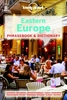
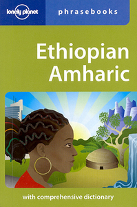
Lonely Planet Ethiopian (Amharic) Phrasebook
The Lonely Planet Ethiopian (Amharic) Phrasebook is not only an extensive list of useful phrases, but also an ideal tool to start getting to grips with a language and beginning two-way communication. Containing excellent sections on language basics such as numbers, question phrases, dates, phrase construction, grammar and pronunciation, as well as containing concise but well-rounded two-way dictionaries, Lonely Planet phrasebooks enable you to quickly & confidently construct your own phrases in addition to those given. The given phrases cover all the essential travel and tourism categories such as transport, communications, business meetings & accommodation, as well as in-depth categories such as health, food and social interaction. The phrasebooks are designed to enable more
than just simple question-answer communication, allowing the start of two-way conversations – putting you comfortably on your way to learning the language and understanding its speakers.True to Lonely Planet’s reputation for ease of use, the Phrasebooks are well designed, well structured and clearly categorized, making it easy to find the information you need quickly. Useful background information is given throughout the phrasebooks, giving you quick tips on culture, customs & etiquette.
than just simple question-answer communication, allowing the start of two-way conversations – putting you comfortably on your way to learning the language and understanding its speakers.True to Lonely Planet’s reputation for ease of use, the Phrasebooks are well designed, well structured and clearly categorized, making it easy to find the information you need quickly. Useful background information is given throughout the phrasebooks, giving you quick tips on culture, customs & etiquette.
%20Phrasebook "Pin It")
Product Description
Reviews/Comments
Add New
Intelligent Comparison
Archived Product
Lonely Planet Egyptian Arabic Phrasebook Stanfords
£4.99
Archived Product
Lonely Planet China Phrasebook Stanfords
£5.99
Archived Product
Lonely Planet Croatian Phrasebook Stanfords
£4.99
Archived Product
Lonely Planet Pidgin Phrasebook Stanfords
£4.99
Archived Product
Lonely Planet Europe Phrasebook Stanfords
£5.99
Archived Product
Lonely Planet South Pacific Phrasebook Stanfords
£4.99
Archived Product
Lonely Planet India Phrasebook Stanfords
£5.99
Archived Product
Lonely Planet Farsi (Persian) Phrasebook Stanfords
£4.99
Vouchers
No voucher codes found.
Do you know a voucher code for this product or supplier? Add it to Insights for others to use.
Do you know a voucher code for this product or supplier? Add it to Insights for others to use.
 Denmark