
 United Kingdom
 France
 Germany
 Netherlands
 Sweden
 USA
USA
 Italy
Italy
 Spain
Spain
More From Contributor


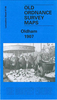


Oldham South 1906 (97.10)
Oldham South in 1906 in a fascinating series of reproductions of old Ordnance Survey plans in the Alan Godfrey Editions, ideal for anyone interested in the history of their neighbourhood or family. The map covers the southern side of Oldham, stretching from Windsor Road eastward to Abbey Hills Road, and from Wellington Street southward to Hollins Road and Hathershaw. Features include railway with Central and Clegg Street stations, Glodwick Brook, Glodwick, Alexandra Park, Brook Mills, Maple Mill, Earl Mill, Belgrave Mill, Castle Mill, Borough Mill, Pearl Mill, Glodwick Mill, Commercial Mill, Broadway Mills, Alma Mills, Copster Mill, Primrose Bank Mills, other mills, tramways, Chamber Colliery, Hulme Grammar School, Primrose Bank, Coppice, St Thomas`s church,
Lowside Brick Works, Cherry Valley, Fitton Hill, etc. On the reverse are street directory entries for Ashton Road, Belgrave Road, Copster Hill Road, King Street, Lee Street, Park Road, Queen`s Road and Waterloo Street, plus an 1897 railway timetable for the Oldham-Stockport line.About the Alan Godfrey Editions of the 25” OS Series:Selected towns in Great Britain and Ireland are covered by maps showing the extent of urban development in the last decades of the 19th and early 20th century. The plans have been taken from the Ordnance Survey mapping and reprinted at about 15 inches to one mile (1:4, 340). On the reverse most maps have historical notes and many also include extracts from contemporary directories. Most maps cover about one mile (1.6kms) north/south, one and a half
miles (2.4kms) across; adjoining sheets can be combined to provide wider coverage.FOR MORE INFORMATION AND A COMPLETE LIST OF ALL AVAILABLE TITLES PLEASE CLICK ON THE SERIES LINK.
 "Pin It")
Product Description
Reviews/Comments
Add New
Vouchers
No voucher codes found.
Do you know a voucher code for this product or supplier? Add it to Insights for others to use.
Do you know a voucher code for this product or supplier? Add it to Insights for others to use.
 Denmark