
 United Kingdom
 France
 Germany
 Netherlands
 Sweden
 USA
USA
 Italy
Italy
 Spain
Spain
More From Contributor


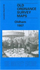


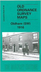
Oldham South West 1916
Oldham South West in 1916 in a fascinating series of reproductions of old Ordnance Survey plans in the Alan Godfrey Editions, ideal for anyone interested in the history of their neighbourhood or family. The map covers the south-western side of Oldham including Werneth, stretching from Coppice Street and Werneth Park westward to Oldham Sewage Works and White Gate, and from Drury Lane northward to Alfred Street. Features include Glebe Mills, Richmond Mill, Butler Green, Gem Mill, Lark Mill, Nile Mill, Raven Mill, Ramsey Mill, Mona Mill, Melrose Mill, Chadderton Mill, Hartford Mill, Werneth Mill, several other mills, short stretch of Rochdale Canal, Durban Mill, Vale Mill, Oak Mills, Hartford House, St John`s church, etc. On the reverse is a selection of street
directory entries, including Coalshaw Green Road, Drury Lane, Frederick Street, Grange Avenue, Manchester Road, Manchester Street, Old Lane and Oxford Street.About the Alan Godfrey Editions of the 25” OS Series:Selected towns in Great Britain and Ireland are covered by maps showing the extent of urban development in the last decades of the 19th and early 20th century. The plans have been taken from the Ordnance Survey mapping and reprinted at about 15 inches to one mile (1:4, 340). On the reverse most maps have historical notes and many also include extracts from contemporary directories. Most maps cover about one mile (1.6kms) north/south, one and a half miles (2.4kms) across; adjoining sheets can be combined to provide wider coverage.FOR MORE INFORMATION AND A COMPLETE LIST OF
ALL AVAILABLE TITLES PLEASE CLICK ON THE SERIES LINK.

Product Description
Reviews/Comments
Add New
Intelligent Comparison
Archived Product

Willenhall South West 1901 Stanfords
£3.50
Archived Product

Wolverhampton South West 1901 Stanfords
£3.50
Archived Product

Colwyn Bay South West 1911 Stanfords
£3.50
Vouchers
No voucher codes found.
Do you know a voucher code for this product or supplier? Add it to Insights for others to use.
Do you know a voucher code for this product or supplier? Add it to Insights for others to use.
 Denmark