More From Contributor

£8.99
A wickedly funny new series for ages six & up from the creator of Where Bear?, Pass It On & the Pom Pom series, with colour illustrations throughout. Jeanie`s Grandma is BAD. Not bad like a vampire or a gangster or anything, more like... up to no good. Sometimes she can be a bit embarrassing but most of the time she`s REALLY fun, especially when she gets Jeanie involved in her mischievous schemes. Everyone says she`s old enough to know better... but she doesn`t seem to care one bit. In fact, Jeanie thinks she might quite like it! Bad Nana is a deliciously wicked new series for ages six & up, told through the eyes of 8-year-old Jeanie. Gorgeously illustrated throughout with vibrantly coloured spreads, Bad Nana`s naughty exploits will shock & appal
- & make you snort with laughter!
...
Archived Product
£3.50
Oldham in 1907 in a fascinating series of reproductions of old Ordnance Survey plans in the Alan Godfrey Editions, ideal for anyone interested in the history of their neighbourhood or family. The map covers the heart of Oldham, with stretching from Westbourne Street eastward to Bleasby Street, & from Cromwell Street northward to Samson Street. Features include railway with Mumps station, St Mary`s church, Market Ground, Market Hall, Coldhurst Hollow, Bank Top, Cold Hurst, Sarah Moor, Oldham Edge, Moorhey, Townfield, Greenacres Moor, St James Mill, Soho Iron Works, Castle Iron Works, tramways, Hartford Old Works, Derker Old Mill, Albany Mills, Granville Mill, Greenbank Mills, Commercial Mills, tramway depot, Glodwick Road station, Hargreaves Spindle Works, Werneth Mill, Summervale Mill, Willowbank Mill, Royal Mill, many other mills, rope works, Oldham Boiler Works, etc. On the reverse are 1918 street directory entries for High Street, Market Place, Mumps, Rock Street, Union Street & Yorkshire Street. About the Alan Godfrey Editions of the 25” OS Series: Selected towns in Great Britain & Ireland are covered by maps showing the extent of urban development in the last decades of the 19th & early 20th century. The plans have been taken from the Ordnance Survey mapping & reprinted at about 15 inches to one mile (1:4, 340). On the reverse most maps have historical notes & many also include extracts from contemporary directories. Most maps cover about one mile (1.6kms) north/south, one & a half miles (2.4kms) across; adjoining sheets can be combined to provide wider coverage.FOR MORE INFORMATION & A COMPLETE LIST OF ALL AVAILABLE TITLES PLEASE CLICK ON THE SERIES LINK. ...
Archived Product
£3.50
Oldham East in 1907 in a fascinating series of reproductions of old Ordnance Survey plans in the Alan Godfrey Editions, ideal for anyone interested in the history of their neighbourhood or family. The map covers the eastern side of Oldham, stretching from Greenacres Hill & Kelverlow Street eastward to Stone Breaks & Shelderslow, & from Waterworks Road southward to Lees station. Areas include Bank Top, Crossbank, Shelderslow, Austerlands, Greenacres, Hey, Greenacres Fold, Birks, Taylor Green, Waterhead & Spring Hill. Features include tramways, Greenacres Cemetery, Stamford Mill, Owl Mill, Banktop Mills, engine shed (at Lees station), Dowry Mill, St John the Baptist church, Brookside Mills (in bottom right corner), Birks Quarry, Majestic Mill, Cairo Mill, Glen Mill, Prince of Wales Mill, football ground, Ruby Mill, Newbreck Mills, several other mills, Sun Hill, etc. The Austerlands & Shelderslow area was in Yorkshire. On the reverse are street directory entries for Greenacres Road, Huddersfield Road, Ripponden Road, Spring Street. About the Alan Godfrey Editions of the 25” OS Series: Selected towns in Great Britain & Ireland are covered by maps showing the extent of urban development in the last decades of the 19th & early 20th century. The plans have been taken from the Ordnance Survey mapping & reprinted at about 15 inches to one mile (1:4, 340). On the reverse most maps have historical notes & many also include extracts from contemporary directories. Most maps cover about one mile (1.6kms) north/south, one & a half miles (2.4kms) across; adjoining sheets can be combined to provide wider coverage.FOR MORE INFORMATION & A COMPLETE LIST OF ALL AVAILABLE TITLES PLEASE CLICK ON THE SERIES LINK. ...
Archived Product
£3.50
Oldham South in 1906 in a fascinating series of reproductions of old Ordnance Survey plans in the Alan Godfrey Editions, ideal for anyone interested in the history of their neighbourhood or family. The map covers the southern side of Oldham, stretching from Windsor Road eastward to Abbey Hills Road, & from Wellington Street southward to Hollins Road & Hathershaw. Features include railway with Central & Clegg Street stations, Glodwick Brook, Glodwick, Alexandra Park, Brook Mills, Maple Mill, Earl Mill, Belgrave Mill, Castle Mill, Borough Mill, Pearl Mill, Glodwick Mill, Commercial Mill, Broadway Mills, Alma Mills, Copster Mill, Primrose Bank Mills, other mills, tramways, Chamber Colliery, Hulme Grammar School, Primrose Bank, Coppice, St Thomas`s church, Lowside Brick Works, Cherry Valley, Fitton Hill, etc. On the reverse are street directory entries for Ashton Road, Belgrave Road, Copster Hill Road, King Street, Lee Street, Park Road, Queen`s Road & Waterloo Street, plus an 1897 railway timetable for the Oldham-Stockport line. About the Alan Godfrey Editions of the 25” OS Series: Selected towns in Great Britain & Ireland are covered by maps showing the extent of urban development in the last decades of the 19th & early 20th century. The plans have been taken from the Ordnance Survey mapping & reprinted at about 15 inches to one mile (1:4, 340). On the reverse most maps have historical notes & many also include extracts from contemporary directories. Most maps cover about one mile (1.6kms) north/south, one & a half miles (2.4kms) across; adjoining sheets can be combined to provide wider coverage.FOR MORE INFORMATION & A COMPLETE LIST OF ALL AVAILABLE TITLES PLEASE CLICK ON THE SERIES LINK. ...
Archived Product
£3.50
Oldham South West in 1916 in a fascinating series of reproductions of old Ordnance Survey plans in the Alan Godfrey Editions, ideal for anyone interested in the history of their neighbourhood or family. The map covers the south-western side of Oldham including Werneth, stretching from Coppice Street & Werneth Park westward to Oldham Sewage Works & White Gate, & from Drury Lane northward to Alfred Street. Features include Glebe Mills, Richmond Mill, Butler Green, Gem Mill, Lark Mill, Nile Mill, Raven Mill, Ramsey Mill, Mona Mill, Melrose Mill, Chadderton Mill, Hartford Mill, Werneth Mill, several other mills, short stretch of Rochdale Canal, Durban Mill, Vale Mill, Oak Mills, Hartford House, St John`s church, etc. On the reverse is a selection of street directory entries, including Coalshaw Green Road, Drury Lane, Frederick Street, Grange Avenue, Manchester Road, Manchester Street, Old Lane & Oxford Street. About the Alan Godfrey Editions of the 25” OS Series: Selected towns in Great Britain & Ireland are covered by maps showing the extent of urban development in the last decades of the 19th & early 20th century. The plans have been taken from the Ordnance Survey mapping & reprinted at about 15 inches to one mile (1:4, 340). On the reverse most maps have historical notes & many also include extracts from contemporary directories. Most maps cover about one mile (1.6kms) north/south, one & a half miles (2.4kms) across; adjoining sheets can be combined to provide wider coverage.FOR MORE INFORMATION & A COMPLETE LIST OF ALL AVAILABLE TITLES PLEASE CLICK ON THE SERIES LINK. ...
Archived Product
£14.99
This autobiography is about growing up in Egypt. It is also an investigation into childhood perception in which the author uses herself & her memories as an insight into how children see & know. It is a look at Egypt up to, & including, World War II from a small girl`s point of view, which is also, ultimately, a moving & rather sad picture of an isolated & lonely little girl. ...
Archived Product
£17.99
Topographic survey of Portugal at 1:50, 000 from the Instituto Geográfico do Exército, the country’s military survey organisation. The maps have contours at 20m intervals & in addition to the standard features shown on topographic mapping at this scale also indicate various types of terrain or vegetation (s&, terraces, rocks, woodlands, vineyards, etc). Each sheet covers an area of 32 x 20km (20 x 12.5 miles approx). The maps have a 1-km UTM grid plus latitude & longitude coordinates for the map corners. Map legend & a glossary of terms used on the maps include English.EDITION DATES: most titles in this series date from 1990s or later. To see all the titles in this series please click on the series link. ...
Archived Product
£17.99
Topographic survey of Portugal at 1:50, 000 from the Instituto Geográfico Português, the country’s civilian survey organisation. The maps have contours at 25m intervals & in addition to the standard features shown on topographic mapping at this scale also indicate various types of vegetation (vineyards, olive groves, etc). Each sheet covers an area of 32 x 20km (20 x 12.5miles approx). The maps have latitude & longitude margin ticks at 1’ intervals & UTM coordinates for the map corners – each sheet also shows conversion details from BBLx (Bessel-Bonnie system, Datum Lisbon) to UTM. Map legend is in Portuguese only.EDITION DATES: most titles in this series have now been updated in the 1990s or later. To see all the titles in this series please click on the series link. ...
Archived Product
£8.99
Stephanie Williams` ” Olga`s Story” is the moving account of a woman`s life lived at the heart of the twentieth century. Olga Yunter was born in July 1900 in a remote frontier post in southern Siberia. A girlhood played out against the backdrop of the China trade changed forever, when, at seventeen, Olga joined her brothers in their fight against the Bolsheviks. Death & retribution followed. Olga was forced to flee to China, rubies sewn into her petticoats. Twice more Olga would be forced to leave everything behind
- first to escape Mao`s Communists, & again when Japan invaded China during World War II. From the comfort of her family to the terror of revolution, war & exile, ” Olga`s Story” is the heartbreaking tale of the author`s grandmother. ”A heartbreaking story of disaster & survival through some of the worst conflicts & upheavals of our benighted age.. .moving & brilliant”. (” Sunday Telegraph”). ”A gripping & authentic narrative of a life that was at once ordinary & remarkable”. (”TLS”). Stephanie Williams has spent the last ten years piecing together her grandmother`s story. A journalist & author of two works of non-fiction she lives in London.
...
Archived Product
£12.99
Topographic survey of Catalonia at 1:25, 000 from the Institut Cartogràfic i Geològic de Catalunya, an attractive alternative to Spain’s national topographic survey at this scale, offering a much larger area per sheet with extensive tourist information & vivid presentation of vegetation & land use. These large, detailed maps have contours at 10m intervals enhanced by hill shading & fine colouring and/or graphics to portray of vegetation or land use (different types of woodlands, marshl&, vineyards, crops, etc). An overprint highlights waymarked local & long-distance GR footpaths plus CT cycling routes. Also highlighted are picturesque locations such as villages, isolated buildings or natural features. A very wide range of symbols indicate various facilities, places of interest & recreational sites: tourist information centres, campsites & other rural accommodation, cultural heritage, vineries, wildlife observation areas, viewpoints & beauty spots, sites for recreational pursuits including horse riding, water sports, paragliding, etc The maps are divided by the publishers into three types: Administrative Units, Natural Protected Areas, & Geographical Areas, as shown on our grid for this series. Coverage by each sheet varies; most maps present an area of 30 x 23km (19 x 14km approx). The maps have a 1km UTM grid, with latitude & longitude values shown for the map corners. Excellently presented topographic map legend is in Catalan only but the legend for the tourist information & the road network

Includes::
English. To see the list of all the titles in this series please click on the series link.

...
Archived Product

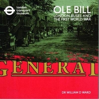
OLE Bill: London Buses And The First World War

In November every year, on Remembrance Sunday, representatives of the whole nation parade past the Cenotaph in Whitehall, London. The last section to pass is always a group of London Transport staff. For decades they marched in the company of a very special vehicle: a bright red open-topped double-decker London bus. This was B-type bus number B43. Written using detailed study of the first hand accounts preserved in official war diaries and reports, and other extensive research, this is the complete story of B43, Ole Bill, and other London buses that went to war in Northern France in 1914.
RIP - This product is no longer available on our network. It was last seen on 25.09.2019

This page now acts as a permanent archive for this product. Add more information using the comments box below to ensure it can still be found by future generations.

Use our search facility to see if it is available from an alternative contributor.
  • Availability: Out Of Stock
  • Supplier: Stanfords
  • SKU: 9781871829228
Availability: In Stock
£15.00

Product Description

In November every year, on Remembrance Sunday, representatives of the whole nation parade past the Cenotaph in Whitehall, London. The last section to pass is always a group of London Transport staff. For decades they marched in the company of a very special vehicle: a bright red open-topped double-decker London bus. This was B-type bus number B43. Written using detailed study of the first hand accounts preserved in official war diaries & reports, & other extensive research, this is the complete story of B43, Ole Bill, & other London buses that went to war in Northern France in 1914.

Reviews/Comments

Add New

Intelligent Comparison

Oooops!
We couldn't find anything!
Perhaps this product's unique.... Or perhaps we are still looking for comparisons!
Click to bump this page and we'll hurry up.

Price History

Vouchers

No voucher codes found.
Do you know a voucher code for this product or supplier? Add it to Insights for others to use.

Facebook

Jargon Buster

Hand - A part of the body at the end of the arm
Hand - A pointer which indicates time on a clock face
vehicle - A manufactured device used to transport people or cargo.
France - A state situated in Western Europe with several overseas territories.
Red - One of the three primary colours
World - A physical grouping, commonly used to describe earth and everything associated with ti
Year - The time it takes the planet earth to orbit the sun. This takes around 365.25 days.
Year - 365 days (366 days in a leap year), the time taken for planet earth to make one full revolution around the sun.
Transport - Something that carries people or goods.

Supplier Information

Stanfords
Stanfords was established in 1853 and opened their iconic Covent Garden flagship store in 1901. They have become the top retailer of maps, travel books and accessories in the UK and arguably offer the largest selection of maps and travel books worldwide. Famous names such as Captain Robert Falcon Scott, Ranulph Fiennes and Michael Palin have purchased from Stanfords. They now have a shop in Bristol and both stores together with other venues operate a calendar of events including talks, book signings and exhibitions. As a specialist map retailer, the map selection is comprehensive and includes road maps, street maps and walking maps from worldwide destinations, as well as a selection of world atlases and wall maps. Books include travel guides and travel literature. Stanfords also stock globes, from miniatures made of blue marble to magnificent floor-standing globes. The website features a selection of interesting articles on travel topics.
Page Updated: 2023-11-12 20:15:36

Community Generated Product Tags

Oh No! The productWIKI community hasn't generated any tags for this product yet!
Menu