
 United Kingdom
 France
 Germany
 Netherlands
 Sweden
 USA
USA
 Italy
Italy
 Spain
Spain
More From Contributor

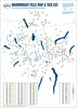
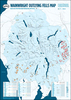


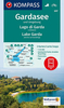

Lake Garda & Verona Flexi Map
Lake Garda & Verona Flexi map is laminated, durable and has its own index that has been categorised for ease of use.Inside Lake Garda & Verona Flexi Map:- A list of recommended sights, divided by theme and linked to the mapping by numbered markers.- A handy information section with concise details on getting around, tourist offices, money, tipping, opening times, public holidays, telephones, emergency telephone numbers and climate. - The main map shows all one-way streets, car parks, pedestrian zones and public transport routes.About Insight Guides: Insight Guides has over 40 years` experience of publishing high-quality, visual travel guides. We produce around 400 full-colour print guide books and maps as well as picture-packed eBooks to meet different travellers` needs.
Insight Guides` unique combination of beautiful travel photography and focus on history and culture together create a unique visual reference and planning tool to inspire your next adventure.
Insight Guides` unique combination of beautiful travel photography and focus on history and culture together create a unique visual reference and planning tool to inspire your next adventure.

Product Description
Reviews/Comments
Add New
Vouchers
No voucher codes found.
Do you know a voucher code for this product or supplier? Add it to Insights for others to use.
Do you know a voucher code for this product or supplier? Add it to Insights for others to use.
 Denmark