
 United Kingdom
 France
 Germany
 Netherlands
 Sweden
 USA
USA
 Italy
Italy
 Spain
Spain
More From Contributor
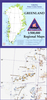


Qaqortoq - Julianehab
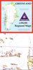
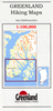
Topographic survey of Greenland at 1:250, 000 from Sagamaps in a series which along the western coast extends past Thule to the latitude of 78°, plus covers selected areas of the east coast including the Stauning Alps. Relief is shown by contours at 50m intervals, augmented by frequent spot heights. Main peaks are named, along with many other physical features, e.g. bays and islands. Glaciers, moraine and low-lying coastal plains are also indicated and contours continue for a limited extent into the icecap region.The maps show settlements, roads, airstrips and heliports, anchorages and selected other landmarks. Lines of longitude and latitude are drawn at 1° and 15` intervals respectively. Map legend which includes English is provided in a separate sheet.Saga’s topographic
mapping of Greenland at 1:250, 000 is available either as 22 smaller sheets, sold separately or in sets of four maps, plus as three larger maps covering the western coast up to approx 65°. Selected titles are also published with a historical guide on the reverse illustrated with old photos, drawings and maps; all the text is in English.To see the full list of titles in this series please click on the series link.
mapping of Greenland at 1:250, 000 is available either as 22 smaller sheets, sold separately or in sets of four maps, plus as three larger maps covering the western coast up to approx 65°. Selected titles are also published with a historical guide on the reverse illustrated with old photos, drawings and maps; all the text is in English.To see the full list of titles in this series please click on the series link.

Product Description
Reviews/Comments
Add New
Vouchers
No voucher codes found.
Do you know a voucher code for this product or supplier? Add it to Insights for others to use.
Do you know a voucher code for this product or supplier? Add it to Insights for others to use.
 Denmark