More From Contributor
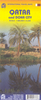
£12.95
Qaqortoq, map no. 3, in a series of waterproof & tear-resistant topographic maps of popular coastal areas of southern & central Greenl&. Countours are shown at 25-metre intervals, with additional altitude colouring. The maps show settlements, farms, shepherds' huts, water supply areas, roads & tracks, fords, rivers & streams, etc. Tourist information

Includes::
marked or partly marked hiking routes, recommended kayak routes, information centres, hotels, campsites, youth hostels, general stores, places of interest, etc. A grid gives UTM co-ordinates plus latitude in steps of 5' & longitude in 10'. Map legend

Includes::
English. On the reverse of selected titles there are notes, in English, with advice on hiking in Greenl&, as well as descriptions of the area, including plans of main settlements highlighting important buildings & institutions.


...
Archived Product
£16.95
Qaqortoq, map no. 3, in a series of topographic maps of popular coastal areas of southern & central Greenl&. Countours are shown at 25-metre intervals, with additional altitude colouring. The maps show settlements, farms, shepherds` huts, water supply areas, roads & tracks, fords, rivers & streams, etc. Tourist information

Includes::
marked or partly marked hiking routes, recommended kayak routes, information centres, hotels, campsites, youth hostels, general stores, places of interest, etc. A grid gives UTM co-ordinates plus latitude in steps of 5` & longitude in 10`. Map legend

Includes::
English. On the reverse of selected titles there are notes, in English, with advice on hiking in Greenl&, as well as descriptions of the area, including plans of main settlements highlighting important buildings & institutions.


...
Archived Product
£13.95
Topographic survey of Greenland at 1:250, 000 from Sagamaps in a series which along the western coast extends past Thule to the latitude of 78°, plus covers selected areas of the east coast including the Stauning Alps. Relief is shown by contours at 50m intervals, augmented by frequent spot heights. Main peaks are named, along with many other physical features, e.g. bays & islands. Glaciers, moraine & low-lying coastal plains are also indicated & contours continue for a limited extent into the icecap region. The maps show settlements, roads, airstrips & heliports, anchorages & selected other landmarks. Lines of longitude & latitude are drawn at 1° & 15` intervals respectively. Map legend which

Includes::
English is provided in a separate sheet. Saga’s topographic mapping of Greenland at 1:250, 000 is available either as 22 smaller sheets, sold separately or in sets of four maps, plus as three larger maps covering the western coast up to approx 65°. Selected titles are also published with a historical guide on the reverse illustrated with old photos, drawings & maps; all the text is in English. To see the full list of titles in this series please click on the series link.

...
Archived Product
£12.95
Qasigiannguit, map no. 17, in a series of waterproof & tear-resistant topographic maps of popular coastal areas of southern & central Greenl&. Countours are shown at 25-metre intervals, with additional altitude colouring. The maps show settlements, farms, shepherds' huts, water supply areas, roads & tracks, fords, rivers & streams, etc. Tourist information

Includes::
marked or partly marked hiking routes, recommended kayak routes, information centres, hotels, campsites, youth hostels, general stores, places of interest, etc. A grid gives UTM co-ordinates plus latitude in steps of 5' & longitude in 10'. Map legend

Includes::
English. On the reverse of selected titles there are notes, in English, with advice on hiking in Greenl&, as well as descriptions of the area, including plans of main settlements highlighting important buildings & institutions.


...
Archived Product
£16.95
Qasigiannguit, map no. 17, in a series of topographic maps of popular coastal areas of southern & central Greenl&. Countours are shown at 25-metre intervals, with additional altitude colouring. The maps show settlements, farms, shepherds` huts, water supply areas, roads & tracks, fords, rivers & streams, etc. Tourist information

Includes::
marked or partly marked hiking routes, recommended kayak routes, information centres, hotels, campsites, youth hostels, general stores, places of interest, etc. A grid gives UTM co-ordinates plus latitude in steps of 5` & longitude in 10`. Map legend

Includes::
English. On the reverse of selected titles there are notes, in English, with advice on hiking in Greenl&, as well as descriptions of the area, including plans of main settlements highlighting important buildings & institutions.


...
Archived Product
£9.99
Doha City on an indexed street plan at 1:12, 500 from ITMB, plus a map of Qatar with Bahrain at 1:300, 000 indicating both developments in progress & future plans including the train line & the causeway to Bahrain. All place names are shown in Latin alphabet only. The street plan extends from the current (2009) International Airport & the C Ring Road to the diplomatic district. The West Bay Lagoon & the Qatar Pearl development are shown as an inset at 1:27, 500. Neighbourhoods & most streets are named, with main traffic arteries across the city highlighted. Symbols mark various places of interest, services & facilities, including selected hotels, embassies, shopping centres, places of worship, etc. The plan covers one half of the map, with the rest taken up by its index & a map of Qatar at 1:300, 000, showing the country’s road network, including selected desert tracks, pipelines & internal administrative boundaries with names of the provinces. Symbols mark locations of petrol stations, the border crossing to Saudi Arabia & various places of interest. Also shown is the Al-Udeid Ab US Air Force Base. The map also indicates various developments, both under construction & in planning stages only: the new Doha International Airport, metro lines in Doha, railway lines to Mesaleed & Ras Laffan, as well as the train line & the road causeway to Bahrain. Topography is shown by altitude colouring with spot heights & graphics for salt flats. Latitude & longitude lines are shown at 30’ intervals. ...
Archived Product
£9.99
Double-sided, GPS-compatible map from the Dubai-based Explorer Publishing, presenting on one side a road map of Qatar at 1:300, 000 with on the reverse a street plan of Doha at 1:25, 000, with a combined index plus a distance table. All place names are in the Latin alphabet only. On one side is a road map of Qatar, showing the country’s road network including desert tracks with distances on main routes & locations of petrol stations. Various places of interest are highlighted & the map also shows internal administrative division. The map has a 10km UTM grid plus latitude & longitude margin ticks at 30’ intervals. On the reverse is a street plan of Doha at 1:25, 000 with a 2-km UTM grid & coverage including The Pearl Qatar (Al Gassar) area. The plan shows names of neighbourhoods, plus of main & selected connecting streets. Various facilities & places of interest are named and/or marked by symbols, including hotels & restaurants, banks, embassies & consulates, etc. The accompanying index covers both the road map & the street plan & lists villages, islands, roundabouts & interchanges, hotels & resorts, shopping malls & souks, etc. Also provided is a distance table, with an additional at-a-glance version of it incorporated into the map cover. Map legend & names of facilities are in English. ...
Archived Product
£14.95
Qatar, whose massive oil reserves go hand in hand with its massive ambitions to be an internationally recognised hub of modern civilisation, is in the news a lot of late, & will be increasingly so in future. News stories centre on such key events as the opening of the spectacular & world class Museum of Islamic Art, or the winning bid for the FIFA World Cup. As the country gears up to reach the ambitious targets it has set itself, the colossal infrastructure requirements will demand unprecedented foreign expertise. The question, What is Qatar? will be heard more & more often. This book answers that query in 190 pages of new photography & well informed text ...
Archived Product
£5.99
Qatar in the Pocket Guide series from Berlitz; a collection of handy, pocket-sized guides dedicated to an extensive range of cities, regions & countries worldwide. Written in narrative form, individual guides explore the history, main sights & attractions, food & drink, accommodation & local culture of the destination in detail. Each Berlitz pocket guide has a similar format, with colour-coded sections helping readers locate information quickly in addition to distinctive chapters exploring the city or region. An introduction outlines the destination for visitors & a section dedicated to 'A Brief History' actually explores the area in relative depth. A where to go chapter is organized by region & city & is written in prose form with references to individual sites highlighted in bold for clarity. There are also further suggestions on where & when to eat. Recommendations for leisure activities in the region, including sport, nightlife & shopping, are also provided & tailored accordingly for each destination. Handy travel tips are listed alphabetically in a dedicated section, providing practical guidance & helping visitors make the most of their stay. The main hotels, particularly for cities, are also listed in an accommodation section, offering a brief overview with approximate price bandings & relevant contact details. ...
Archived Product
£19.99
The Qatar Residents` Guide is the ultimate guide to life in Doha & beyond. Comprehensive, fun & easy to use, & updated by a resident team of writers, photographers & lovers of life, the resulting work holds the most in-depth, practical & accurate coverage of Doha, & further afield in Qatar. From baffling bureaucracy & practical issues such as housing & healthcare, to exploring, activities & socialising, it`s all covered here in meticulous detail. The content
Includes:: Qatar: A country profile; Qatar: Becoming a resident; Housing: Moving in, setting up & home improvements; Getting around: Driving, taxis & public transport; Work, finance & the law; Family & education; Health, fitness & well-being; Discover Doha: Attractions & activities; Out of the city: Beyond the capital & elsewhere in the GCC; Shopping; Going out: Entertainment, restaurants, bars, pubs & clubs.
...
Archived Product

Qatar A Companion

The only travel guide that exists for the oil-rich Persian Gulf state of Qatar, a major hub for business travelers and expatriates.David Chaddock explores the markets and general way of life, as well as advising newcomers on settling in and how to run a successful local business. An essential guide--no other exists.
RIP - This product is no longer available on our network. It was last seen on 25.09.2019

This page now acts as a permanent archive for this product. Add more information using the comments box below to ensure it can still be found by future generations.

Use our search facility to see if it is available from an alternative contributor.
  • Availability: Out Of Stock
  • Supplier: Stanfords
  • SKU: 9781908531063
Availability: In Stock
£14.95

Product Description

The only travel guide that exists for the oil-rich Persian Gulf state of Qatar, a major hub for business travelers & expatriates. David Chaddock explores the markets & general way of life, as well as advising newcomers on settling in & how to run a successful local business. An essential guide--no other exists.

Reviews/Comments

Add New

Intelligent Comparison

Oooops!
We couldn't find anything!
Perhaps this product's unique.... Or perhaps we are still looking for comparisons!
Click to bump this page and we'll hurry up.

Price History

Vouchers

No voucher codes found.
Do you know a voucher code for this product or supplier? Add it to Insights for others to use.

Facebook

Jargon Buster

Oil - A hydrophobic liquid with high carbon and hydrogen content. Has many variations including; cooking oils, petrochemical oils, essential oils.

Supplier Information

Stanfords
Stanfords was established in 1853 and opened their iconic Covent Garden flagship store in 1901. They have become the top retailer of maps, travel books and accessories in the UK and arguably offer the largest selection of maps and travel books worldwide. Famous names such as Captain Robert Falcon Scott, Ranulph Fiennes and Michael Palin have purchased from Stanfords. They now have a shop in Bristol and both stores together with other venues operate a calendar of events including talks, book signings and exhibitions. As a specialist map retailer, the map selection is comprehensive and includes road maps, street maps and walking maps from worldwide destinations, as well as a selection of world atlases and wall maps. Books include travel guides and travel literature. Stanfords also stock globes, from miniatures made of blue marble to magnificent floor-standing globes. The website features a selection of interesting articles on travel topics.
Page Updated: 2023-11-12 20:15:36

Community Generated Product Tags

Oh No! The productWIKI community hasn't generated any tags for this product yet!
Menu