More From Contributor

£9.95
Medium size, 127 x 81.5cm (4ft 2 x 2ft 8 approx.), political map of the world from Rand Mc Nally
- PAPER version
- with countries

...
Archived Product
£12.99
Map No. 1328, Randa, in the topographic survey of Switzerland at 1:25, 000 from Swisstopo. The map covers the central section of the Mattertal from just north of Zermatt to Herbriggen, & extends west to include Weisshorn & eastwards across the Mischabel range with Dom to outskirts of Saas Fee. Swiss topographic survey at 1:25, 000 covers the whole country on 247 small format sheets, with special larger maps published for popular regions including some titles now available in hiking versions. Highly regarded for their superb use of graphic relief & hill shading, the maps give an almost 3-D picture of Switzerland`s mountainous terrain. Contours are at 10 m intervals, with 20m intervals in the mountainous areas. All the maps have a 1-km grid for Swiss national coordinates (datum CH 1903). SMALL FORMAT SHEETS (Nos. 1011
- 1374)
- map legend in the language of the area covered by the map. Additional margin ticks show latitude & longitude in steps of 2`. The area covered by each map is 17 x 12 km (11 x 7 miles approx). SPECIAL LARGER SHEETS (Nos. from 2501 onwards) – STANDARD editions: no map legend is included but a separate leaflet can be provided instead. The area covered by each map is 25 x 17 km (15 x 11 miles approx).SPECIAL LARGER SHEETS (Nos. from 2501 onwards) – HIKING editions: an overprint highlights hiking, mountain & alpine paths, including regional & national long-distance trails. The maps also show bus routes with bus stops, plus inns in remote locations. The area covered by each map is 25 x 17 km (15 x 11 miles approx).

...
Archived Product
£29.99
Topographic survey of Denmark at 1:100, 000 from Kort & Matrikelstyrelsen, the country’s national survey organization. The maps have contours at 5 metre intervals, with colouring and/or graphics showing various types of terrain & land use: woodlands, orchards, heath, sand & dunes, tidal flats, meadows & marshl&, etc. The maps provide detailed presentation of the road & rail networks & other information expected of topographic mapping at this scale. No specifically tourist information such as waymarked cycling or hiking routes is shown. Standard size sheets cover an area of 56 x 45km / 35x 28 miles approx. Map legend

Includes::
English. To see other titles in this series please click on the series link.IMPORTANT – PLEASE NOTE BEFORE ORDERING:AVAILABILITY: all the maps are now printed on dem&. Delivery from Denmark can take over 4 weeks. Once an order has been placed we cannot accept any returns for credit.COORDINATES: although the maps are meant to have UTM coordinates for EUREF 89 (WGS 84) datum, sheets are sometimes delivered printed without any grid or margin ticks for UTM or latitude & longitude.

...
Archived Product
£9.99
Did you know that Napoleon was once attacked by rabbits? Or that the Mars Rover sang itself ” Happy Birthday”? How about the odd ingredient Civil War soldiers used to make coffee? From the illustrator behind The Kid`s Awesome Activity Calendar & Doodle Adventures comes a collection of obscure, fascinating facts, each captured in Lowery`s signature quirky style. With full-page illustrations as well as handwritten webs of interconnected facts, the book will be teeming with unusual & entertaining trivia. ...
Archived Product
£23.99
Randonnées dans les vignes de l’ Ile de France from Rando Editions offers 30 walks in the region, with three routes in the capital itself: in Montmartre, Père-Lachaise
- Belleville area, & from Jardins des Plantes to Bercy. Most are in the outer suburbs, easily accessible by metro or RER. All the routes, between one & five hours long, start & end at or near a metro, RER or SNC station. The routes are designed to include not only small local vineyards but also various historical monuments, interesting streets, etc. * Route instructions are in easily accessible French*, & are cross-referenced to street plans or detailed maps overprinted with the route. Longer descriptions provide historical background for places of interest. Each route is annotated with information about metro/rail &, where appropriate, road access. Also included are recommendations for local bistrots à vin, opening hours of museums, etc.
...
Archived Product
£29.99
A traditional base-plate compass, ideal for hiking, trekking & Duke of Edinburgh award expeditions. With a detachable safety-release lanyard & luminous markings for night navigation, the Silva Ranger compass is a convenient & handy piece for anyone relying an map navigation to get where they%27re going. The Silva Ranger features Dry Flex™ grip for easy handling & comes with a use-anywhere declination scale inside the capsule, a magnifying lens & base plate map (measuring in mm & scales of 1:50, 000 & 1:25, 000).- Dry Flex™ Rubber grip: Easy handling of the compass detachable safety-release lanyard- Declination scale inside the capsule: can be used anywhere- Map measuring scales (mm & inch): 1:50, 000 & 1:25, 000- Luminous marking enable night navigation- Weight: 33g ...
Archived Product
£9.99
If you`re like most kids who love the outdoors, you want to do more than go on picnics or hike a nature trail. You don`t want to go home at the end of the day. You want to stay out in the woods, mountains, or desert. You want to camp. With Ranger Rick Kids` Guide to Camping, you`ll learn how to make roughing it easy. You`ll find great tips for choosing the best campsite & setting up your home away from home. You`ll even find recipes for great fireside dishes. Also included is a real working compass to help you navigate through the wilderness. It might take you a while to read this book, because it is filled with ideas for things to do. You might stop reading right in the middle of a page to go out & try a new camping skill. & that`s great, because the better you get at those skills, the more fun you`ll have on your camping adventure. ...
Archived Product
£49.99
This compass features a distance lanyard; a lanyard with scales (1:25, & 1:50) which facilitates to measure the distance of your hike. Silva Ranger S features Dry Flex™ grip for easy handling & comes with a use-anywhere declination scale inside the capsule. A base plate map-measuring in mm & scales of 1:50, 000 & 1:25, 000. Ranger S has the additional benefit of 45-degree angle assistance on the mirror sighting function. A go-anywhere tool for serious compass users. The lanyard is soft & bendable & easy to place directly on to your route on the map. The new graphics contain a more distinct arrow (Ranger) & also a more contemporary font. The colors change to green & black to harmonize with the other outdoor assortment. If you are looking for a basic but yet functional compass for your outdoor adventure, Ranger should be your choice. Thanks to the magnifier you can make sure to see every detail on the map. ...
Archived Product
£6.99
John Flanagan makes a spectacular return to the world of Ranger`s Apprentice
- but what has happened since you last saw Will &
...
Archived Product
£55.00
Intricately crafted with timeless tradition, this carefully dyed sisal fiber & sweet grass vase makes a stunning statement ...
Archived Product

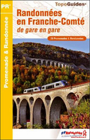
Randonnées En Franche-Comté De Gare En Gare FFRP Topo-guide No. RE18

Randonnées en Franche-Comté de gare en gare, FFRP topo-guide Ref. No. RE18, with 28 day walks of varying length and difficulty in the French Jura between Belfort and St-Claude. Each walk links two SNCF stations and is presented on a separate colour extract from IGN’s topographic survey of France at 1:25, 000, with its description cross-referenced to the map. Current edition of this title was published in October 2011.To see the list of other FFRP guides with day walks please click on the series link.ABOUT THE FFRP (Fédération française de la randonnée pédestre) TOPOGUIDES: published in a handy A5 paperback format, the guides are the best companions for hiking in France. In addition to their topo-guides to the long-distance GR routes FFRP also publish an extensive range of
guides with local day walks. Each walk in presented on a colour extract from IGN`s 1:50, 000 or 1:25, 000 topographic survey mapping overprinted with the route, with important points cross-referenced to the accompanying text, in French only, placed on the adjoining page. For each walk the guides also indicate the degree of difficulty and provide information on length, time and change in altitude, waymarking signs, access by road and parking facilities. An “info practiques” section of the guide indicates where shops, restaurants and accommodation can be found. The guides are published on high quality paper and include descriptions of the most interesting aspects of the surrounding region: historical and cultural sites, local specialties, fauna and flora, etc, all illustrated
with colour photos.
RIP - This product is no longer available on our network. It was last seen on 25.09.2019

This page now acts as a permanent archive for this product. Add more information using the comments box below to ensure it can still be found by future generations.

Use our search facility to see if it is available from an alternative contributor.
  • Availability: Out Of Stock
  • Supplier: Stanfords
  • SKU: 9782751405501
Availability: In Stock
£20.50

Product Description

Randonnées en Franche-Comté de gare en gare, FFRP topo-guide Ref. No. RE18, with 28 day walks of varying length & difficulty in the French Jura between Belfort & St-Claude. Each walk links two SNCF stations & is presented on a separate colour extract from IGN’s topographic survey of France at 1:25, 000, with its description cross-referenced to the map. Current edition of this title was published in October 2011. To see the list of other FFRP guides with day walks please click on the series link.ABOUT THE FFRP (Fédération française de la randonnée pédestre) TOPOGUIDES: published in a handy A5 paperback format, the guides are the best companions for hiking in France. In addition to their topo-guides to the long-distance GR routes FFRP also publish an extensive range of guides with local day walks. Each walk in presented on a colour extract from IGN`s 1:50, 000 or 1:25, 000 topographic survey mapping overprinted with the route, with important points cross-referenced to the accompanying text, in French only, placed on the adjoining page. For each walk the guides also indicate the degree of difficulty & provide information on length, time & change in altitude, waymarking signs, access by road & parking facilities. An “info practiques” section of the guide indicates where shops, restaurants & accommodation can be found. The guides are published on high quality paper & include descriptions of the most interesting aspects of the surrounding region: historical & cultural sites, local specialties, fauna & flora, etc, all illustrated with colour photos.

Reviews/Comments

Add New

Intelligent Comparison

Oooops!
We couldn't find anything!
Perhaps this product's unique.... Or perhaps we are still looking for comparisons!
Click to bump this page and we'll hurry up.

Price History

Vouchers

No voucher codes found.
Do you know a voucher code for this product or supplier? Add it to Insights for others to use.

Facebook

Jargon Buster

Paper - A thin sheet mainly used for writing. Available in a variety of colours. Made mainly from wood pulp.
Hiking - An outdoor activity envolving walking in nature
France - A state situated in Western Europe with several overseas territories.
Colour - The categorised spectrum of light visable to humans
Day - The time it takes a planet or other space objects to complete one rotation.
Quality - An object that has quality is superior in function and finish than a less quality object.
Road - a manmade lane or a path that is used to speed up travel.
Altitude - Something that can be quite high in relation to sea or ground level.
Accommodation - A room in which someone can live in, for example in a hotel
Degree - An angle measurement, also can be the measurement of an extent that something happens, can also relate to an university academic measurement.
degree - The extremity of something or the angle. Can also relate to a university achievement.

Supplier Information

Stanfords
Stanfords was established in 1853 and opened their iconic Covent Garden flagship store in 1901. They have become the top retailer of maps, travel books and accessories in the UK and arguably offer the largest selection of maps and travel books worldwide. Famous names such as Captain Robert Falcon Scott, Ranulph Fiennes and Michael Palin have purchased from Stanfords. They now have a shop in Bristol and both stores together with other venues operate a calendar of events including talks, book signings and exhibitions. As a specialist map retailer, the map selection is comprehensive and includes road maps, street maps and walking maps from worldwide destinations, as well as a selection of world atlases and wall maps. Books include travel guides and travel literature. Stanfords also stock globes, from miniatures made of blue marble to magnificent floor-standing globes. The website features a selection of interesting articles on travel topics.
Page Updated: 2023-11-12 20:15:36

Community Generated Product Tags

Oh No! The productWIKI community hasn't generated any tags for this product yet!
Menu