
 United Kingdom
 France
 Germany
 Netherlands
 Sweden
 USA
USA
 Italy
Italy
 Spain
Spain
More From Contributor


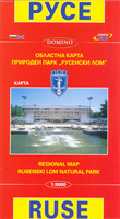
Ruse
Street plan of Ruse at 1:9, 000 from Domino, with an enlargement for the city centre plus on the reverse and extensive English language directory of various services including hotels, restaurants, entertainment, etc.On one side is a street plan of the city with insets extending coverage to the satellite districts, including the crossing point from Romania across the Danube. The plan shows trolleybus and bus routes with stops and line numbers, and is annotated with symbols highlighting locations various facilities. Streets show selected house numbers for easier identification of addresses. An enlargement shows the city centre in greater detail. Names of main streets and districts are also shown in Latin alphabet; street index is in Cyrillic alphabet only. Map legend includes English.
On the reverse is an extensive bilingual directory of various servicies and facilities in the town with notes abut its history and main sights. Also provided is a road map of the surrounding region (place names in Cyrillic), plus a small map of the nearby Rusenski Lom Natural Park.
On the reverse is an extensive bilingual directory of various servicies and facilities in the town with notes abut its history and main sights. Also provided is a road map of the surrounding region (place names in Cyrillic), plus a small map of the nearby Rusenski Lom Natural Park.

Product Description
Reviews/Comments
Add New
Vouchers
No voucher codes found.
Do you know a voucher code for this product or supplier? Add it to Insights for others to use.
Do you know a voucher code for this product or supplier? Add it to Insights for others to use.
 Denmark