
 United Kingdom
 France
 Germany
 Netherlands
 Sweden
 USA
USA
 Italy
Italy
 Spain
Spain
More From Contributor


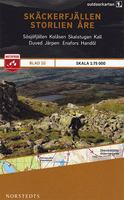
Skackerfjallen Storlien Are
This map of Skackerfjallen Storlien Are in 1:75, 000 is part of a series of topographic maps from Norstedts Kartforlaget which includes 28 outdoor maps covering the mountain areas and popular recreation areas in southern Sweden. The maps in this series have a new look and are printed on a durable and water resistant paper. Cartography, material and printing quality provides clear and easy to read maps ideal for hiking, canoeing and mountain tours. Each map presents an accurate topography which describes local footpaths, cycle or ski routes, sport and recreational facilities, places of interest, places to stay and eat, viewpoints.The maps have contours at 5 metre intervals, plus relief shading and graphics for rocky outcrops and boulders. Further graphics and/or colouring show
different types of land use or vegetation (forests, arable land, orchards, marshes, peat bogs, etc). The maps have a 2-km UTM grid, plus latitude and longitude lines 10’ intervals. Map legend includes English.The mountain region is covered– from Riksgränsen in the north to Sälen in the south – in the unique scale of 1:75 000 and adapted to hiking trails. The Kungsleden trail is specially marked with information about distance and approximate hiking time for different stages. The maps for southern Sweden cover popular recreation areas on the east- and west coast in the scale – 1:50 000.To see the list of the other titles in this series, please click on the series link.
different types of land use or vegetation (forests, arable land, orchards, marshes, peat bogs, etc). The maps have a 2-km UTM grid, plus latitude and longitude lines 10’ intervals. Map legend includes English.The mountain region is covered– from Riksgränsen in the north to Sälen in the south – in the unique scale of 1:75 000 and adapted to hiking trails. The Kungsleden trail is specially marked with information about distance and approximate hiking time for different stages. The maps for southern Sweden cover popular recreation areas on the east- and west coast in the scale – 1:50 000.To see the list of the other titles in this series, please click on the series link.

Product Description
Reviews/Comments
Add New
Vouchers
No voucher codes found.
Do you know a voucher code for this product or supplier? Add it to Insights for others to use.
Do you know a voucher code for this product or supplier? Add it to Insights for others to use.
 Denmark