More From Contributor

£16.95
One of the maps in the topographic survey of Iceland at 1:100, 000. The series was last revised in the early eighties. Contour interval is 20 meters. In addition to the usual features shown on survey mapping, the maps also include a large amount of information indicating the type of the terrain & land use (block or smooth surfaced lava, clay, boulders, sand & dunes, cultivated area, meadows, pastures, bogs, wetlands, etc.) & details not often found on maps: physicians' residences, parsonages, etc. Each map covers an area of 44 x 40 km / 27 x 25 miles. Margin ticks give latitude & longitude in steps of 6'. Map legend

Includes::
English.

...
Archived Product
£23.99
Map No. 10096, Skäckerfjällen, in the new topographic survey of Norway at 1:50, 000 covering the country on 195 double-sided sheets & first published by Nordeca in 2011
- 2012; fully GPS compatible, indicating waymarked footpaths, campsites, tourist huts, illuminated ski runs, etc. The maps, now published by Nordeca, the successors to Statens Kartverk & its subsequent owners the Ugland Group, are printed on light, waterproof & tear-resistant synthetic paper. Each map covers an area of 62x 45 kilometres (39 x 28 miles approx.), with a 2-km overlap between the sheets. The maps have contours at 20m intervals (10m glacier contours), plus colouring & graphics to show cultivated areas, bogs, forests, etc. In addition to all the information expected of topographic mapping at this scale the maps distinguish between waymarked & unmarked footpaths & show campsites, tourist huts (serviced/self service/no supplies), country hotels & restaurants, & illuminated ski trails. The series uses EUREF89 (WGS84) datum & the maps have a 1-km UTM grid. Map legend is in Norwegian & English. Each title comes in a sturdy protective card envelope.
...
Archived Product
£13.99
This map of Skackerfjallen Storlien Are in 1:75, 000 is part of a series of topographic maps from Norstedts Kartforlaget which


...
Archived Product
£12.95
Skadar Lake National Park & its environs on a detailed topographic map at 1:55, 000 from Huber Verlag with English language descriptions of hiking & biking trails accompanied by route profiles, & other information about the area. The map covers the National Park with the area between the lake & the Adriatic. Contours at 10m intervals are enhanced by relief shading, graphics to show swamps & colouring indicating woodlands & vineyards. An overprint highlights waymarked hiking & cycling routes & symbols indicate locations with tourist accommodation, cafes & restaurants, bird-watching towers, beaches, etc. Road network shows petrol stations & railway lines are presented with stations. The map has both 1-km UTM grid & latitude/longitude lines at intervals of 5 ...
Archived Product
£11.99
Skadar Lake National Park in Montenegro including the adjoining area with the Adriatic coast, plus the Albanian side of the lake, on a detailed, contoured & GPS compatible map at 1:55, 000 from Huber Verlag. Contours at 10m intervals are enhanced by relief shading, graphics to show swamps & colouring indicating woodlands & vineyards. An overprint highlights waymarked hiking & cycling routes & symbols indicate locations with tourist accommodation, cafes & restaurants, bird-watching towers, beaches, etc. The map also prominently highlights various sites for bird watching & exploration of local flora & geology. Road network shows petrol stations & railway lines are presented with stations. The map has both 1-km UTM grid & latitude/longitude lines at intervals of 5’, & is indexed. Map legend

Includes::
English. On the reverse are notes about the area, a list of nine GPS waypoints for particularly interesting sites, plus photos & descriptions of over 50 examples of local flora & fauna. All the text is in German only, but names of plants & animals are also in Latin & English.

...
Archived Product
£16.95
Skaftafell National Park at 1:100, 000, with on the reverse an enlargement of the Skaftafell area at 1:25, 000, in a series of special detailed hiking & touring maps, based on the Icelandic topographic survey, covering the most visited parts of the country. Contours at 20m intervals, with bright colouring and/or graphics show different types of vegetation & terrain, e.g. cultivated areas, bogs, meadows, heath, lichen & moss, lava, glaciers, etc. Footpaths & bridleways are marked Road network shows locations of river fords. Map ticks give latitude & longitude in steps of 4 ...
Archived Product
£20.99
Skaftafell National Park at 1:100, 000, with on the reverse an enlargement of the Skaftafell area at 1:25, 000, in a series of special detailed hiking & touring maps, based on the Icelandic topographic survey, covering the most visited parts of the country. Contours at 20m intervals, with bright colouring and/or graphics show different types of vegetation & terrain, e.g. cultivated areas, bogs, meadows, heath, lichen & moss, lava, glaciers, etc. Footpaths & bridleways are marked Road network shows locations of river fords. Map ticks give latitude & longitude in steps of 4’. On the reverse, the Skaftafell area is shown in much greater detail at 1:25, 000, indicating the local campsite & guesthouse, & information centre. Latitude & longitude lines are drawn at 1’ & 2’ respectively. Map legend & additional text on the area & its hiking trails include English. Map legend

Includes::
English. To see the list of titles in this series please click on the series link.

...
Archived Product
£29.99
Topographic survey of Denmark at 1:100, 000 from Kort & Matrikelstyrelsen, the country’s national survey organization. The maps have contours at 5 metre intervals, with colouring and/or graphics showing various types of terrain & land use: woodlands, orchards, heath, sand & dunes, tidal flats, meadows & marshl&, etc. The maps provide detailed presentation of the road & rail networks & other information expected of topographic mapping at this scale. No specifically tourist information such as waymarked cycling or hiking routes is shown. Standard size sheets cover an area of 56 x 45km / 35x 28 miles approx. Map legend

Includes::
English. To see other titles in this series please click on the series link.IMPORTANT – PLEASE NOTE BEFORE ORDERING:AVAILABILITY: all the maps are now printed on dem&. Delivery from Denmark can take over 4 weeks. Once an order has been placed we cannot accept any returns for credit.COORDINATES: although the maps are meant to have UTM coordinates for EUREF 89 (WGS 84) datum, sheets are sometimes delivered printed without any grid or margin ticks for UTM or latitude & longitude.

...
Archived Product
£14.99
Skagi, map no. 9, in the topographic survey of Iceland at 1:100, 000 published by Mál og menning, with excellent, vivid presentation of the terrain, footpaths & bridleways, campsites, etc. The maps have contours at 20m intervals, enhanced by bold relief shading plus colouring and/or graphics to show glaciers, lava fields, sands & mudflats, as well as to distinguish land with vegetation cover from the more sparsely covered terrain. The series provides a splendid presentation of the country’s topography, with large amount of detail & over 43, 000 place names. Road network indicates gravel roads &

Includes::
country tracks. Also marked are local footpaths, clear to see with their distinctive colouring, & bridleways. Symbols shows campsites, tourist huts or shelters, emergency shelters, summer houses, river fords, golf courses & swimming pools, hydro-electric or thermal power stations, local airports, etc, & detail such as individual farms, abandoned farms or ruins, sheepfolds, etc. Each map covers an area of 84 x 67km (53 x 42 miles approx.) & has latitude & longitude lines drawn at intervals of 2’ & 5’ respectively. Map legend

Includes::
English, German & French. To see the other titles in this series please click on the series link.


...
Archived Product
£19.99
The southern part of Sweden in a series of 30 double-sided cycling maps from Norstedts printed on light, waterproof & tear-resistant synthetic paper. Mainland is covered at 1:90, 000 with Gotland at 1:100, 000. The maps, prepared in association with Cykelfrämjandet
- Sweden’s largest national cycling organization, highlight all the national & other major cycle routes, plus a selection of local routes. The overprint indicates sections which are on gravel roads and/or not singposted. Also marked are selected hiking trails. A range of symbols indicate various facilities & places of interest, including campsites & youth hostels, wind shelters, cultural & historical sites, interesting nature & geological spots, etc. The maps provide a very detailed picture of the road network, including privately maintained roads open to the general public. Railway lines are shown with stations & ferry connections are marked. Topography is indicated by light relief shading with spot heights, plus colouring and/or graphics for forests & marshl&. The maps have a UTM grid, plus latitude & longitude lines at intervals of 10’. Map legend

Includes::
English. Each map also provides phone numbers & web addresses of local tourist offices.


...
Archived Product

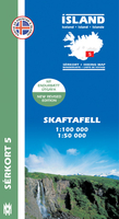
Skaftafell

Skaftafell area of Iceland at 1:100, 000 in a series of detailed hiking and recreational topographic maps from Mál og menning - the country`s leading cartographic publishers, with beautiful drawings of local birds and tourist information. An enlargement shows the Skaftafell and the surrounding glaciers in greater detail at 1:50, 000.The maps in this series present very detailed picture of country’s topography, with contours at 20m intervals supplemented by spot heights and relief shading. Colouring and/or graphics indicate different types of terrain and vegetation: lava, sand and mudflats, glaciers, etc. Road network includes gravel roads and tracks, indicating fords across rivers and streams. Footpaths and bridleways are marked and symbols indicate locations of campsites,
tourist huts and shelters, emergency shelters, golf courses and swimming pools, hydro-electric or geothermal power stations, etc. Each title carries on the reverse an enlargement of the most interesting area, descriptions of main sights, plus beautiful detailed drawings of over 35 local birds (Latin and English names are included). Map legend and the descriptions include English.To see the list of titles in this series please click on the series link.
RIP - This product is no longer available on our network. It was last seen on 25.09.2019

This page now acts as a permanent archive for this product. Add more information using the comments box below to ensure it can still be found by future generations.

Use our search facility to see if it is available from an alternative contributor.
  • Availability: Out Of Stock
  • Supplier: Stanfords
  • SKU: 9789979330363
Availability: In Stock
£15.99

Product Description

Skaftafell area of Iceland at 1:100, 000 in a series of detailed hiking & recreational topographic maps from Mál og menning
- the country`s leading cartographic publishers, with beautiful drawings of local birds & tourist information. An enlargement shows the Skaftafell & the surrounding glaciers in greater detail at 1:50, 000. The maps in this series present very detailed picture of country’s topography, with contours at 20m intervals supplemented by spot heights & relief shading. Colouring and/or graphics indicate different types of terrain & vegetation: lava, sand & mudflats, glaciers, etc. Road network

Includes::
gravel roads & tracks, indicating fords across rivers & streams. Footpaths & bridleways are marked & symbols indicate locations of campsites, tourist huts & shelters, emergency shelters, golf courses & swimming pools, hydro-electric or geothermal power stations, etc. Each title carries on the reverse an enlargement of the most interesting area, descriptions of main sights, plus beautiful detailed drawings of over 35 local birds (Latin & English names are included). Map legend & the descriptions include English. To see the list of titles in this series please click on the series link.

Reviews/Comments

Add New

Intelligent Comparison

Oooops!
We couldn't find anything!
Perhaps this product's unique.... Or perhaps we are still looking for comparisons!
Click to bump this page and we'll hurry up.

Price History

Vouchers

No voucher codes found.
Do you know a voucher code for this product or supplier? Add it to Insights for others to use.

Facebook

Jargon Buster

Electric - A general term for the flow of electric charge
Hiking - An outdoor activity envolving walking in nature
Graphics - A general term for visual aspects of an item/display
Gravel - A size of rock between 2mm and 64mm
Network - A link and communication between things. Often computers or people.
Road - a manmade lane or a path that is used to speed up travel.
Golf - A sport played on a large outside grass course, the aim to hit a small ball with a club into small holes.

Supplier Information

Stanfords
Stanfords was established in 1853 and opened their iconic Covent Garden flagship store in 1901. They have become the top retailer of maps, travel books and accessories in the UK and arguably offer the largest selection of maps and travel books worldwide. Famous names such as Captain Robert Falcon Scott, Ranulph Fiennes and Michael Palin have purchased from Stanfords. They now have a shop in Bristol and both stores together with other venues operate a calendar of events including talks, book signings and exhibitions. As a specialist map retailer, the map selection is comprehensive and includes road maps, street maps and walking maps from worldwide destinations, as well as a selection of world atlases and wall maps. Books include travel guides and travel literature. Stanfords also stock globes, from miniatures made of blue marble to magnificent floor-standing globes. The website features a selection of interesting articles on travel topics.
Page Updated: 2023-11-12 20:15:36

Community Generated Product Tags

Oh No! The productWIKI community hasn't generated any tags for this product yet!
Menu