More From Contributor
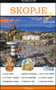
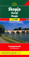
£14.99
Skomer Island is a National Nature Reserve, a Site of Special Scientific Interest, a world-renowned bird paradise & home to the world`s largest colony of Manx Shearwaters. It is also home to author, painter & photographer Jane Matthews. In this new revised edition of the superb natural history book, Jane provides a close up of the isl&. Its six chapters illustrate the landscape, seasons, populations & the research that takes place throughout the year. A collection of over 100 full colour photographs, with contributions from Iolo Williams & Matthew Parris, this unique book encapsulates the beauty & magic of Skomer, an ideal gift for wildlife enthusiasts worldwide. ...
Archived Product
£7.50
Road Edition maps are produced in co-operation with the Hellenic Army Geographical Service, the national survey organisation. The maps have contours with colour altitude tints. All the place names are shown in both Greek & Roman script. Road classification distinguishes between unsurfaced roads of good & poor quality. Tourist information

Includes::
scenic routes, petrol stations, archaeological sites, campsites, beaches, etc. Brief descriptions, in Greek & English, illustrate some of the interesting aspects of each isl&. Map legend

Includes::
English. On the reverse, there are lists of various types of accommodation from hotels to private rooms. Please note: deliveries from Road Editions are not very reliable. For titles currently not in stock it may be advisable to choose a map from another publisher.


...
Archived Product
£8.99
Skopelos on a contoured & GPS compatible map at 1:30, 000 from Greek publishers Orama Editions, with a street plan of Skopelos Town & multilingual notes about the isl&. Place names are in both Greek & Latin alphabets. Topography is presented by contours at 20m intervals (although in places only the 100m contour lines are clearly visible), with additional shading & spot heights. Road network

Includes::
dirt roads, showing distances on main routes & locations of service stations. Symbols indicate various places of interest & facilities; best sights are prominently highlighted. The map has a 1km UTM grid plus latitude & longitude margin ticks at 1’ intervals. Also provided is a basic street plan of Skopelos Town with names of main street only but with locations of various facilities including selected hotels, etc. Map legend that the text about the island include English.

...
Archived Product
£9.99
Skopelos at 1:25, 000 on a contoured, GPS compatible map published by Terrain Editions, printed on light, waterproof & tear-resistant synthetic paper. Beaches indicate their surface & facilities. All place names are shown in both Greek & Latin alphabet. On the reverse are brief descriptions of seven hiking trails, plus general information about the isl&, illustrated with colour photos. Map legend & all the text include English. Maps of the Greek islands from Terrain Editions have topography well presented by contours at 20m intervals, enhanced by spot heights, subtle relief shading & additional altitude colouring. Road network is very clearly graded according to width & the type of surface, distinguishing between good & rough dirt roads. Distances are marked on most small local roads, as well as locations of petrol stations and/or tyre repair workshops; scenic routes are highlighted. Each map also shows which ports are served by ferry services. Hiking paths are graded as main or narrow trails. National parks & other protected areas are marked & a wide range of symbols indicate various places of interest & recreational facilities, with main sights clearly highlighted. Most titles distinguish between sandy & pebble beaches; some also indicate beaches with natural shade and/or the type of sea bed. The maps have a UTM grid, plus latitude & longitude margin ticks. The reverse side of each title is covered by general information about the isl&, illustrated with colour photos. Many titles also include brief descriptions of recommended hiking trails and/or a street plan of the island’s main town, with colouring clearly showing various tourist facilities. ...
Archived Product
£8.50
Street plan of Skopje at 1:18, 000 from the locally based Trimaks, presenting the Macedonian capital with its outer suburbs. On the reverse a large panels shows the city & suburban bus routes, & an enlargement presents the environs of Skopje. Coverage extends west to the exit onto the M1 motorway, north to Radišani & south-east to Dracevo (both shown on insets). The plan indicates main traffic arteries & shows one way streets, car parks & locations of petrol stations. A wide range of symbols indicate various facilities & places of interest, including hotels, banks, shopping malls, embassies, etc. The index is on the reverse. Map legend

Includes::
English. On the reverse a large panels presents Skopje with its main streets overprinted with bus lines indicating route number. Another panel shows a road map of the city’s environs at 1:300, 000.

...
Archived Product
£8.50
Skopje’s city centre on both sides of the Vardar River on a lovely street plan from the local publishers Trimaks, with buildings drawn in 3-D vividly presenting the capital’s mixture of old buildings, the communist era architecture, & more recent additions. 68 locations, including museums & cultural institutions, selected embassies & other public buildings, historic sites, etc, are cross-referenced to a thematic index. Symbols indicate locations of restaurants, cafes or bars, & car parks. Street names are in the Latin alphabet. On the reverse numerous sites & institutions have descriptions accompanied by colour photos. Map legend & the text include English. ...
Archived Product
£9.99
Skopje with its outer suburbs in a street atlas at 1:22, 222 approx. from the locally based Trimaks, highlighting locations of various facilities & places of interest, , including hotels, banks, shopping malls, embassies, etc. Streets are shown with their names plus numbers and/or just numbers, & in some districts on housing estates individual buildings have numbers. In the outlaying suburbs only main streets are named. The plan indicates main traffic arteries & shows one way streets, car parks & locations of petrol stations. A wide range of symbols indicate various facilities & places of interest. All place names are in the Latin alphabet. Each page has its individual index, & there is a combined double index at the back of the atlas: alphabetically (but according to the Cyrillic alphabet, a, b, v, g, etc) & by street number. Also provided are lists of useful addresses and/or phone numbers, including selected embassies, hotels, banks, etc., plus a road map of Macedonia for route planning. Map legend

Includes::
English.

...
Archived Product
£14.99
The city of Skopje, from the ancient past to the present, with over 700 photographs, illustrations & maps offering information on the places to visit, where to stay, where to eat. The guide contains a city map showing all the streets & important buildings, as well as an index for easier navigation across the maps. The guide contains all points of interest about Skopje & its beauties, churches & monasteries, mosques, monuments, museums, restaurants & cafes, cinemas, the Fortress Kale, the Millennium Cross & many other famous natural beauties that adorn Skopje. All this is enriched with beautiful photographs & detailed descriptions in Macedonian & English, & maps of the city. ...
Archived Product
£19.95
Topographic survey of Faroe Islands at 1:20, 000 prepared by the Danish national mapping agency Kort og Matrikelstyrelsen. The islands’ topography is vividly presented by contours at 5 metre intervals, enhanced by relief shading plus colouring and/or graphics for different types of terrain or vegetation (scree, boulders, etc). The maps show all the detail expected of the topographic mapping at this scale & have a 1-km UTM grid, plus margin ticks for latitude & longitude at 1’ & 2` respectively. Map legend is in Danish only. The maps are available either separately or as sets of five of more sheets, each covering the main island group: Vagar, Sandoy, Suduroy, Nordoyar, Streymoy & Eysturoy. To see the list of all the titles in this series please click on the series link. ...
Archived Product
£16.99
Sverigeserien is an outdoor map series consisting of 116 sheets with coverage of southern & central Sweden & the northern coastline. The map is suitable for outdoor activities such as hiking, excursions, trail running, hunting, fishing, riding, cycling, mountain biking, paddling, skating & much more. Every sheet covers an area of 45x 68km. These topographical maps in scale 1:50 000 contain all the information needed for outdoor activities: Terrain information, hiking trails, illuminated tracks, camping, shelters, golf courses, leisure baths, historical remains, roads in different categories, railway lines & much more. Easy to read topography with contour lines, vertical interval 5 m. Sverigeserien is a high-quality map series & is durable for frequent use! Updated content with map data from Lantmäteriet (National Land Survey of Sweden) & printed on Polyart which is water & tear resistant. This means that the map can be folded repeatedly without breaking & can withstand the challenging weather in Sweden during both winter & summer. Legend is in Swedish, English & German. ...
Archived Product

Skopje F&B

Skopje at 1:15, 000 from Freytag & Berndt in a large indexed street plan covering the city with its outer districts. Principal traffic arteries are highlighted and the city’s main places of interest or local facilities are marked and named. Street index is on the reverse. Multilingual map legend includes English.
RIP - This product is no longer available on our network. It was last seen on 25.09.2019

This page now acts as a permanent archive for this product. Add more information using the comments box below to ensure it can still be found by future generations.

Use our search facility to see if it is available from an alternative contributor.
  • Availability: Out Of Stock
  • Supplier: Stanfords
  • SKU: 9783707907933
Availability: In Stock
£9.99

Product Description

Skopje at 1:15, 000 from Freytag & Berndt in a large indexed street plan covering the city with its outer districts. Principal traffic arteries are highlighted & the city’s main places of interest or local facilities are marked & named. Street index is on the reverse. Multilingual map legend

Includes::
English.

Reviews/Comments

Add New

Intelligent Comparison

Oooops!
We couldn't find anything!
Perhaps this product's unique.... Or perhaps we are still looking for comparisons!
Click to bump this page and we'll hurry up.

Price History

Vouchers

No voucher codes found.
Do you know a voucher code for this product or supplier? Add it to Insights for others to use.

Facebook

Jargon Buster

Large - something that takes up more space than normal.

Supplier Information

Stanfords
Stanfords was established in 1853 and opened their iconic Covent Garden flagship store in 1901. They have become the top retailer of maps, travel books and accessories in the UK and arguably offer the largest selection of maps and travel books worldwide. Famous names such as Captain Robert Falcon Scott, Ranulph Fiennes and Michael Palin have purchased from Stanfords. They now have a shop in Bristol and both stores together with other venues operate a calendar of events including talks, book signings and exhibitions. As a specialist map retailer, the map selection is comprehensive and includes road maps, street maps and walking maps from worldwide destinations, as well as a selection of world atlases and wall maps. Books include travel guides and travel literature. Stanfords also stock globes, from miniatures made of blue marble to magnificent floor-standing globes. The website features a selection of interesting articles on travel topics.
Page Updated: 2023-11-12 20:15:36

Community Generated Product Tags

Oh No! The productWIKI community hasn't generated any tags for this product yet!
Menu