
 United Kingdom
 France
 Germany
 Netherlands
 Sweden
 USA
USA
 Italy
Italy
 Spain
Spain
More From Contributor

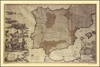

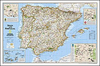
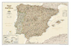
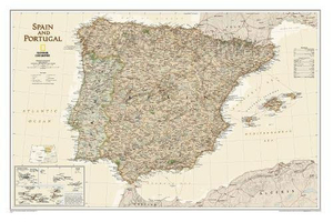
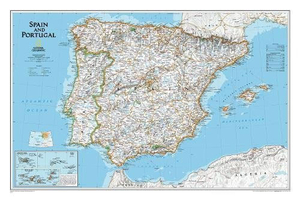
Spain And Portugal NGS Executive Wall Map ENCAPSULATED
Spain and Portugal Executive Style Wall Map, size 84 x 56cm (33” x 22” approx) - encapsulated version, from the National Geographic Society, showing the Iberian Peninsula at 1:1, 803, 000 with current information presented in elegant antique style of muted shades of brown and beige.Within Spain the map shows internal administrative boundaries with names of the regions. Road and rail networks are presented on a base with relief shading to show the topography, with plenty of names of mountain ranges, etc. In Spain national parks are highlighted. Latitude and longitude lines are drawn at intervals of 1°. Insets show Madeira, the Azores and Canary Islands.* This map is also available on paper without the encapsulation.*LAMINATED and ENCAPSULATED WALL MAPS:*- *laminated* wall maps
have a thin layer of plastic usually applied to the printed side only. They can be written on with suitable marker pens without any damage to the map but, unless laminated on both sides, they are not damp-proof.- *encapsulated* wall maps are sealed between two sheets of plastic. They are more rigid and heavier than laminated maps of the same size. They are damp-proof and do not crinkle in humid conditions. Encapsulation gives the map a shiny surface, similar to being displayed behind glass.- *please note:* many publishers and retailers often use these two terms interchangeably. Our map titles and descriptions follow the definitions provided above.
have a thin layer of plastic usually applied to the printed side only. They can be written on with suitable marker pens without any damage to the map but, unless laminated on both sides, they are not damp-proof.- *encapsulated* wall maps are sealed between two sheets of plastic. They are more rigid and heavier than laminated maps of the same size. They are damp-proof and do not crinkle in humid conditions. Encapsulation gives the map a shiny surface, similar to being displayed behind glass.- *please note:* many publishers and retailers often use these two terms interchangeably. Our map titles and descriptions follow the definitions provided above.
Product Description
Reviews/Comments
Add New
Intelligent Comparison
Archived Product
Spain And Portugal NGS Executive Wall Map PAPER Stanfords
£12.99
Archived Product
Spain And Portugal NGS Classic Wall Map ENCAPSULATED Stanfords
£17.99
Archived Product
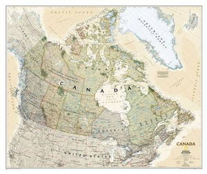
Canada NGS Executive Wall Map ENCAPSULATED Stanfords
£20.99
Archived Product
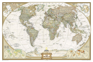
World NGS Executive Wall Map ENCAPSULATED Stanfords
£20.99
Archived Product
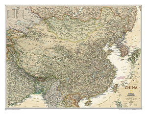
China NGS Executive Wall Map ENCAPSULATED Stanfords
£17.99
Archived Product

United States NGS Executive Wall Map ENCAPSULATED Stanfords
£20.99
Archived Product

Mexico NGS Executive Wall Map ENCAPSULATED Stanfords
£17.99
Archived Product
North America NGS Executive Wall Map ENCAPSULATED Stanfords
£16.99
Vouchers
No voucher codes found.
Do you know a voucher code for this product or supplier? Add it to Insights for others to use.
Do you know a voucher code for this product or supplier? Add it to Insights for others to use.
 Denmark