
 United Kingdom
 France
 Germany
 Netherlands
 Sweden
 USA
USA
 Italy
Italy
 Spain
Spain
More From Contributor


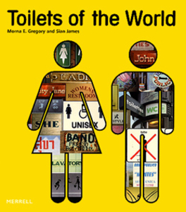
Toilets Of The World
Toilets of the World is a celebratory tour of the world of toilets and their various appearances in surprising places around the globe. Powder room, comfort station, privy, loo, dunny the infinite variety of names we invent for this universal necessity, the toilet, is matched by an extraordinary variety of designs worldwide, from miniature log cabins in the Canadian wilderness to state-of-the-art cubicles in Japan, and from huts on stilts in the Caribbean to solar-powered sanitary ware in New Zealand. This light-hearted but highly informative photographic journey reveals the idiosyncrasy and inventiveness that characterize the construction of the humble toilet around the globe. Along the way, you will encounter every possible permutation, from the traditional English `thunderbox`
to the Swazi thatched `beehive` hut, and discovers the minute but fascinating cultural and historical differences that can make our travels to other countries so enjoyable.
to the Swazi thatched `beehive` hut, and discovers the minute but fascinating cultural and historical differences that can make our travels to other countries so enjoyable.

Product Description
Reviews/Comments
Add New
Intelligent Comparison
Archived Product

Turtles Of The World Stanfords
£35.00
Archived Product
Top Treks Of The World Stanfords
£12.99
Archived Product
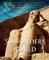
Wonders Of The World Stanfords
£25.00
Archived Product
Wonders Of The World Stanfords
£25.95
Archived Product
Wonders Of The World Stanfords
£8.99
Archived Product

Flags Of The World Stanfords
£16.99
Archived Product
Rainforests Of The World Stanfords
£30.00
Archived Product
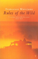
Rules Of The Wild Stanfords
£8.99
Vouchers
No voucher codes found.
Do you know a voucher code for this product or supplier? Add it to Insights for others to use.
Do you know a voucher code for this product or supplier? Add it to Insights for others to use.
 Denmark