-
Home
-
Contributors
-
International
-
Account
-
Information
More From Contributor
Includes:: local tracks. Railways are shown with stations & the maps include other details expected of topographic mapping at this scale. Where appropriate, place names are given in both Irish & English. Each map covers an area of 40 x 30km (25 x 19 miles approximately) & has a 1km ITM (Irish Transverse Mercator) grid, plus latitude & longitude margin ticks at 1` intervals. Map legend is in Irish & English. To see the list of all the titles in this series please click on the series link. ...
Includes:: additional notes on the area, its heritage & fauna & flora. ...

Wicklow Mountains West
sites, etc. The map has a 1km UTM grid and provides a list of useful websites for additional information.
This page now acts as a permanent archive for this product. Add more information using the comments box below to ensure it can still be found by future generations.
Use our search facility to see if it is available from an alternative contributor.
- External links may include paid for promotion
- Availability: Out Of Stock
- Supplier: Stanfords
- SKU: 9781899815265
Product Description
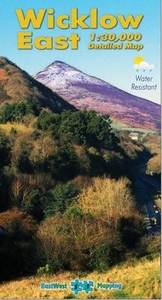
Wicklow Mountains West at 1:30, 000 on a detailed GPS compatible map from East West Mapping, printed on light, waterproof & tear-resistant paper. Contours at 20m intervals are enhanced by altitude colouring & graphics showing scree, peat bogs, marshl&, gorse, different types of woodlands, cultivated areas, etc. The map shows the boundary of the Wicklow Mountains National Park & highlights the Wicklow Way, St. Kevin's Way & other agreed access routes. Hillwalking access points are marked & a note provides information on the rules of public access to the l&. A wide range of symbols indicate various places of interest including hotels & campsites, pubs, shops, restaurants, rock climbing & bird watching sites, recreational facilities, historical & geological sites, etc. The map has a 1km UTM grid & provides a list of useful websites for additional information.
Reviews/Comments
Add New
Price History
Vouchers
Do you know a voucher code for this product or supplier? Add it to Insights for others to use.


 United Kingdom
 France
 Germany
 Netherlands
 Sweden
 USA
USA
 Italy
Italy
 Spain
Spain


 Denmark