
 United Kingdom
 France
 Germany
 Netherlands
 Sweden
 USA
USA
 Italy
Italy
 Spain
Spain
More From Contributor


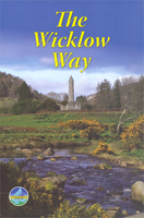
Wicklow Way
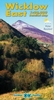
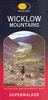
Wicklow Way, a 132-km (82 mile) trail from Marley Park on the outskirts of Dublin to Clonegal, in an A5, spiral bound, waterproof guide from Rucksack Readers with contoured mapping at 1:100, 000, detailed route descriptions and general information.The 64-page guide provides general advice on planning accommodation, Glendalough’s Monastic City, history, geology and scenery, habitats and wildlife, as well as other paths across the Wicklow Mountains. Detailed route descriptions, arranged in daily stages, are preceded by a summary of each section of the route giving distance, terrain, grade and side-trips.The route is presented on five maps placed on a fold-out flap of the back cover of the guide. The maps provide somewhat generalized presentation of the topography, with
altitude colouring and peaks in the surrounding countryside. The maps highlight campsites, youth hostels and bunkhouses, historic and nature sites, car parks, etc. Also marked is the course of St Kevin’s way leading westwards from the Monastic City. No geographical coordinates for GPS users are provided. The publishers themselves recommend that their guide is used in conjunction with more detailed, contoured and GPS compatible maps from the OSI, the Ordnance Survey of Ireland.For other titles in this series please click on the series link.
altitude colouring and peaks in the surrounding countryside. The maps highlight campsites, youth hostels and bunkhouses, historic and nature sites, car parks, etc. Also marked is the course of St Kevin’s way leading westwards from the Monastic City. No geographical coordinates for GPS users are provided. The publishers themselves recommend that their guide is used in conjunction with more detailed, contoured and GPS compatible maps from the OSI, the Ordnance Survey of Ireland.For other titles in this series please click on the series link.

Product Description
Reviews/Comments
Add New
Vouchers
No voucher codes found.
Do you know a voucher code for this product or supplier? Add it to Insights for others to use.
Do you know a voucher code for this product or supplier? Add it to Insights for others to use.
 Denmark