More From Contributor

£2.50
Annan street map from Nicolson Maps; coverage

Includes::
Eastriggs, Gretna & Longtown. Nicolson Maps, Scotland’s

...
Archived Product
£3.50
Annan in 1898 in a fascinating series of reproductions of old Ordnance Survey plans in the Alan Godfrey Editions, ideal for anyone interested in the history of their neighbourhood or family. Coverage stretches from Howes eastward to Watchhill, & from Annan station northward to Gala Bank. Features include the town centre, High Street area, banks, hotels, churches, stretch of GSWR railway with station & goods yard, stretch of CR railway with station, infectious diseases hospital, Milnfield, River Annan, Ever Holm, Silverwalk, Solway Place, Provost Mills, violetbank, Fish Cross, Newington Lodge, auction mart, etc. On the reverse are extracts from a trade directory. About the Alan Godfrey Editions of the 25” OS Series: Selected towns in Great Britain & Ireland are covered by maps showing the extent of urban development in the last decades of the 19th & early 20th century. The plans have been taken from the Ordnance Survey mapping & reprinted at about 15 inches to one mile (1:4, 340). On the reverse most maps have historical notes & many also include extracts from contemporary directories. Most maps cover about one mile (1.6kms) north/south, one & a half miles (2.4kms) across; adjoining sheets can be combined to provide wider coverage.FOR MORE INFORMATION & A COMPLETE LIST OF ALL AVAILABLE TITLES PLEASE CLICK ON THE SERIES LINK. ...
Archived Product
£12.99
The Annandale Way is a charming long walk in a little-known, but very accessible, part of southern Scotl&. Walked southward from source to the sea, it starts in the sheep town of Moffat, & runs for 56 miles (90 km) via Lochmaben, with superb views from the top of Almagill Hill. A slightly shorter branch of the route goes via Lockerbie & Eskrigg Nature Reserve. The two branches rejoin north of Annan to reach the Solway Firth at Newbiebarns. This guidebook contains everything you need to plan & enjoy your trip: detailed route description for walking from north to south foreword by broadcaster Stephen Jardine background on the history & economy of Annandale seven pages of habitats & wildlife with superb images planning information for transport & accommodation seven pages of detailed mapping of the route at 1:44, 000 summary of each section showing distance, terrain & food/drink stops concise directions for those who prefer to walk south to north lavishly illustrated, with over 100 colour photographs rucksack-friendly format, printed on rainproof paper. ...
Archived Product
£6.39
A detailed topographic map of Annandale from the Ordnance Survey Explorer series, covering Annan, Lockerbie & Beattock. Edition A1; Publication date August 2006 About this series: These highly detailed maps show all the administrative boundaries, settlements as small as isolated farms, the road network down to unfenced roads & country tracks, & field boundaries (hedges & drystone walls) which make navigation across the countryside much easier. Steep gradients on roads are indicated. Various landmarks, e.g. powerlines, archaeological sites, windmills, churches & lighthouses are shown & additional graphics indicate natural terrain features such as cliffs, scree, mud & vegetation variations. The contour interval is 5 metres in the lower parts of the country & 10 metres in the uplands, & spot heights are marked. Each map covers an area of 30 x 20km (i.e. approx. 19 x 12 miles), with some double-sided maps covering more, as indicated in the individual descriptions. The maps are fully GPS compatible, with the National Grid shown at 1km intervals & latitude & longitude indicated by margin ticks at 1'. The Explorer series has replaced the earlier, green-cover Pathfinder maps. The Explorer series is now complete & covers all of Engl&, Wales & Scotl&. Some sheets for popular areas like the National Parks are still branded as Outdoor Leisure (OL) maps, but are now included in this series as the cartography is the same as that in the Explorer Maps. The Explorer maps offer a substantial improvement on the Pathfinder series, with greater use of colour, larger area per map, & stronger emphasis on information for ramblers & tourists. This series is ideal for walking & other outdoor pursuits & each map shows a large amount of information for ramblers & tourists. Public rights of way are shown (except in Scotland), together with other routes with public access: National Trails & Recreational Paths, permitted paths & bridleways, & selected cycle routes. Open access land created under the Countryside & Rights of Way Act 2000 is marked. Tourist information

Includes::
caravan & camp sites, Park & Ride locations, recreation/leisure/sport centres, museums, historic buildings, English Heritage & National Trust sites, rural pubs, etc. The map legend is in English only, except for the tourist information content which is also in French & German.

...
Archived Product
£11.19
Laminated waterproof edition of a detailed topographic map of Annandale from the Ordnance Survey Explorer series, covering Annan, Lockerbie & Beattock. Edition A1; Publication date November 2006 About this series: These highly detailed maps show all the administrative boundaries, settlements as small as isolated farms, the road network down to unfenced roads & country tracks, & field boundaries (hedges & drystone walls) which make navigation across the countryside much easier. Steep gradients on roads are indicated. Various landmarks, e.g. powerlines, archaeological sites, windmills, churches & lighthouses are shown & additional graphics indicate natural terrain features such as cliffs, scree, mud & vegetation variations. The contour interval is 5 metres in the lower parts of the country & 10 metres in the uplands, & spot heights are marked. Each map covers an area of 30 x 20km (i.e. approx. 19 x 12 miles), with some double-sided maps covering more, as indicated in the individual descriptions. The maps are fully GPS compatible, with the National Grid shown at 1km intervals & latitude & longitude indicated by margin ticks at 1'. The Explorer series has replaced the earlier, green-cover Pathfinder maps. The Explorer series is now complete & covers all of Engl&, Wales & Scotl&. Some sheets for popular areas like the National Parks are still branded as Outdoor Leisure (OL) maps, but are now included in this series as the cartography is the same as that in the Explorer Maps. The Explorer maps offer a substantial improvement on the Pathfinder series, with greater use of colour, larger area per map, & stronger emphasis on information for ramblers & tourists. This series is ideal for walking & other outdoor pursuits & each map shows a large amount of information for ramblers & tourists. Public rights of way are shown (except in Scotland), together with other routes with public access: National Trails & Recreational Paths, permitted paths & bridleways, & selected cycle routes. Open access land created under the Countryside & Rights of Way Act 2000 is marked. Tourist information

Includes::
caravan & camp sites, Park & Ride locations, recreation/leisure/sport centres, museums, historic buildings, English Heritage & National Trust sites, rural pubs, etc. The map legend is in English only, except for the tourist information content which is also in French & German.

...
Archived Product
£8.99
Annandale, Annan, Lockerbie & Beattock area on a detailed topographic & GPS compatible map No. 322, paper version, from the Ordnance Survey’s 1:25, 000 Explorer series.MOBILE DOWNLOADS: this title & all the other OS Explorer maps include a code for downloading after purchase the digital version onto your smartphone or tablet for viewing on the OS smartphone app.OS EXPLORER SERIES: to see the list of all the titles in the OS Explorer series, both paper & waterproof versions, please click on the series link. The Explorer series, Ordnance Survey’s most detailed maps recommended for anyone enjoying outdoor activities, provides topographic coverage of Great Britain at 1:25, 000 on GPS compatible maps with hiking trails, cycling routes & extensive tourist information. Each printed map is available either on paper or as a waterproof & tear-resistant OS Active Map, as indicated in its title. Britain’s National Parks & other areas of particular tourist interest are presented on often double-sided OL (Outdoor Leisure) maps, whilst most standard format Explorers cover an area of 30 x 20km (approx. 19 x 12 miles). All three versions (paper, waterproof & digital) are the same & provide plenty of recreational & tourist information, indicating the traditional public right of way paths (except in Scotland where different laws apply), including bridleways & byways. National Trails & other long-distance paths are marked, as well as permissive footpaths or bridleways & on-road or traffic-free cycle routes with, where appropriate, their National/ Regional Cycle Network numbers. Boundaries of access land are clearly marked. A wide range of symbols provides additional tourist information, highlighting camping & caravanning sites, information offices & visitors’ centres, parking & picnicking places, country pubs, sport & recreational facilities including cycle hire locations & mountain biking trails, historic buildings & museums, etc. Exceptionally clear presentation of the landscape is provided by contours at 5m or in the uplands at 10m intervals, with additional spot heights plus colouring and/or graphics for different types of woodlands, orchards, heath, marshl&, scree or boulders, & other topographic features. For GPS users the maps have British National Grid lines at 1km intervals, with latitude & longitude given by margin ticks at 1`. Clearly laid out map legend

Includes::
French & German translations for the tourist information symbols.

...
Archived Product
£12.99
Annapurna region at 1:100, 000 in a series of detailed topographic maps of selected trekking areas of Nepal originally prepared by E. Schneider & now edited by the German Scientific Association of Comparative High-Mountain Research (Arbeitsgemeinschaft für vergleichende Hochgebirgsforschung). The map covers the whole of the Annapurna Circuit, extending from Pokhara to Muktinath & Jomosom. Contours are at 100m intervals. An overprint highlights the route of the Annapurna Circuit, but no other tourist information is provided. The map has 10-km UTM crosshairs, plus margin ticks for latitude & longitude at 15’. Map legend is in English. Current edition of this map was published in 2005. Traditionally referred to as “the Schneider maps”, titles in this series cover Nepal’s most popular trekking regions at 1:50, 000 or 1:100, 000. The maps were originally prepared by the Austrian climber & cartographer Erwin Schneider & for nearly five decades provided the best & often the only coverage of these areas. Now sponsored by the German Scientific Association of Comparative High-Mountain Research (Arbeitsgemeinschaft für vergleichende Hochgebirgsforschung), the maps are still"ed in most trekking guides to Nepal. Most maps have contours at 40-m intervals &, with bold relief shading & colouring for the glaciers, provide a vivid representation of the terrain. As the series is currently being revised to include more trekking information, please see the individual descriptions for more details. Please click on the series link to see the full list of currently available titles. ...
Archived Product
£14.00
Seen from the lakeside town of Pokhara in central Nepal, a tremendous wall of snow & ice-capped mountains dominates the northern horizon
- the Annapurna Himal. With no less than 12 summits topping 7000m (23, 000ft) soaring above a foreground of intricately terraced foothills, this is one of the most beautiful & ethnically diverse landscapes on earth. Around this island block goes the route of the classic Annapurna Circuit
- one of the great walks of the world. Into the heart of these mountains another trekker's trail leads to the Annapurna Sanctuary. Through the world's deepest valley, between Annapurna & Dhaulagiri, goes the Pilgrim's Trail to Muktinath, while the Ghandruk Foothill Trek provides an introduction to some of the best of Nepal's hill villages & mountain views. Kev Reynolds describes each of these treks with full route details for 'tea-house' trekkers & those journeying with & organised group. Information with regard to lodges, tea-houses & villages is provided; there are sections on how to plan a trek, where & when to go, permits & preparations, health matters, an equipment check list &, of equal importance, how to avoid giving offence to the local people. Outline suggestions are offered for other treks in the region, & details of Trekking Peaks are also given. This is a new, full-colour edition of an established guide.

...
Archived Product
£10.99
Since first publication, when it sold 400, 000 copies, “ Annapurna” has acquired classic status. It is the enthralling account, by the leader of the French expedition, of the first conquest of Annapurna
- at that time, & at more than 8, 000 metres, the highest mountain ever climbed. It is a story of breathtaking courage & determination against appalling odds. In records of mountaineering, in tales of human endeavour, there is nothing so unforgettable as the account of the descent by the triumphant but frost-bitten men, after the monsoon had broken, through the flooded valleys of Nepal. As well as an introduction by Joe Simpson, this new edition

Includes::
16 pages of photographs, which provide a remarkable visual record of this legendary expedition.


...
Archived Product
£9.99
Annapurna area at 1:135, 000 approx. on indexed, light, waterproof & tear-resistant hiking map, with a plan of the Kathmandu/ Patan area including an enlargement of the Thamel district, plus an overview map of the whole country. The map is part of a series covering Nepal’s four most popular trekking areas. The maps were prepared by the NGS/ Trails Illustrated team responsible for the highly acclaimed hiking maps of national parks in the USA, in cooperation with the Nepa Maps (Himalayan Maphouse), publishers of a wide range of trekking maps of Nepal. Contours (see below) with additional spot heights, relief shading & colouring for glaciers & forested areas present the topography of each area. The maps show settlements, roads & trekking routes, as well as extensive information for tourists: local airports, lodgings & campsites, numerous places of interest including temples, monasteries, caves, waterfalls, etc. Map ticks at intervals of 1` indicate latitude & longitude. An index of localities

Includes::
a list of peaks, passes & lakes. Sherpa spellings are used within the Khumbu area & Nepali spellings elsewhere in the country. On the reverse of each title, a general road map of the whole of Nepal highlights the country’s national parks & nature reserves. Also included is a street plan of Kathmandu with Patan, plus an enlargement for the central Thamel area of the city. The two plans highlight hotels & guesthouses, restaurants, banks, embassies & consulates, places of interest, etc.* In this title:* the map covers the whole of the Annapurna circuit between Pokhara & Jomoson. Contours are at 100m intervals & all peak heights are also given in metres. Latitude & longitude margin ticks are at 1` intervals. Please note: the cover incorrectly identifies this title as No. 3001 in the series – its correct number is 3003, as shown inside).

...
Archived Product

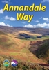
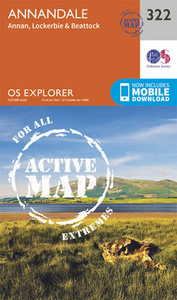
Annandale, Annan, Lockerbie & Beattock OS Explorer Active Map 322
(waterproof)

Annandale, Annan, Lockerbie and Beattock area on a detailed topographic and GPS compatible map No. 322, waterproof version, from the Ordnance Survey’s 1:25, 000 Explorer series. MOBILE DOWNLOADS: this title and all the other OS Explorer maps include a code for downloading after purchase the digital version onto your smartphone or tablet for viewing on the OS smartphone app.OS EXPLORER SERIES: to see the list of all the titles in the OS Explorer series, both paper and waterproof versions, please click on the series link.The Explorer series, Ordnance Survey’s most detailed maps recommended for anyone enjoying outdoor activities, provides topographic coverage of Great Britain at 1:25, 000 on GPS compatible maps with hiking trails, cycling routes and extensive tourist information.
Each printed map is available either on paper or as a waterproof and tear-resistant OS Active Map, as indicated in its title. Britain’s National Parks and other areas of particular tourist interest are presented on often double-sided OL (Outdoor Leisure) maps, whilst most standard format Explorers cover an area of 30 x 20km (approx. 19 x 12 miles).All three versions (paper, waterproof and digital) are the same and provide plenty of recreational and tourist information, indicating the traditional public right of way paths (except in Scotland where different laws apply), including bridleways and byways. National Trails and other long-distance paths are marked, as well as permissive footpaths or bridleways and on-road or traffic-free cycle routes with, where appropriate, their
National/Regional Cycle Network numbers. Boundaries of access land are clearly marked. A wide range of symbols provides additional tourist information, highlighting camping and caravanning sites, information offices and visitors’ centres, parking and picnicking places, country pubs, sport and recreational facilities including cycle hire locations and mountain biking trails, historic buildings and museums, etc. Exceptionally clear presentation of the landscape is provided by contours at 5m or in the uplands at 10m intervals, with additional spot heights plus colouring and/or graphics for different types of woodlands, orchards, heath, marshland, scree or boulders, and other topographic features. For GPS users the maps have British National Grid lines at 1km intervals, with
latitude and longitude given by margin ticks at 1`. Clearly laid out map legend includes French and German translations for the tourist information symbols.
RIP - This product is no longer available on our network. It was last seen on 25.09.2019

This page now acts as a permanent archive for this product. Add more information using the comments box below to ensure it can still be found by future generations.

Use our search facility to see if it is available from an alternative contributor.
  • External links may include paid for promotion
  • Availability: Out Of Stock
  • Supplier: Stanfords
  • SKU: 9780319471944
Availability: In Stock
£14.99

Product Description

Annandale, Annan, Lockerbie & Beattock area on a detailed topographic & GPS compatible map No. 322, waterproof version, from the Ordnance Survey’s 1:25, 000 Explorer series. MOBILE DOWNLOADS: this title & all the other OS Explorer maps include a code for downloading after purchase the digital version onto your smartphone or tablet for viewing on the OS smartphone app.OS EXPLORER SERIES: to see the list of all the titles in the OS Explorer series, both paper & waterproof versions, please click on the series link. The Explorer series, Ordnance Survey’s most detailed maps recommended for anyone enjoying outdoor activities, provides topographic coverage of Great Britain at 1:25, 000 on GPS compatible maps with hiking trails, cycling routes & extensive tourist information. Each printed map is available either on paper or as a waterproof & tear-resistant OS Active Map, as indicated in its title. Britain’s National Parks & other areas of particular tourist interest are presented on often double-sided OL (Outdoor Leisure) maps, whilst most standard format Explorers cover an area of 30 x 20km (approx. 19 x 12 miles). All three versions (paper, waterproof & digital) are the same & provide plenty of recreational & tourist information, indicating the traditional public right of way paths (except in Scotland where different laws apply), including bridleways & byways. National Trails & other long-distance paths are marked, as well as permissive footpaths or bridleways & on-road or traffic-free cycle routes with, where appropriate, their National/ Regional Cycle Network numbers. Boundaries of access land are clearly marked. A wide range of symbols provides additional tourist information, highlighting camping & caravanning sites, information offices & visitors’ centres, parking & picnicking places, country pubs, sport & recreational facilities including cycle hire locations & mountain biking trails, historic buildings & museums, etc. Exceptionally clear presentation of the landscape is provided by contours at 5m or in the uplands at 10m intervals, with additional spot heights plus colouring and/or graphics for different types of woodlands, orchards, heath, marshl&, scree or boulders, & other topographic features. For GPS users the maps have British National Grid lines at 1km intervals, with latitude & longitude given by margin ticks at 1`. Clearly laid out map legend

Includes::
French & German translations for the tourist information symbols.

Reviews/Comments

Add New

Intelligent Comparison

Oooops!
We couldn't find anything!
Perhaps this product's unique.... Or perhaps we are still looking for comparisons!
Click to bump this page and we'll hurry up.

Price History

Vouchers

No voucher codes found.
Do you know a voucher code for this product or supplier? Add it to Insights for others to use.

Facebook

Jargon Buster

GPS - Global Positioning System - Global position using satellites
Paper - A thin sheet mainly used for writing. Available in a variety of colours. Made mainly from wood pulp.
Hiking - An outdoor activity envolving walking in nature
Digital - A system that uses only 0s and 1s to transmit data
Graphics - A general term for visual aspects of an item/display
Waterproof - Resistant to water, usualy specified by depth in metres
Network - A link and communication between things. Often computers or people.
Road - a manmade lane or a path that is used to speed up travel.
Traditional - Something that has become the same through a period of time and thus repeated.
Resistant - Something that can repel against something.
Traditional - Something that has been around for a while and is repeated regularly.
Wide - Something with a large width.
Regional - An adjective to describe a set geographic area.

Supplier Information

Stanfords
Stanfords was established in 1853 and opened their iconic Covent Garden flagship store in 1901. They have become the top retailer of maps, travel books and accessories in the UK and arguably offer the largest selection of maps and travel books worldwide. Famous names such as Captain Robert Falcon Scott, Ranulph Fiennes and Michael Palin have purchased from Stanfords. They now have a shop in Bristol and both stores together with other venues operate a calendar of events including talks, book signings and exhibitions. As a specialist map retailer, the map selection is comprehensive and includes road maps, street maps and walking maps from worldwide destinations, as well as a selection of world atlases and wall maps. Books include travel guides and travel literature. Stanfords also stock globes, from miniatures made of blue marble to magnificent floor-standing globes. The website features a selection of interesting articles on travel topics.
Page Updated: 2023-11-12 20:15:36

Community Generated Product Tags

Oh No! The productWIKI community hasn't generated any tags for this product yet!
Menu