More From Contributor

£6.39
A detailed topographic map of Annandale from the Ordnance Survey Explorer series, covering Annan, Lockerbie & Beattock. Edition A1; Publication date August 2006 About this series: These highly detailed maps show all the administrative boundaries, settlements as small as isolated farms, the road network down to unfenced roads & country tracks, & field boundaries (hedges & drystone walls) which make navigation across the countryside much easier. Steep gradients on roads are indicated. Various landmarks, e.g. powerlines, archaeological sites, windmills, churches & lighthouses are shown & additional graphics indicate natural terrain features such as cliffs, scree, mud & vegetation variations. The contour interval is 5 metres in the lower parts of the country & 10 metres in the uplands, & spot heights are marked. Each map covers an area of 30 x 20km (i.e. approx. 19 x 12 miles), with some double-sided maps covering more, as indicated in the individual descriptions. The maps are fully GPS compatible, with the National Grid shown at 1km intervals & latitude & longitude indicated by margin ticks at 1'. The Explorer series has replaced the earlier, green-cover Pathfinder maps. The Explorer series is now complete & covers all of Engl&, Wales & Scotl&. Some sheets for popular areas like the National Parks are still branded as Outdoor Leisure (OL) maps, but are now included in this series as the cartography is the same as that in the Explorer Maps. The Explorer maps offer a substantial improvement on the Pathfinder series, with greater use of colour, larger area per map, & stronger emphasis on information for ramblers & tourists. This series is ideal for walking & other outdoor pursuits & each map shows a large amount of information for ramblers & tourists. Public rights of way are shown (except in Scotland), together with other routes with public access: National Trails & Recreational Paths, permitted paths & bridleways, & selected cycle routes. Open access land created under the Countryside & Rights of Way Act 2000 is marked. Tourist information

Includes::
caravan & camp sites, Park & Ride locations, recreation/leisure/sport centres, museums, historic buildings, English Heritage & National Trust sites, rural pubs, etc. The map legend is in English only, except for the tourist information content which is also in French & German.

...
Archived Product
£11.19
Laminated waterproof edition of a detailed topographic map of Annandale from the Ordnance Survey Explorer series, covering Annan, Lockerbie & Beattock. Edition A1; Publication date November 2006 About this series: These highly detailed maps show all the administrative boundaries, settlements as small as isolated farms, the road network down to unfenced roads & country tracks, & field boundaries (hedges & drystone walls) which make navigation across the countryside much easier. Steep gradients on roads are indicated. Various landmarks, e.g. powerlines, archaeological sites, windmills, churches & lighthouses are shown & additional graphics indicate natural terrain features such as cliffs, scree, mud & vegetation variations. The contour interval is 5 metres in the lower parts of the country & 10 metres in the uplands, & spot heights are marked. Each map covers an area of 30 x 20km (i.e. approx. 19 x 12 miles), with some double-sided maps covering more, as indicated in the individual descriptions. The maps are fully GPS compatible, with the National Grid shown at 1km intervals & latitude & longitude indicated by margin ticks at 1'. The Explorer series has replaced the earlier, green-cover Pathfinder maps. The Explorer series is now complete & covers all of Engl&, Wales & Scotl&. Some sheets for popular areas like the National Parks are still branded as Outdoor Leisure (OL) maps, but are now included in this series as the cartography is the same as that in the Explorer Maps. The Explorer maps offer a substantial improvement on the Pathfinder series, with greater use of colour, larger area per map, & stronger emphasis on information for ramblers & tourists. This series is ideal for walking & other outdoor pursuits & each map shows a large amount of information for ramblers & tourists. Public rights of way are shown (except in Scotland), together with other routes with public access: National Trails & Recreational Paths, permitted paths & bridleways, & selected cycle routes. Open access land created under the Countryside & Rights of Way Act 2000 is marked. Tourist information

Includes::
caravan & camp sites, Park & Ride locations, recreation/leisure/sport centres, museums, historic buildings, English Heritage & National Trust sites, rural pubs, etc. The map legend is in English only, except for the tourist information content which is also in French & German.

...
Archived Product
£14.99
Annandale, Annan, Lockerbie & Beattock area on a detailed topographic & GPS compatible map No. 322, waterproof version, from the Ordnance Survey’s 1:25, 000 Explorer series. MOBILE DOWNLOADS: this title & all the other OS Explorer maps include a code for downloading after purchase the digital version onto your smartphone or tablet for viewing on the OS smartphone app.OS EXPLORER SERIES: to see the list of all the titles in the OS Explorer series, both paper & waterproof versions, please click on the series link. The Explorer series, Ordnance Survey’s most detailed maps recommended for anyone enjoying outdoor activities, provides topographic coverage of Great Britain at 1:25, 000 on GPS compatible maps with hiking trails, cycling routes & extensive tourist information. Each printed map is available either on paper or as a waterproof & tear-resistant OS Active Map, as indicated in its title. Britain’s National Parks & other areas of particular tourist interest are presented on often double-sided OL (Outdoor Leisure) maps, whilst most standard format Explorers cover an area of 30 x 20km (approx. 19 x 12 miles). All three versions (paper, waterproof & digital) are the same & provide plenty of recreational & tourist information, indicating the traditional public right of way paths (except in Scotland where different laws apply), including bridleways & byways. National Trails & other long-distance paths are marked, as well as permissive footpaths or bridleways & on-road or traffic-free cycle routes with, where appropriate, their National/ Regional Cycle Network numbers. Boundaries of access land are clearly marked. A wide range of symbols provides additional tourist information, highlighting camping & caravanning sites, information offices & visitors’ centres, parking & picnicking places, country pubs, sport & recreational facilities including cycle hire locations & mountain biking trails, historic buildings & museums, etc. Exceptionally clear presentation of the landscape is provided by contours at 5m or in the uplands at 10m intervals, with additional spot heights plus colouring and/or graphics for different types of woodlands, orchards, heath, marshl&, scree or boulders, & other topographic features. For GPS users the maps have British National Grid lines at 1km intervals, with latitude & longitude given by margin ticks at 1`. Clearly laid out map legend

Includes::
French & German translations for the tourist information symbols.

...
Archived Product
£8.99
Annandale, Annan, Lockerbie & Beattock area on a detailed topographic & GPS compatible map No. 322, paper version, from the Ordnance Survey’s 1:25, 000 Explorer series.MOBILE DOWNLOADS: this title & all the other OS Explorer maps include a code for downloading after purchase the digital version onto your smartphone or tablet for viewing on the OS smartphone app.OS EXPLORER SERIES: to see the list of all the titles in the OS Explorer series, both paper & waterproof versions, please click on the series link. The Explorer series, Ordnance Survey’s most detailed maps recommended for anyone enjoying outdoor activities, provides topographic coverage of Great Britain at 1:25, 000 on GPS compatible maps with hiking trails, cycling routes & extensive tourist information. Each printed map is available either on paper or as a waterproof & tear-resistant OS Active Map, as indicated in its title. Britain’s National Parks & other areas of particular tourist interest are presented on often double-sided OL (Outdoor Leisure) maps, whilst most standard format Explorers cover an area of 30 x 20km (approx. 19 x 12 miles). All three versions (paper, waterproof & digital) are the same & provide plenty of recreational & tourist information, indicating the traditional public right of way paths (except in Scotland where different laws apply), including bridleways & byways. National Trails & other long-distance paths are marked, as well as permissive footpaths or bridleways & on-road or traffic-free cycle routes with, where appropriate, their National/ Regional Cycle Network numbers. Boundaries of access land are clearly marked. A wide range of symbols provides additional tourist information, highlighting camping & caravanning sites, information offices & visitors’ centres, parking & picnicking places, country pubs, sport & recreational facilities including cycle hire locations & mountain biking trails, historic buildings & museums, etc. Exceptionally clear presentation of the landscape is provided by contours at 5m or in the uplands at 10m intervals, with additional spot heights plus colouring and/or graphics for different types of woodlands, orchards, heath, marshl&, scree or boulders, & other topographic features. For GPS users the maps have British National Grid lines at 1km intervals, with latitude & longitude given by margin ticks at 1`. Clearly laid out map legend

Includes::
French & German translations for the tourist information symbols.

...
Archived Product
£12.99
Annapurna region at 1:100, 000 in a series of detailed topographic maps of selected trekking areas of Nepal originally prepared by E. Schneider & now edited by the German Scientific Association of Comparative High-Mountain Research (Arbeitsgemeinschaft für vergleichende Hochgebirgsforschung). The map covers the whole of the Annapurna Circuit, extending from Pokhara to Muktinath & Jomosom. Contours are at 100m intervals. An overprint highlights the route of the Annapurna Circuit, but no other tourist information is provided. The map has 10-km UTM crosshairs, plus margin ticks for latitude & longitude at 15’. Map legend is in English. Current edition of this map was published in 2005. Traditionally referred to as “the Schneider maps”, titles in this series cover Nepal’s most popular trekking regions at 1:50, 000 or 1:100, 000. The maps were originally prepared by the Austrian climber & cartographer Erwin Schneider & for nearly five decades provided the best & often the only coverage of these areas. Now sponsored by the German Scientific Association of Comparative High-Mountain Research (Arbeitsgemeinschaft für vergleichende Hochgebirgsforschung), the maps are still"ed in most trekking guides to Nepal. Most maps have contours at 40-m intervals &, with bold relief shading & colouring for the glaciers, provide a vivid representation of the terrain. As the series is currently being revised to include more trekking information, please see the individual descriptions for more details. Please click on the series link to see the full list of currently available titles. ...
Archived Product
£10.99
Since first publication, when it sold 400, 000 copies, “ Annapurna” has acquired classic status. It is the enthralling account, by the leader of the French expedition, of the first conquest of Annapurna
- at that time, & at more than 8, 000 metres, the highest mountain ever climbed. It is a story of breathtaking courage & determination against appalling odds. In records of mountaineering, in tales of human endeavour, there is nothing so unforgettable as the account of the descent by the triumphant but frost-bitten men, after the monsoon had broken, through the flooded valleys of Nepal. As well as an introduction by Joe Simpson, this new edition

Includes::
16 pages of photographs, which provide a remarkable visual record of this legendary expedition.


...
Archived Product
£9.99
Annapurna area at 1:135, 000 approx. on indexed, light, waterproof & tear-resistant hiking map, with a plan of the Kathmandu/ Patan area including an enlargement of the Thamel district, plus an overview map of the whole country. The map is part of a series covering Nepal’s four most popular trekking areas. The maps were prepared by the NGS/ Trails Illustrated team responsible for the highly acclaimed hiking maps of national parks in the USA, in cooperation with the Nepa Maps (Himalayan Maphouse), publishers of a wide range of trekking maps of Nepal. Contours (see below) with additional spot heights, relief shading & colouring for glaciers & forested areas present the topography of each area. The maps show settlements, roads & trekking routes, as well as extensive information for tourists: local airports, lodgings & campsites, numerous places of interest including temples, monasteries, caves, waterfalls, etc. Map ticks at intervals of 1` indicate latitude & longitude. An index of localities

Includes::
a list of peaks, passes & lakes. Sherpa spellings are used within the Khumbu area & Nepali spellings elsewhere in the country. On the reverse of each title, a general road map of the whole of Nepal highlights the country’s national parks & nature reserves. Also included is a street plan of Kathmandu with Patan, plus an enlargement for the central Thamel area of the city. The two plans highlight hotels & guesthouses, restaurants, banks, embassies & consulates, places of interest, etc.* In this title:* the map covers the whole of the Annapurna circuit between Pokhara & Jomoson. Contours are at 100m intervals & all peak heights are also given in metres. Latitude & longitude margin ticks are at 1` intervals. Please note: the cover incorrectly identifies this title as No. 3001 in the series – its correct number is 3003, as shown inside).

...
Archived Product
£18.95
Annapurna & Mustang area in the Newgrove Consultants’ series covering the course of Great Himalaya Trail High Route at 1:100, 000 on nine maps printed on light, waterproof & tear-resistant plastic paper. The map is double-sided, with a very generous overlap between the sides, & covers the GHT High Route between the Niwar Pass, across the northern part of the Annapurna Circuit, to Hokam in the Manaslu Conservation Area. The base map, derived from satellite imagery, has contours at 200m intervals enhanced by relief shading & colouring to show glaciers, the snow line at 6000m, barren l&, forests, etc. Numerous spot heights are marked in the high-laying areas, but not very many & in places none on the south side of the trail. Important peaks & mountain passes are prominently marked. Boundaries of national parks & other protected areas are also shown. The High Route of the GHT is clearly highlighted & adjoining local routes are divided into main trails & footpaths. Icons indicate locations of campsites & hotels/lodges, health posts, stupas, gompas & mani walls both along the GHT itself & in other locations on the map. Settlements are graded into large towns, towns, villages & small villages. The maps have latitude & longitude lines at intervals of 5’. All information is in English. Seven of the maps are double-sided, with the last three maps covering the easternmost part of the country from Rolwaling Himal & Mt Everest to Kanchenjunga on single-sided maps. PEASE NOTE: Sheet No. 1, Far West, covers an area outside the course of the High Route. It shows the route of the Lower Great Himalaya Trail. According to the publishers’ notes: “ The maps have been created & published by Newgrove Consultants on behalf of The Great Himalaya Trail Development Programme which is funded by the UK Department for International Development & managed by SNV Netherland’s Development Organization. United Nations World Tourism Organization through its “ Sustainable Tourism – Eliminating Poverty” programme ahs played a key role in bringing the project into fruition. The maps are based on data from the National Geographic Information Infrastructure Programme (NGIIP) of Nepal. The International Centre for Integrated Mountain Development (ICIMOD) also provided low scale data. Trekkers & guides have been consulted on current routes.” ...
Archived Product
£13.95
Annapurna Base Camp trekking map at 1:50, 000 in the Nepa Maps series which provides extensive coverage of trekking areas of Nepal on detailed contoured maps with trekking routes & hiking trails, huts & camp sites, local places of interest & other tourist information. The map covers the trekking route from Pokhara to Annapurna ...
Archived Product
£13.99
Annapurna Base Camp trekking map at 1:50, 000 from Nepa Maps, covering the trekking route from Pokhara to Annapurna’s South Base Camp & the Machhapuchhre (Mt. Fish Tail) Base Camp, & beyond them showing the climbing routes to Tharpu Chuli (Tent Peak) & Singu Chuli (Fluted Peak). Also highlighted are various trekking routes on the lower slopes west of Pokhara, including the Ghorepani
- Ghandruk Trek & the routes to the west & south base camps of Mardi Himal. Contours are at 40m intervals. The index lists settlements, peaks, base camps, passes & lakes. Margin ticks give latitude & longitude at 2’30” intervals. Also included is a profile of the Annapurna BC route & a table showing the route in stages with altitudes in metres & feet, plus trekking times. Titles in this Nepa Maps series have cartography is based on the country’s topographic survey, with contours usually at 40m or 50m intervals, enhanced by relief shading, colouring & graphics to show various features of the terrain, including glaciers, forested or cultivated areas, etc. Numerous peaks, with additional spot heights, plus names of glaciers & mountain ranges are prominently shown. The network of rivers, streams & lakes is shown in great detail, with many smaller rivers & lakes named. Overprint highlights main trekking routes & numerous local trails, with symbols indicating various places of interest & tourist facilities. Most maps are indexed & include additional information such as route profiles, glossaries, etc. All the information is in English & heights are given in metres. To see other titles in this series please click in the series link.
...
Archived Product

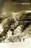
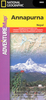
Annapurna - A Trekker's Guide SUPERCEDED

Seen from the lakeside town of Pokhara in central Nepal, a tremendous wall of snow and ice-capped mountains dominates the northern horizon - the Annapurna Himal. With no less than 12 summits topping 7000m (23, 000ft) soaring above a foreground of intricately terraced foothills, this is one of the most beautiful and ethnically diverse landscapes on earth. Around this island block goes the route of the classic Annapurna Circuit - one of the great walks of the world. Into the heart of these mountains another trekker's trail leads to the Annapurna Sanctuary. Through the world's deepest valley, between Annapurna and Dhaulagiri, goes the Pilgrim's Trail to Muktinath, while the Ghandruk Foothill Trek provides an introduction to some of the best of Nepal's hill villages and mountain views.
Kev Reynolds describes each of these treks with full route details for 'tea-house' trekkers and those journeying with and organised group.Information with regard to lodges, tea-houses and villages is provided; there are sections on how to plan a trek, where and when to go, permits and preparations, health matters, an equipment check list and, of equal importance, how to avoid giving offence to the local people. Outline suggestions are offered for other treks in the region, and details of Trekking Peaks are also given. This is a new, full-colour edition of an established guide.
RIP - This product is no longer available on our network. It was last seen on 25.09.2019

This page now acts as a permanent archive for this product. Add more information using the comments box below to ensure it can still be found by future generations.

Use our search facility to see if it is available from an alternative contributor.
  • External links may include paid for promotion
  • Availability: Out Of Stock
  • Supplier: Stanfords
  • SKU: 9781852843977
Availability: In Stock
£14.00

Product Description

Seen from the lakeside town of Pokhara in central Nepal, a tremendous wall of snow & ice-capped mountains dominates the northern horizon
- the Annapurna Himal. With no less than 12 summits topping 7000m (23, 000ft) soaring above a foreground of intricately terraced foothills, this is one of the most beautiful & ethnically diverse landscapes on earth. Around this island block goes the route of the classic Annapurna Circuit
- one of the great walks of the world. Into the heart of these mountains another trekker's trail leads to the Annapurna Sanctuary. Through the world's deepest valley, between Annapurna & Dhaulagiri, goes the Pilgrim's Trail to Muktinath, while the Ghandruk Foothill Trek provides an introduction to some of the best of Nepal's hill villages & mountain views. Kev Reynolds describes each of these treks with full route details for 'tea-house' trekkers & those journeying with & organised group. Information with regard to lodges, tea-houses & villages is provided; there are sections on how to plan a trek, where & when to go, permits & preparations, health matters, an equipment check list &, of equal importance, how to avoid giving offence to the local people. Outline suggestions are offered for other treks in the region, & details of Trekking Peaks are also given. This is a new, full-colour edition of an established guide.

Reviews/Comments

Add New

Intelligent Comparison

Oooops!
We couldn't find anything!
Perhaps this product's unique.... Or perhaps we are still looking for comparisons!
Click to bump this page and we'll hurry up.

Price History

Vouchers

No voucher codes found.
Do you know a voucher code for this product or supplier? Add it to Insights for others to use.

Facebook

Jargon Buster

Ice - Frozen water, the solid state of water.
Wall - A physical barrier between two areas
World - A physical grouping, commonly used to describe earth and everything associated with ti
Tea - A hot beverage made from the leaves of a tea plant
Colour - The categorised spectrum of light visable to humans
Earth - A planet third from the sun. Similar size to Venus but rich in water and complex life.
Heart - An organ that pumps blood around the body. Usually related to love.
Ice - Frozen water, Ice is cold to the touch and forms when water reaches 0 degrees centigrade.
Equipment - A product or good that is tactile.
Snow - Water and vapour in clouds that falls in a white crystal form leaving a white layer.
Classic - Something that is still like it was originally a high quality standard.

Supplier Information

Stanfords
Stanfords was established in 1853 and opened their iconic Covent Garden flagship store in 1901. They have become the top retailer of maps, travel books and accessories in the UK and arguably offer the largest selection of maps and travel books worldwide. Famous names such as Captain Robert Falcon Scott, Ranulph Fiennes and Michael Palin have purchased from Stanfords. They now have a shop in Bristol and both stores together with other venues operate a calendar of events including talks, book signings and exhibitions. As a specialist map retailer, the map selection is comprehensive and includes road maps, street maps and walking maps from worldwide destinations, as well as a selection of world atlases and wall maps. Books include travel guides and travel literature. Stanfords also stock globes, from miniatures made of blue marble to magnificent floor-standing globes. The website features a selection of interesting articles on travel topics.
Page Updated: 2023-11-12 20:15:36

Community Generated Product Tags

Oh No! The productWIKI community hasn't generated any tags for this product yet!
Menu