More From Contributor
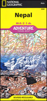
£17.99
Roof of the world, land of legend & beauty
- within its narrow confines, Nepal contains an utterly spectacular variety of culture
...
Archived Product
£9.50
Nepal at 1:950, 000 on an indexed map from the Kathmandu-based Nepa Maps (Himalayan Map House) with enlargements presenting in more detail the four most visited areas: Mount Everest, Annapurna, Langtang & Helambu, plus Manaslu & Ganesh. The main map presents the country at 1:950, 000 on a base derived from satellite imagery, with heights of numerous peaks & passes. National parks & conservation areas are highlighted. Road network

Includes::
selected local trails; domestic airports are marked. The map also shows the division of the country into regions, with town symbols indicating their administrative status. Symbols highlight various places of interest including UNESCO World heritage sites. The map has latitude & longitude lines at 30’ & is indexed, including lists of peaks, passes & lakes. The areas beyond Nepal’s borders are blank. The four enlargements provide an excellent, vivid representation of each area’s topography more peak names, highlight main trekking routes, & show campsites & locations with tourist hotels. The regions covered are:- Jiri
- Mt Everest region at 1:350, 000 including the whole of the trekking route from Jiri- southern part of the Annapurna Conservation Area at 1:375, 000 with the whole of the Annapurna Circuit, including the spurs to Naar & Phu- Langtang & Helambu region at 1:425, 000 including Kathmandu- the Manaslu – Ganesh area at 1:375, 000 with Besisahar & Gorkha Also provided are lists of national parks/conservation areas/wildlife reserves, highest peaks, domestic air routes with flight times, World Heritage sites, a distance table, etc.


...
Archived Product
£13.59
Nepal in the Countries & Regions series from Lonely Planet, market-leading comprehensive guides aimed at independent travellers & serving a large range of international destinations. Frank & informal in style, the guides explore an extensive range of sights, activities, accommodation, restaurants & nightlife & are designed for practical use while travelling on the road. Written & researched by a team of experts, each book is independent in its recommendations & suggestions, often offering individual takes on individual destinations. Widely recognised for their reliability, each Lonely Planet country & region guide has the same layout. Introductory sections profile the destination with individual chapters on particular highlights, getting started, (including when to go) itineraries, history, culture, arts, food & drink & the environment. Each guide is organised geographically by region, with individual sections detailing an extensive range of sights, places of interest, attractions, restaurants, nightlife, accommodation & any local activities. The guides have detailed explanations of historical context where relevant. There is also practical guidance on ...
Archived Product
£7.99
Nepal in the Culture Smart range of pocket-sized guide books; providing detailed information on local customs, culture, etiquette & manners & ensuring that visitors are prepared for a diverse range of social environments. The series covers an extensive number of countries worldwide & are designed both for those working & living abroad, as well as for visitors who do not want to offend, either intentionally or inadvertently. Their aim is to prevent readers from making embarrassing mistakes & feel confident in unfamiliar situations, while preparing them before arrival on what to expect & how to behave. Each guide is arranged thematically, with dedicated individual chapters on land & people, values & attitudes, customs & traditions, making friends, people at home, ‘time-out’, travelling & communicating. There is also a separate chapter for business travelers, with important information on subjects such as business culture, meetings & making appointments. A Further Reading section also offers a list of recommended other history, travel literature & language titles available on the country. ...
Archived Product
£14.99
The Trekking & Climbing Guide to Nepal covers 25 treks & 12 climbing peaks in the Nepal Himalaya, & is an essential tool for both experienced explorers or climbers & first-time trekkers. Each year Nepal receives nearly 1/2 million visitors, with increasing numbers discovering the joys of trekking, spurred on by the challenges set by early mountaineers & the country's own rich mix of cultures. The treks covered in this book run the gamut from classic teahouse routes to newly charted expedition-style routes, while the peaks featured are chosen as a natural highpoint of trekking in a high-altitude region. Information on trekking & climbing styles, ecological concerns & mountain photography is also included. This unique full-colour guide to covers Nepal's climbing peaks in detail. There is also top-class original mapping & lavish photography throughout. ...
Archived Product
£10.99
An overview map of Nepal from Gecko Maps, Swiss cartographic publishers specializing in coverage of Tibet. The map


...
Archived Product
£22.95
Geological map of Nepal from Nepa Maps, presenting the country on a base map with numerous peaks & passes, main towns, districts & the road network. The legend, all in English, divides the information into geographical groups: Siwalik, Surkhet, Mid L&, Kathmandu, Jaljala, Dadeldhura & Himal, each sub-divided into sub-groups & formations. Also included are five cross-section diagrams across different parts of the country. The map has latitude & longitude margin ticks at 1° intervals & an index listing districts, towns, peaks, passes & lakes. ...
Archived Product
£14.99
Nepal on a laminated, waterproof & tear-resistant map from terra Quest, combining coverage of the whole country with more detail mapping for trekking in the Mt. Everest & Annapurna/ Dhaulagiri regions, an enlargement of the Kathmandu Valley, plus street plans of Kathmandu & Pokhara. The map consists of a series of panels presenting: The whole of Nepal at 1:1, 100, 000 with relief shading to show its topography. The map shows boundaries of national parks/protected areas & highlights names of main peaks & places of particular interest. Principal trekking routes & locations of base camps are marked. The map has no geographical coordinates. Mount Everest region north of Lukla on an enlargement at 1:115, 000, with trekking routes to the Base Camp, Island Peak & the Gokyo Lakes. The Annapurna ...
Archived Product
£14.99
Nepal on a laminated, waterproof & tear-resistant map from terra Quest, combining coverage of the whole country with more detailed contoured & GPS compatible mapping for trekking in the Mt. Everest & Annapurna/ Dhaulagiri regions, an enlargement of the Kathmandu Valley, plus street plans of Kathmandu & Pokhara. Multilingual map legend

Includes::
English. The map is laminated in a format similar to the old cloth-dissected maps so that sections of it can be easily folded back without damage, & can be annotated with write-on/wipe-off marker pens. Coverage consists of a series of panels presenting:- The whole of Nepal at 1:1, 100, 000 on a 68x 24cm panel. Topography is indicated by contours at 250m intervals with heights of main peaks & colouring for forests, glaciers, etc. The map shows boundaries of national parks/protected areas & prominently highlights names of main peaks & places of particular interest. Principal trekking routes & locations of base camps are marked. Latitude & longitude lines are drawn at 10’ intervals.- Enlargements with trekking routes in the country’s two most visited areas: the Mount Everest region north of Lukla on a 29x 49cm panel at 1:115, 000, with trekking routes to the Base Camp, Island Peak, Amphu Labsta & the Gokyo Lakes, plus the Annapurna
- Dhaulagiri region on a 72x 49cm panel at 1:150, 000 with the Annapurna circuit, the variant via the Tilicho Lakes, routes to the main & the north Base Camps, the Dhaulagiri circuit, etc. Both panels have mapping with contours at 50m intervals with colouring for vegetation & glaciers, indicate locations with tourist accommodation & facilities / places of interest, & have a latitude/longitude grid at intervals of 1’.- Kathmandu Valley at 1:150, 000 on a 22x 24cm panel with its road network presented on contoured mapping with places of interest but without special highlighting for trekking routes. Latitude & longitude grid is at 5’ intervals- Two large panels with street plans of Kathmandu/ Patan & Pokhara, annotated with selected accommodation, sights, etc.


...
Archived Product
£12.00
Throughout 1949 & 1950 H.W. ` Bill` Tilman mounted pioneering expeditions to Nepal & its Himalayan mountains, taking advantage of some of the first access to the country for Western travellers in the 20th century. Tilman & his party-including a certain Sherpa Tenzing Norgay-trekked into the Kathmandu Valley & on to the Langtang region, where the highs & lows began. They first explored the Ganesh Himal, before moving on to the Jugal Himal & the following season embarking on an ambitious trip to Annapurna & Everest. Manaslu was their first objective, but left to `better men`, & Annapurna IV very nearly climbed instead but for bad weather which dogged the whole expedition. Needless to say, Tilman was leading some very lightweight expeditions into some seriously heavyweight mountains. After the Annapurna adventure Tilman headed to Everest with-among others-Dr Charles Houston. Approaching from the delights of Namche Bazaar, the party made progress up the flanks of Pumori to gaze as best they could into the Western Cwm, & at the South Col & South-East Ridge approach to the summit of Everest. His observations were both optimistic & pessimistic: ` One cannot write off the south side as impossible until the approach from the head of the West Cwm to this remarkably airy col has been seen.` But then of the West Cwm: `A trench overhung by these two tremendous walls might easily become a grave for any party which pitched its camp there.` Nepal Himalaya presents Tilman`s favourite sketches, encounters with endless yetis, trouble with the porters, his obsessive relationship with alcohol & issues with the food. & so Tilman departs Nepal for the last time proper with these retiring words: ` If a man feels he is failing to achieve this stern standard he should perhaps withdraw from a field of such high endeavour as the Himalaya.` ...
Archived Product

Nepal Adventure Map

Nepal Adventure Map from the National Geographic presenting the country at 1:625, 000 on light, waterproof and tear-resistant synthetic paper, with a large panel showing the main sights and facilities in the Kathmandu – Patan area.The map is double-sided, dividing the country east/west with a good overlap between the sides. Topography is presented by contours at 200m intervals enhanced by relief shading and colouring for glaciers, with names of mountain ranges, passes and numerous peaks. National parks and conservation areas are highlighted. The map shows the country’s road network indicating scenic roads, locations of petrol stations and distances of main routes. Also included are main and selected local trails, railway lines and local airports. The map also shows the
administrative division of the country into provinces. Symbols show various places of interest including cultural and religious sites, base camps, rivers for rafting or kayaking, classic trekking routes (e.g. Jiri to Everest BC or the Annapurna Circuit), etc. The map is indexed and has latitude and longitude lines at intervals of 30’. Also provided is a panel showing the Kathmandu – Patan area at approx. 1:50, 000 with names of main roads and locations of various sights, institutions and tourist facilities.
RIP - This product is no longer available on our network. It was last seen on 25.09.2019

This page now acts as a permanent archive for this product. Add more information using the comments box below to ensure it can still be found by future generations.

Use our search facility to see if it is available from an alternative contributor.
  • Availability: Out Of Stock
  • Supplier: Stanfords
  • SKU: 9781566956536
Availability: In Stock
£9.99

Product Description

Nepal Adventure Map from the National Geographic presenting the country at 1:625, 000 on light, waterproof & tear-resistant synthetic paper, with a large panel showing the main sights & facilities in the Kathmandu – Patan area. The map is double-sided, dividing the country east/west with a good overlap between the sides. Topography is presented by contours at 200m intervals enhanced by relief shading & colouring for glaciers, with names of mountain ranges, passes & numerous peaks. National parks & conservation areas are highlighted. The map shows the country’s road network indicating scenic roads, locations of petrol stations & distances of main routes. Also included are main & selected local trails, railway lines & local airports. The map also shows the administrative division of the country into provinces. Symbols show various places of interest including cultural & religious sites, base camps, rivers for rafting or kayaking, classic trekking routes (e.g. Jiri to Everest BC or the Annapurna Circuit), etc. The map is indexed & has latitude & longitude lines at intervals of 30’. Also provided is a panel showing the Kathmandu – Patan area at approx. 1:50, 000 with names of main roads & locations of various sights, institutions & tourist facilities.

Reviews/Comments

Add New

Intelligent Comparison

Oooops!
We couldn't find anything!
Perhaps this product's unique.... Or perhaps we are still looking for comparisons!
Click to bump this page and we'll hurry up.

Price History

Vouchers

No voucher codes found.
Do you know a voucher code for this product or supplier? Add it to Insights for others to use.

Facebook

Jargon Buster

Paper - A thin sheet mainly used for writing. Available in a variety of colours. Made mainly from wood pulp.
Waterproof - Resistant to water, usualy specified by depth in metres
Network - A link and communication between things. Often computers or people.
Large - something that takes up more space than normal.
Adventure - an undertaking of an exciting challenge or experience.
Road - a manmade lane or a path that is used to speed up travel.
Resistant - Something that can repel against something.
Classic - Something that is still like it was originally a high quality standard.

Supplier Information

Stanfords
Stanfords was established in 1853 and opened their iconic Covent Garden flagship store in 1901. They have become the top retailer of maps, travel books and accessories in the UK and arguably offer the largest selection of maps and travel books worldwide. Famous names such as Captain Robert Falcon Scott, Ranulph Fiennes and Michael Palin have purchased from Stanfords. They now have a shop in Bristol and both stores together with other venues operate a calendar of events including talks, book signings and exhibitions. As a specialist map retailer, the map selection is comprehensive and includes road maps, street maps and walking maps from worldwide destinations, as well as a selection of world atlases and wall maps. Books include travel guides and travel literature. Stanfords also stock globes, from miniatures made of blue marble to magnificent floor-standing globes. The website features a selection of interesting articles on travel topics.
Page Updated: 2023-11-12 20:15:36

Community Generated Product Tags

Oh No! The productWIKI community hasn't generated any tags for this product yet!
Menu