
 United Kingdom
 France
 Germany
 Netherlands
 Sweden
 USA
USA
 Italy
Italy
 Spain
Spain
More From Contributor
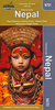


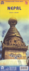

Nepal Gecko Map
An overview map of Nepal from Gecko Maps, Swiss cartographic publishers specializing in coverage of Tibet. The map includes enlargements for Kathmandu and Pokhara Valleys, a comprehensive distance table and climate information.Bold relief shading is supplements by colouring and graphics to indicate different types of terrain and vegetation: high mountain chains with glaciers, the highlands, grassland, forests or shrubs, agricultural land, swamps, etc. Many peaks are named but perhaps not always easy to find among all the information provided on the map.Road network indicates picturesque routes. Main trekking trails are marked. The map shows the boundaries of national parks and highlights locations and natural features of particular interest. Latitude and longitude lines are drawn
at 15’ intervals. No index is provided. Map legend includes English.Enlargements show Kathmandu and Pokhara Valley at 1:250, 000. Also included is a comprehensive distance table and month by month graphs showing mean monthly temperature and rainfall for 20 selected locations.
at 15’ intervals. No index is provided. Map legend includes English.Enlargements show Kathmandu and Pokhara Valley at 1:250, 000. Also included is a comprehensive distance table and month by month graphs showing mean monthly temperature and rainfall for 20 selected locations.

Product Description
Reviews/Comments
Add New
Intelligent Comparison
Archived Product

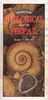
Nepal Geological Map Stanfords
£22.95
Vouchers
No voucher codes found.
Do you know a voucher code for this product or supplier? Add it to Insights for others to use.
Do you know a voucher code for this product or supplier? Add it to Insights for others to use.
 Denmark