
 United Kingdom
 France
 Germany
 Netherlands
 Sweden
 USA
USA
 Italy
Italy
 Spain
Spain
More From Contributor


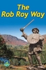

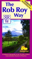
Rob Roy Way
The Rob Roy Way, a 126 km/79 mile trail from Drymen near Loch Lomond to Pitlochry, at 1:40, 000 on a light, waterproof and tear-resistant map from Footprint Walks in their series covering long-distance hiking routes. The trail is presented on 11 overlapping panels, each designed to cover one daily stage, with mapping providing user-friendly yet comprehensive information about the challenges of the route, services along the way, places of interest, etc.The maps have contours are at 10 metres intervals with altitude colouring, plus additional colouring for woodlands. The route is clearly highlighted, indicating where it follows roads, tracks, cycle paths, footpaths or no visible paths, with mile markers and, where useful, possible danger signs. A range of symbols indicate
various overnight accommodation options, cafes and pubs, grocery shops and ATMs, places of interest, etc. Each panel has British National Grid lines and includes route instructions plus a profile showing changes in altitude. The map also provides general information on local public transport, etc.
various overnight accommodation options, cafes and pubs, grocery shops and ATMs, places of interest, etc. Each panel has British National Grid lines and includes route instructions plus a profile showing changes in altitude. The map also provides general information on local public transport, etc.

Product Description
Reviews/Comments
Add New
Vouchers
No voucher codes found.
Do you know a voucher code for this product or supplier? Add it to Insights for others to use.
Do you know a voucher code for this product or supplier? Add it to Insights for others to use.
 Denmark